

Severe Thunderstorm Warning: West Alabama
The NWS in Birmingham has issued a severe thunderstorm warning for parts of these three West Alabama counties:
LAMAR COUNTY IN WEST CENTRAL ALABAMA…
PICKENS COUNTY IN WEST CENTRAL ALABAMA…
WESTERN FAYETTE COUNTY IN WEST CENTRAL ALABAMA…
* UNTIL 415 PM CDT
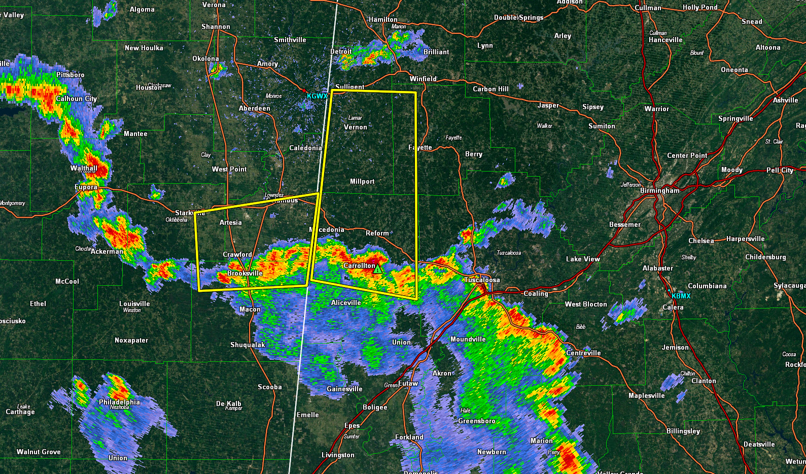
As you can see, storms are lined up all along US-82 from Macedonia and Reform to Centreville.
The strongest storm is approaching Reform from the south and will impact Millport and Vernon in Lamar County and possibly Fayette in Fayette County.
Another warning affects areas south of and just including Columbus MS.
It looks like all of this activity will remain west of the Birmingham area this afternoon.
* AT 332 PM CDT…A SEVERE THUNDERSTORM WAS LOCATED NEAR REFORM…
MOVING NORTH AT 40 MPH.
HAZARD…60 MPH WIND GUSTS AND QUARTER SIZE HAIL.
SOURCE…RADAR INDICATED.
IMPACT…HAIL DAMAGE TO VEHICLES IS EXPECTED. EXPECT WIND DAMAGE
TO ROOFS…SIDING AND TREES.
* LOCATIONS IMPACTED INCLUDE…
FAYETTE…VERNON…SULLIGENT…GORDO…REFORM…MILLPORT…
CARROLLTON…PICKENSVILLE…KENNEDY…BELK…ETHELSVILLE…BLOOMING
GROVE…LAMAR COUNTY AIRPORT…ASHCRAFT CORNER…BLUFF…BEDFORD…
KIRK…LUBBUB…MCSHAN AND MELBORNE.
Category: Severe Weather
About the Author (Author Profile)
Subscribe
If you enjoyed this article, subscribe to receive more just like it.


