

Wet Weather Pattern Returns
PATTERN CHANGE: After only about a third of an inch of rain for the entire month of May, showers/storms returned late yesterday afternoon, soaking parts of Central Alabama with over one inch. And, that moist air will stick around for a while with an upper trough to the west, meaning a good chance of occasional showers and storms.
In fact, it is raining early this Memorial Day over parts of West Alabama…
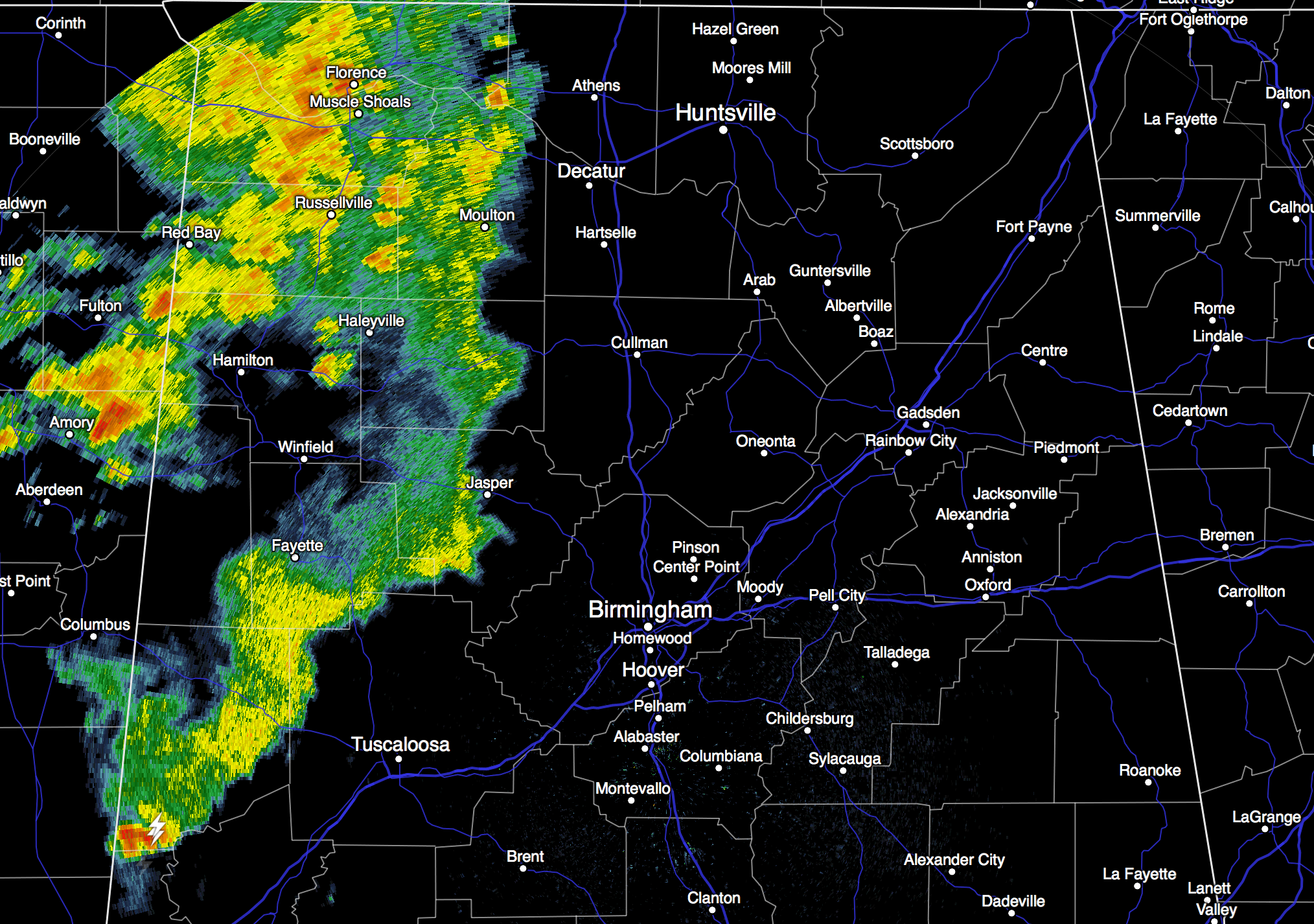
We might hold in the 70s all day today due to clouds and occasional showers. While a strong storm is possible this afternoon, organized severe weather is not expected through tonight.
TOMORROW: SPC has defined the standard “slight” severe weather risk of much of North and Central Alabama, with a “marginal” risk for the entire state…
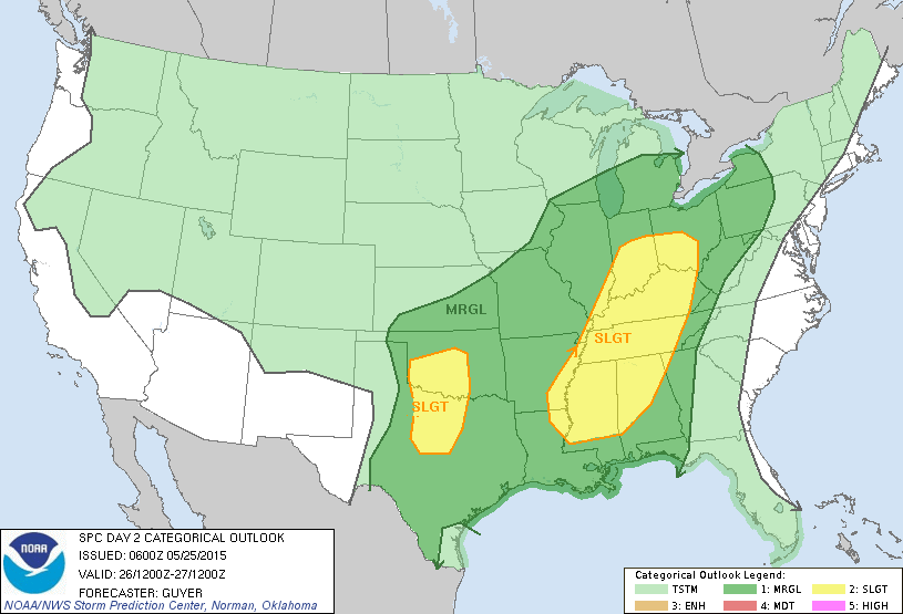
No doubt we will deal with showers and storms at times tomorrow, there are really more questions than answers about severe weather. On the positive side for severe storms, the high resolution (4km) NAM ramps up surface based instability values over West Alabama to around 4,000 j/kg tomorrow afternoon. Not sure this is realistic since we will probably have clouds over the state much of the state. Higher storm relative helicity values are over the Tennessee Valley of far North Alabama, but overall wind fields look weak, and I am less than impressed with the risk of organized severe weather.
WEDNESDAY: Not much change; moist air, upper trough to the west, so the sky will be mostly cloudy with occasional showers or storms… the high will be in the low 80s.
THURSDAY/FRIDAY: Showers and storms should begin to thin out on these days, with the better chance during the afternoon and evening hours. Otherwise, a mix of sun and clouds both days with a high up in the mid 80s.
THE WEEKEND: The last weekend of May looks pretty routine for this time of the year; partly sunny, warm days with the risk of scattered, mostly afternoon and evening showers and thunderstorms. Highs Saturday and Sunday will remain mostly in the mid 80s. The same pattern continues next week as June begins.
AT THE BEACH: About 3 to 5 hours of sunshine from Panama City over to Gulf Shores today and tomorrow with a few passing showers and storms likely. Then, 8 to 10 hours of sunshine each day Wednesday through the weekend, with just a few widely scattered showers and storms around each day. Highs on the immediate coast will remain in the low 80s, and the sea water temperature early this morning at the Dauphin Island Sea Lab is 78 degrees.
WEATHER BRAINS: Don’t forget you can listen to our weekly 90 minute netcast anytime on the web, or on iTunes. This is the show all about weather featuring many familiar voices, including our meteorologists here at ABC 33/40. We will produce this week’s show tonight at 8:30 CT… you can watch it on “James Spann 24/7” on cable systems around the state, or on the web here.
CONNECT: You can find me on all of the major social networks…
Facebook
Twitter
Google Plus
Instagram
Just one Weather Xtreme video today as we are on a holiday schedule, but I will post fresh forecast notes later this afternoon. Enjoy the day!
Category: Alabama's Weather
About the Author (Author Profile)
James Spann is one of the most recognized and trusted television meteorologists in the industry. He holds the AMS CCM designation and television seals from the AMS and NWA. He is a past winner of the Broadcast Meteorologist of the Year from both professional organizations.Subscribe
If you enjoyed this article, subscribe to receive more just like it.


