Storms To Our West Due in Here Tomorrow Morning
It has been a rough afternoon and night to the west of Alabama with a huge squall line producing tornadoes in Oklahoma, Texas, Arkansas, Mississippi and Louisiana. Tornadoes have threatened the Shreveport Metro, the Little Rock Metro and menaced Denison, Texas. A flash flood emergency has been in effect for Austin, Texas, where catastrophic flooding was reported.
The day started with at least an EF1 and perhaps an EF2 in Amory, Mississippi around 9 a.m. The NWS in Memphis will make a final determination based on further evidence. There were actually two tornadoes from that same mesoscale convective vortex.
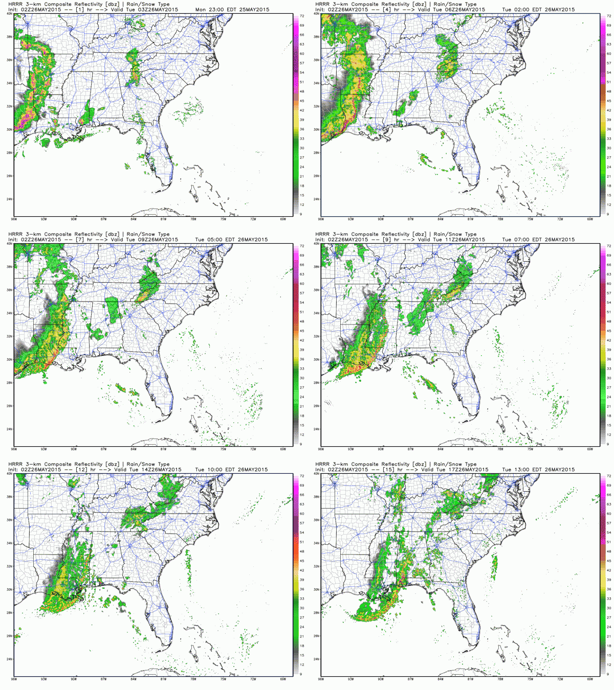
The line of storms has been racing east all day and is crossing the Mississippi River. It will reach West Alabama around 6-8 a.m. It will be weaker than earlier today, but storms could still pack a punch. Additional showers and storms will form overnight it appears in areas along and east of I-59 and those could affect the storms’ ability to become intense tomorrow. But if the line is slower and we can get some heating ahead of it, instability levels will be higher and there is a chance some of the storms could become severe. The SPC Day Two Outlook has had Alabama in a slight risk, their standard base level severe weather threat forecast.
Here is the High Resolution Rapid Refresh model depiction of the line overnight.
The line will reach the Mississippi River after midnight and West Alabama around 5-6 a.m. probably getting to Birmingham around midmorning.
So rest easy overnight but watch out tomorrow (especially West Alabama early) in case the storms are severe.
Category: Severe Weather


