

Rain, Storms Lifting Northeast
It is nice to see our old friend SimuAWIPS working again. It is a go to site for me for rapid analysis of the state of the atmosphere.
Here is the SimuAWIPS depiction of the radar across the Southeast in the large panel. You can clearly see the shield of rain and storms. If you look closely, you also see some curvature in the radar echoes over Mississippi. This is a weak surface low or mesoscale convective vortex that is moving to the northeast.
That little surface low was kicked up by a trough of low pressure in the mid-levels of the atmosphere that swept southeastward during the early morning hours out of Louisiana and across southern Mississippi.
There have been a few reports of trees down and isolated power outages with the storms this afternoon, but nothing serious. Torrential rains will cause minor flooding spots. There has already been flooding in Lamar County and an areal flood advisory has been posted for Talladega County. It is raining to beat the band in the city of Talladega right now.
Lots of lightning down there between Selma and Clanton will be lifting northeast and bringing very heavy rain, deadly lightning and gusty winds to Chilton, Coosa, Talladega and southeastern Shelby Counties for the next couple of hours. Shouldn’t become severe but will be packing a punch for sure.
The storms will continue to lift northeastward this evening, slowly weakening as they go. Parts of the area could get a few more hours of generally light to moderate rain. Here is the HRRR model radar simulation through the evening and overnight.
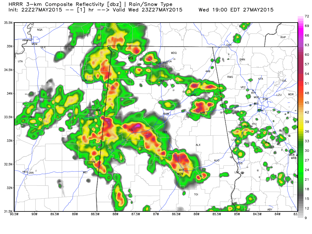
You can see that additional development is possible overnight, starting over southwestern sections around Demopolis around 10 p.m. and moving northeast, reaching Birmingham after midnight. Rainfall amounts will be generally light.
NOTE FROM NORTHWEST ALABAMA
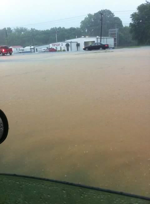
Reports indicate that flooding is pretty bad in Russellville in Franklin County where water is about to get into homes and a water rescue of a motorist is underway.
Here is a picture retweeted by meteorologist Ben Smith at WHNT in Huntsville of flooding along highway 43 in Russellville:
Category: Alabama's Weather
About the Author (Author Profile)
Bill Murray is the President of The Weather Factory. He is the site's official weather historian and a weekend forecaster. He also anchors the site's severe weather coverage. Bill Murray is the proud holder of National Weather Association Digital Seal #0001 @wxhistorianSubscribe
If you enjoyed this article, subscribe to receive more just like it.


