

Showers and Storms Firing Up
Showers and storms are starting to fire in an area of surface convergence generally along and just south of I-20 that is associated with a weak surface trough.
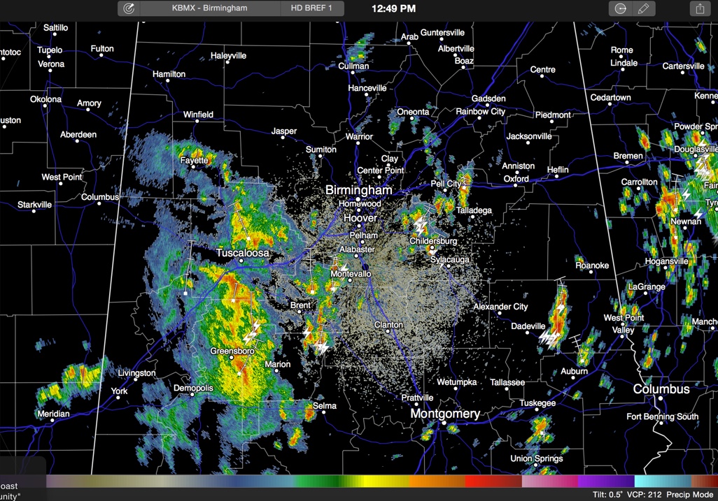
All morning, we have been tracking showers and storms in a large mas over West Central Alabama. A smaller batch moved through Tuscaloosa earlier and now the larger batch is moving toward T-town. Tuscaloosa could get a lengthy steady to heavy rain. One half to one inch of rain is possible in one hour from this activity.
Now showers and storms are clumped in eastern Bibb and southwestern Shelby Counties and over northeastern Shelby and Talladega counties. This activity will push north at just under 20 mph and will affect areas west of I-65 in Jefferson County and areas from Moody and Pell City up to Springville.
Skies are cloudy across the area with a few breaks mainly over the eastern part of the area. Temperatures are mainly in the 70s except where additional sunshine has pushed the mercury into the 80s.
Category: Alabama's Weather
About the Author (Author Profile)
Bill Murray is the President of The Weather Factory. He is the site's official weather historian and a weekend forecaster. He also anchors the site's severe weather coverage. Bill Murray is the proud holder of National Weather Association Digital Seal #0001 @wxhistorianSubscribe
If you enjoyed this article, subscribe to receive more just like it.


