

Scattered Strong Storms Tonight
RADAR CHECK: Heaviest storms in Alabama at mid-afternoon were over the northwest corner of the state; they are producing heavy, gusty winds, and frequent lightning as they move east. Some scattered wind damage was reported in Florence around 2:30…
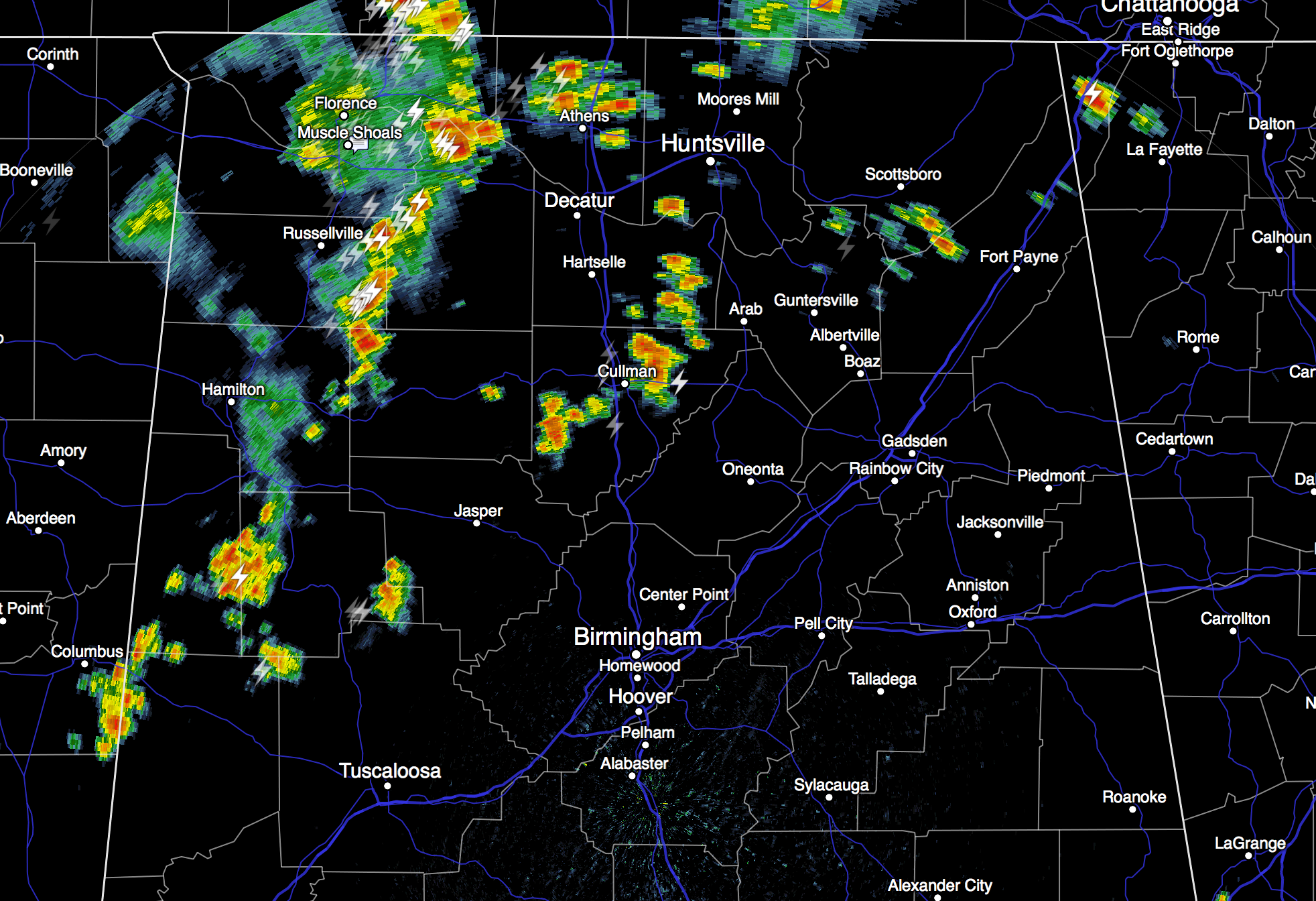
A surface front, supported by a fairly robust upper trough, is moving into extreme North Tennessee this afternoon, and as they approaches we will maintain the chance of at least scattered showers and thunderstorms tonight across the northern half of Alabama. Storms won’t be especially organized, and the overall severe weather threat for Alabama remains low with the better dynamic support passing to the north. But the heavier storms tonight will bring lightning, gusty winds, and brief heavy rain.
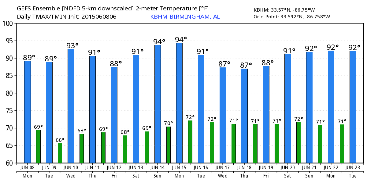
REST OF THE WEEK: Drier air will creep into North Alabama tomorrow as the front becomes nearly stationary somewhere around I-20; best chance of a passing shower or storm through Friday will be over the southern half of the state, with rain more widely scattered over the northern counties. Daily highs will be in the 86 to 90 degree range, about where we should be in mid-June in Alabama. Very typical of early summer.
THE ALABAMA WEEKEND: An upper high will begin to build across the Southeast U.S… meaning a trend toward hotter and drier weather. Looks like the high will be up in the low 90s Saturday and Sunday, with a good supply of hazy sunshine both days and only isolated afternoon showers or thunderstorms.
That ridge will most likely keep us hot through the first half of next week, with afternoon thunderstorms staying very isolated. See the Weather Xtreme video for maps, graphics, and more details.
AT THE BEACH: About 7 to 9 hours of sunshine each day through the weekend, with potential for scattered showers and thunderstorms. Highs on the immediate coast will be in the mid 80s, with 87 to 90 degrees likely each afternoon inland. Sea water temperatures are in the mid 80s.
TROPICS: The Atlantic basin remains quiet, and tropical storm formation is not expected this week.
WEATHER BRAINS: Don’t forget you can listen to our weekly 90 minute netcast anytime on the web, or on iTunes. This is the show all about weather featuring many familiar voices, including our meteorologists here at ABC 33/40. We will produce this week’s show tonight at 8:30 CT… you can watch it on “James Spann 24/7” on cable systems around the state, or on the web here.
CONNECT: You can find me on all of the major social networks…
Facebook
Twitter
Google Plus
Instagram
Look for the next Weather Xtreme video here by 7:00 a.m. tomorrow…
Category: Alabama's Weather
About the Author (Author Profile)
James Spann is one of the most recognized and trusted television meteorologists in the industry. He holds the AMS CCM designation and television seals from the AMS and NWA. He is a past winner of the Broadcast Meteorologist of the Year from both professional organizations.Subscribe
If you enjoyed this article, subscribe to receive more just like it.


