

Severe Thunderstorm Warning for Shelby County
UPDATE AT 645PM
THe NWS has canceled the warning as the storms have weakened slightly.
ORIGINAL POST: Strong thunderstorms near Calera have the potential to produce winds of 60 mph or greater and hail to the size of nickels.
This storm will move across the Birmingahm Metro over the next 75 minutes.
There is a storm out ahead of this one that is moving into southern Birmingham now but it is not severe.
Other storms are lined up from northwest to southeast across Cental Alabama. Everything is moving north at about 25 mph.
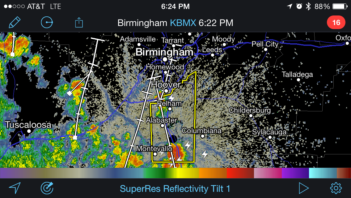
THE NATIONAL WEATHER SERVICE IN BIRMINGHAM HAS ISSUED A
* SEVERE THUNDERSTORM WARNING FOR…
CENTRAL SHELBY COUNTY IN CENTRAL ALABAMA…
* UNTIL 700 PM CDT
* AT 622 PM CDT…A SEVERE THUNDERSTORM WAS LOCATED OVER CALERA…
MOVING NORTH AT 35 MPH.
HAZARD…60 MPH WIND GUSTS.
SOURCE…RADAR INDICATED.
IMPACT…EXPECT DAMAGE TO ROOFS…SIDING AND TREES.
* LOCATIONS IMPACTED INCLUDE…
HOOVER…ALABASTER…PELHAM…HELENA…CALERA…CHELSEA…
MONTEVALLO…INDIAN SPRINGS VILLAGE…WILTON…UNIVERSITY OF
MONTEVALLO…LAKE PURDY…MEADOWBROOK…OAK MOUNTAIN STATE PARK…
MAYLENE…SHELBY COUNTY AIRPORT…AMERICAN VILLAGE…OAK MOUNTAIN
AMPHITHEATER…BROOK HIGHLAND…RIVERCHASE AND SAGINAW.
Category: Severe Weather
About the Author (Author Profile)
Subscribe
If you enjoyed this article, subscribe to receive more just like it.


