

It’s Official! It’s a Bill!
Here is the information from the first advisory on Tropical Storm Bill.
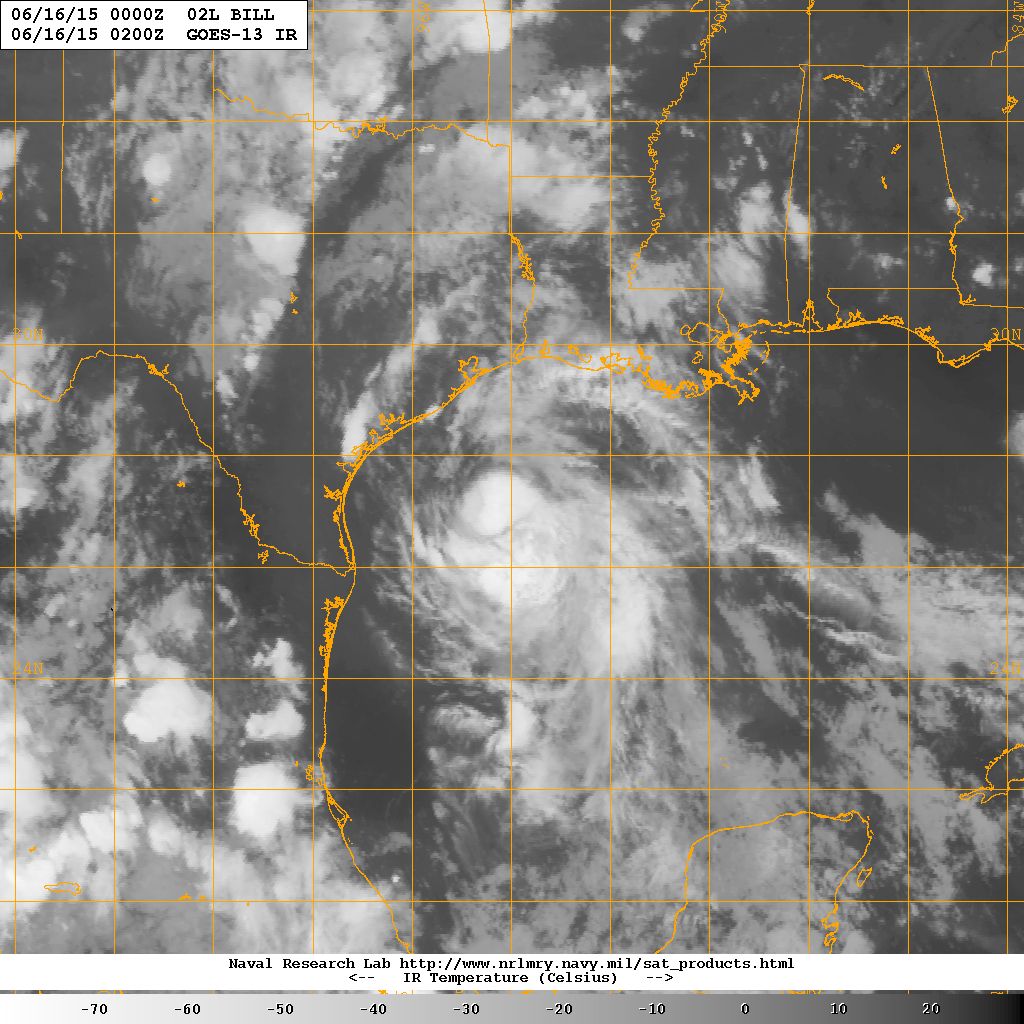
SUMMARY OF 1000 PM CDT…INFORMATION
———————————————–
LOCATION…27.1N 94.2W
ABOUT 160 MI…260 KM ESE OF PORT OCONNOR TEXAS
ABOUT 155 MI…250 KM SSE OF GALVESTON TEXAS
MAXIMUM SUSTAINED WINDS…50 MPH…85 KM/H
PRESENT MOVEMENT…NW OR 320 DEGREES AT 12 MPH…19 KM/H
MINIMUM CENTRAL PRESSURE…1005 MB…29.68 INCHES
Here is the official track forecast, which shows that the center of the remnants of Bill won’t make it past Austin until early Wednesday morning. Heavy rainfalls of 4-8 inches will affect eastern Texas up into eastern Oklahoma.
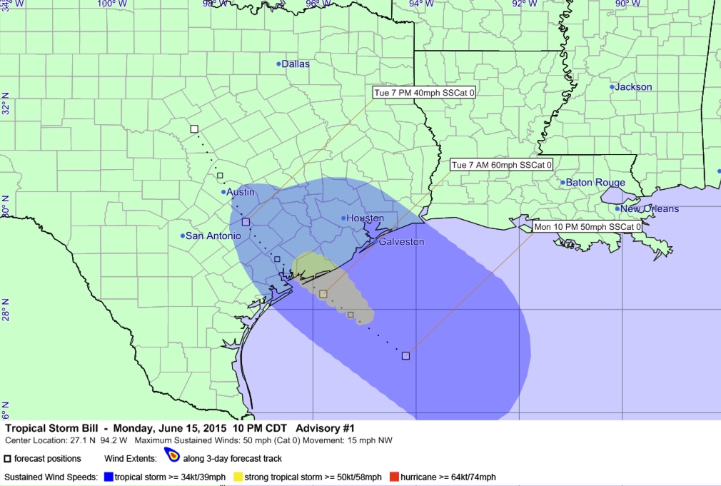
The accumulated wind swath is overlaid on the track path. The light blue shows the expected area of tropical storm force winds. The yellow indicates strong tropical storm force winds greater than or equal to 58 mph. There will be coastal flooding along the upper Texas coast over to Central Louisiana.
Bill will make landfall on the Texas Coast near Matagorda Bay early tomorrow morning, moving into the inland Texas Coast by late morning.
We will have to watch for rip currents all along the Gulf Coast. Two young boys died off North Padre Island this afternoon after they were caught in a rip current.
Category: Tropical
About the Author (Author Profile)
Bill Murray is the President of The Weather Factory. He is the site's official weather historian and a weekend forecaster. He also anchors the site's severe weather coverage. Bill Murray is the proud holder of National Weather Association Digital Seal #0001 @wxhistorianSubscribe
If you enjoyed this article, subscribe to receive more just like it.


