

3 Looks at a Landfalling Bill
Bill is making landfall on the Texas coast this morning as a strong tropical storm just south of Port OConnor.
Here is three looks at the storm this morning. The large panel is the composite radar. The top left is a visible satellite image and the lower left is an enhanced infrared satellite image.
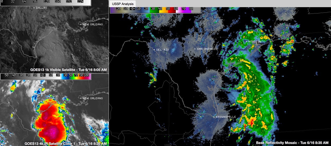
Top winds on the last advisory had strengthened to 60 mph and the Air Force plane just found a maximum sustained wind of 63.3 mph as measured by the Stepped Frequency Microwave Radiometer on board the aircraft.
So, Bill will be just below hurricane strength it appears at landfall.
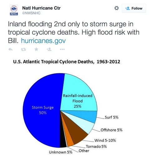
The main threat is heavy rain and a high flood risk across eastern Texas up into eastern Oklahoma. The heavy rains will continue on into the Midwest and even the Northeast. Inland flooding is the second biggest killer in tropical cyclones.
Category: Tropical
About the Author (Author Profile)
Bill Murray is the President of The Weather Factory. He is the site's official weather historian and a weekend forecaster. He also anchors the site's severe weather coverage. Bill Murray is the proud holder of National Weather Association Digital Seal #0001 @wxhistorianSubscribe
If you enjoyed this article, subscribe to receive more just like it.


