

Storms Approaching Northwest Alabama
The surface low that is the remnant of Tropical Storm Bill is still very well defined this afternoon over southern Missouri, approaching Cape Girardeau. There are distinct “feeder bands” or spokes of vorticity rotating around the system. One thin line of storms is approaching Northwest Alabama at this hour.
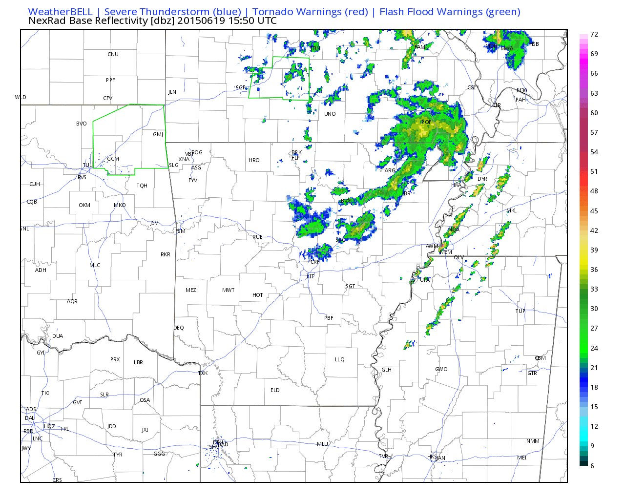
The convection will be into Northwest Alabama in about 90 minutes to 2 hours. The mesoscale models have been predicting that this convection will die out as it approaches the state, but I have a feeling that it will hold together as it continues to plow through moderately unstable air given the fairly strong forcing from the low.
Additional convection develop and/or move into Alabama later this evening and Saturday morning.
Winds have been gusty to the east and southeast of the low center over Arkansas, western Tennessee and northwestern Mississippi Winds gusted to 34 mph at Germantown TN near Memphis at 1:30 p.m. and have been consistently gusting above 25 mph in this area. Winds will start to pick up a little this evening over North Alabama, averaging over 10 mph through the overnight hours.
Category: Alabama's Weather, Headlines
About the Author (Author Profile)
Bill Murray is the President of The Weather Factory. He is the site's official weather historian and a weekend forecaster. He also anchors the site's severe weather coverage. Bill Murray is the proud holder of National Weather Association Digital Seal #0001 @wxhistorianSubscribe
If you enjoyed this article, subscribe to receive more just like it.


