

Heat Levels Fall Later This Week
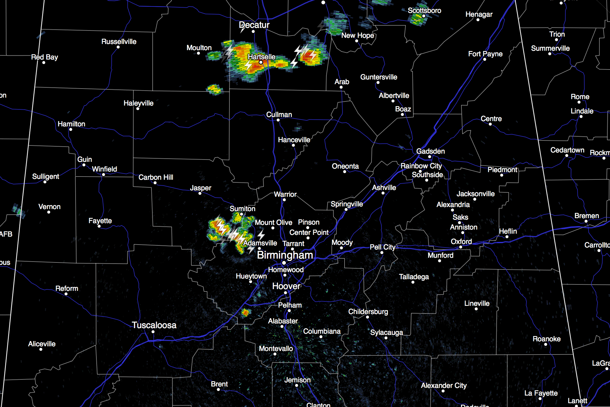
HOT SUMMER DAY: Temperatures are generally in the 92 to 95 degree range across North/Central Alabama, and as expected showers and storms are few and far between. But, where storms have formed, they are strong with frequent lightning and gusty winds.
An upper ridge will keep our weather hot tomorrow and Wednesday; we project a high between 94 and 98 degrees for most communities with a good supply of hazy sunshine. Like today, afternoon storms will be isolated.
HEAT LEVELS FALL LATER THIS WEEK: A pattern change means the heat will back off late this week with an increase in the number of showers and thunderstorms. It will be most noticeable Friday, with scattered to numerous showers and thunderstorms along with a high only in the 80s.
THE ALABAMA WEEKEND: Saturday looks relatively wet with occasional showers and storms, but it won’t rain all day, and there will be intervals of sunshine. Interesting to note that the 12Z GFS run is printing a high of only 81 degrees for Birmingham Saturday afternoon due to the clouds and showers. And, that same model run is suggesting drier, continental air drops into the northern half of Alabama Sunday, with lower humidity, and few, if any showers by then. Sunday’s high is expected to be in the mid 80s with the bulk of the showers and storms over the southern half of the state.
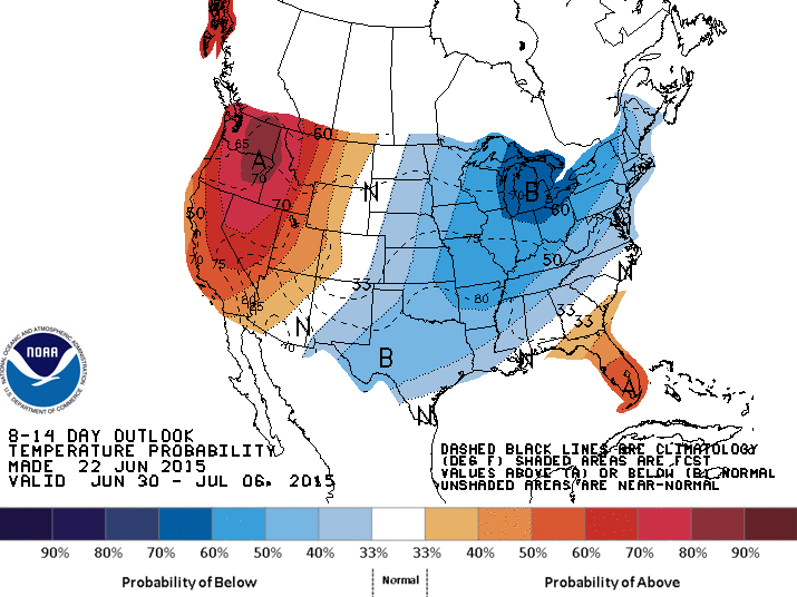
NEXT WEEK: For now it looks dry and pleasant Monday and Tuesday, with ample sunshine both days, low humidity levels, and highs in the 80s. The chance of scattered showers and storms will return by Wednesday and Thursday; see the Weather Xtreme video for maps, graphics, and more details.
AT THE BEACH: About 8 to 10 hours of sunshine along the Gulf Coast from Panama City Beach west to Gulf Shores tomorrow through Friday with widely scattered thunderstorms each day. Then, for the weekend, about 5 to 7 hours of sunshine with scattered storms becoming a little more numerous Saturday and Sunday. Highs on the immediate coast will be in the upper 80s, with 90s likely inland.
TROPICS: The Atlantic basin remains quiet, and tropical storm formation is not expected through the week.
WEATHER BRAINS: Don’t forget you can listen to our weekly 90 minute netcast anytime on the web, or on iTunes. This is the show all about weather featuring many familiar voices, including our meteorologists here at ABC 33/40. We will produce this week’s show tonight at 8:30p CT… you can watch it on “James Spann 24/7” on cable systems around Alabama, or on the web here.
CONNECT: You can find me on all of the major social networks…
Facebook
Twitter
Google Plus
Instagram
Look for the next Weather Xtreme video here by 7:00 a.m. tomorrow…
Category: Alabama's Weather
About the Author (Author Profile)
James Spann is one of the most recognized and trusted television meteorologists in the industry. He holds the AMS CCM designation and television seals from the AMS and NWA. He is a past winner of the Broadcast Meteorologist of the Year from both professional organizations.Subscribe
If you enjoyed this article, subscribe to receive more just like it.


