

New Rapidly Intensifying Storm Over Eastern Jefferson, NE Shelby
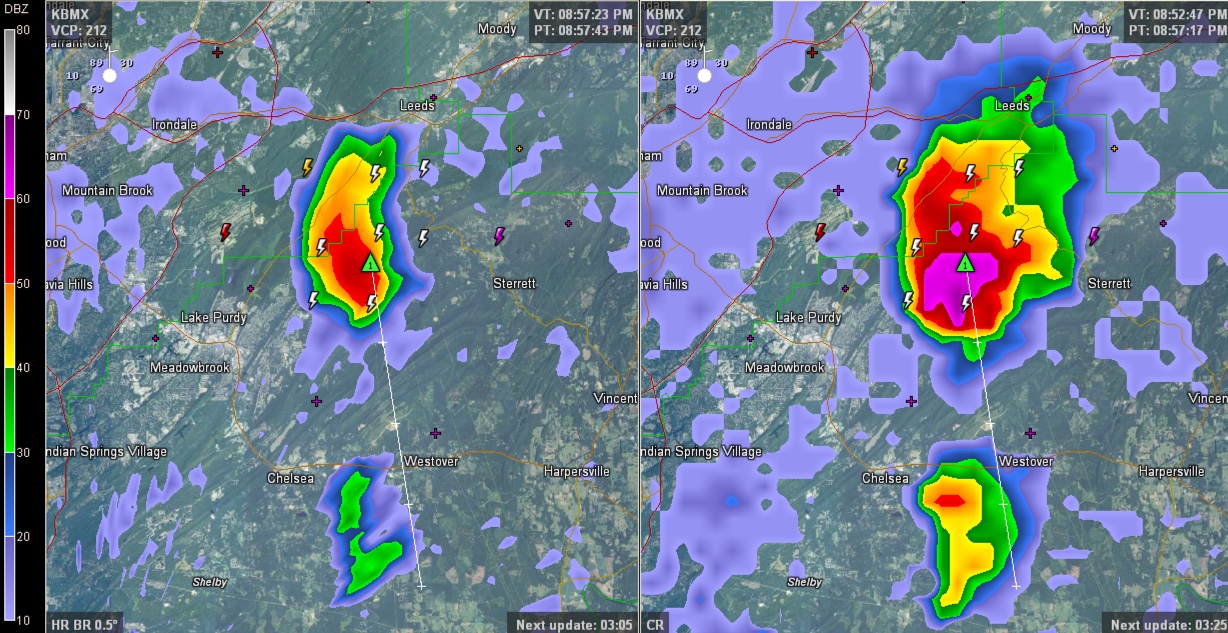
A new storm has fired south of Moody on the Jefferson/Shelby County Line. It is pushing south and will cross mountainous NE Shelby County moving in the direction of US-280 at Westover, passing between Chelsea and Harpersville.
This storm has a lot of rain and hail aloft that must come down, and it could bring strong winds eventually with that. You can see that in the composite reflectivity in the right panel of the image.
There could also be some hail. And of course lightning and torrential rain.
It will be a good idea to be inside as this storm approaches.
Another storm has formed in northeastern Tuscaloosa County near Lake View. It will affect I-59 shortly near Caffee Junction.
The storms are forming ahead of approaching outflow from the East Alabama storms.
Category: Alabama's Weather
About the Author (Author Profile)
Bill Murray is the President of The Weather Factory. He is the site's official weather historian and a weekend forecaster. He also anchors the site's severe weather coverage. Bill Murray is the proud holder of National Weather Association Digital Seal #0001 @wxhistorianSubscribe
If you enjoyed this article, subscribe to receive more just like it.


