

Severe Thunderstorm Warning Southern Dallas Co.
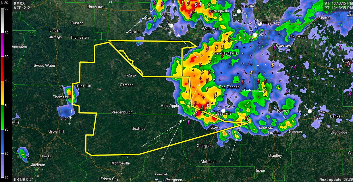
Strong indications of damaging winds from the storms moving southwest out of the Montgomery area. See the bow configuration on the thunderstorm complex on the radar image. This is a bow echo.
THE NATIONAL WEATHER SERVICE IN BIRMINGHAM HAS ISSUED A
* SEVERE THUNDERSTORM WARNING FOR…
SOUTHERN DALLAS COUNTY IN SOUTH CENTRAL ALABAMA…
* UNTIL 1100 PM CDT
* AT 1008 PM CDT…SEVERE THUNDERSTORMS WERE LOCATED ALONG A LINE
EXTENDING FROM NEAR BENTON TO 8 MILES SOUTHEAST OF BELKNAP TO 7
MILES SOUTHEAST OF PINE APPLE…MOVING WEST AT 35 MPH.
HAZARD…60 MPH WIND GUSTS.
SOURCE…RADAR INDICATED.
IMPACT…EXPECT DAMAGE TO ROOFS…SIDING AND TREES.
* LOCATIONS IMPACTED INCLUDE…
DANNELLY RESERVOIR…BELKNAP…DALLAS LAKE…TILDEN…MINTER…
CARLOWVILLE AND CRUMPTONIA.
Category: Severe Weather
About the Author (Author Profile)
Bill Murray is the President of The Weather Factory. He is the site's official weather historian and a weekend forecaster. He also anchors the site's severe weather coverage. Bill Murray is the proud holder of National Weather Association Digital Seal #0001 @wxhistorianSubscribe
If you enjoyed this article, subscribe to receive more just like it.


