

Lower Heat Levels, Higher Rain Chances
RADAR CHECK: Like you expect on a summer afternoon in Alabama, we have scattered showers and thunderstorms in progress this afternoon. They are drifting slowly to the southwest, and the heavier storms are producing heavy rain and lots of lightning.
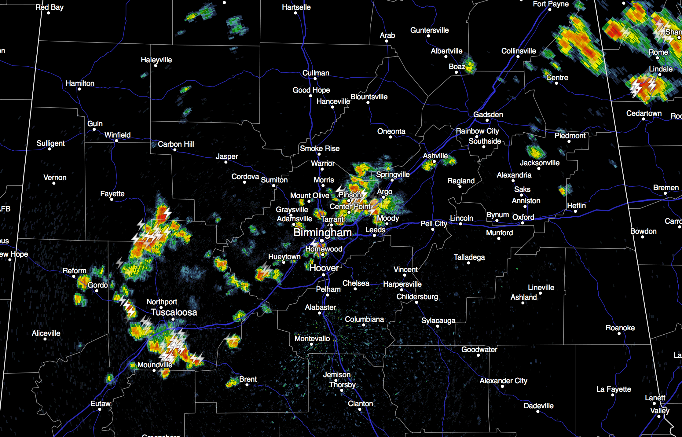
These storms will die down later tonight. Away from the storms, temperatures this afternoon are mostly in the mid 90s.
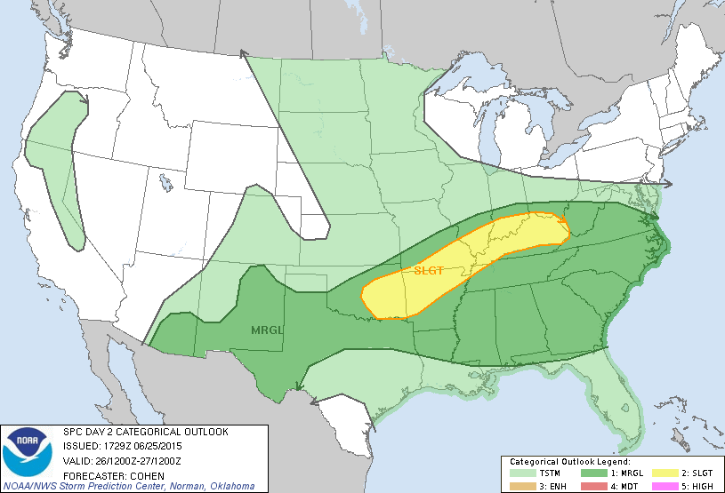
TOMORROW/SATURDAY: The long awaited pattern change begins, as a long wave upper trough forms over the eastern U.S. We expect an increase in the coverage of showers and storms tomorrow afternoon, and a decent chance we won’t get out of the 80s. We also note SPC has all of the state in a “marginal” severe weather risk… some of the afternoon storms will pack a punch, with potential for a few wet microbursts.
Saturday will be a day with more clouds than sun, and occasional showers and thunderstorms. The day won’t be all wet, but if you have something planned outdoors, understand rain delays are likely. The high Saturday will be only in the 82 to 85 degree range, a nice change from the recent heat. Rain ends Saturday evening as a rare late June front pushes down into South Alabama.
SUNDAY/MONDAY: Dry, continental air settles in, and we expect mostly sunny days, lower humidity, and cooler nights. Highs will be in the 80s, and some of the normally cooler spots could reach the upper 50s both Sunday and Monday morning for a nice fall preview.
Moisture returns along with a chance of scattered showers and thunderstorms Tuesday through Thursday… highs will be in the 87 to 90 degree range. See the Weather Xtreme video for maps, graphics, and more details.
AT THE BEACH: About 5 to 7 hours of sunshine each day along the coast from Panama City Beach west to Gulf Shores through the weekend, with the daily potential of scattered thunderstorms. Next week looks very routine, with 7 to 9 hours of sun each day, and the usual chance of a passing storm from time to time. Highs on the immediate coast will be in the mid to upper 80s, with low 90s possible just a few miles inland. Sea water temperatures are mostly in the mid 80s.
TROPICS: A vast amount of dry air continues to cover the tropical Atlantic basin, and tropical storm formation is not expected anytime soon.
WEATHER BRAINS: Don’t forget you can listen to our weekly 90 minute netcast anytime on the web, or on iTunes. This is the show all about weather featuring many familiar voices, including our meteorologists here at ABC 33/40.
CONNECT: You can find me on all of the major social networks…
Facebook
Twitter
Google Plus
Instagram
I had a great time today seeing the kids at the Guy Hunt Library and Museum in Holly Pond… be looking for them on the Pepsi KIDCAM today at 5:00 on ABC 33/40 News! The next Weather Xtreme video will be posted here by 7:00 a.m. tomorrow…
Category: Alabama's Weather
About the Author (Author Profile)
James Spann is one of the most recognized and trusted television meteorologists in the industry. He holds the AMS CCM designation and television seals from the AMS and NWA. He is a past winner of the Broadcast Meteorologist of the Year from both professional organizations.Subscribe
If you enjoyed this article, subscribe to receive more just like it.


