

Strong Storms Possible Later Today
AT DAYBREAK: A pretty quiet morning across Alabama, although a few widely scattered showers are forming across the central counties of the state.
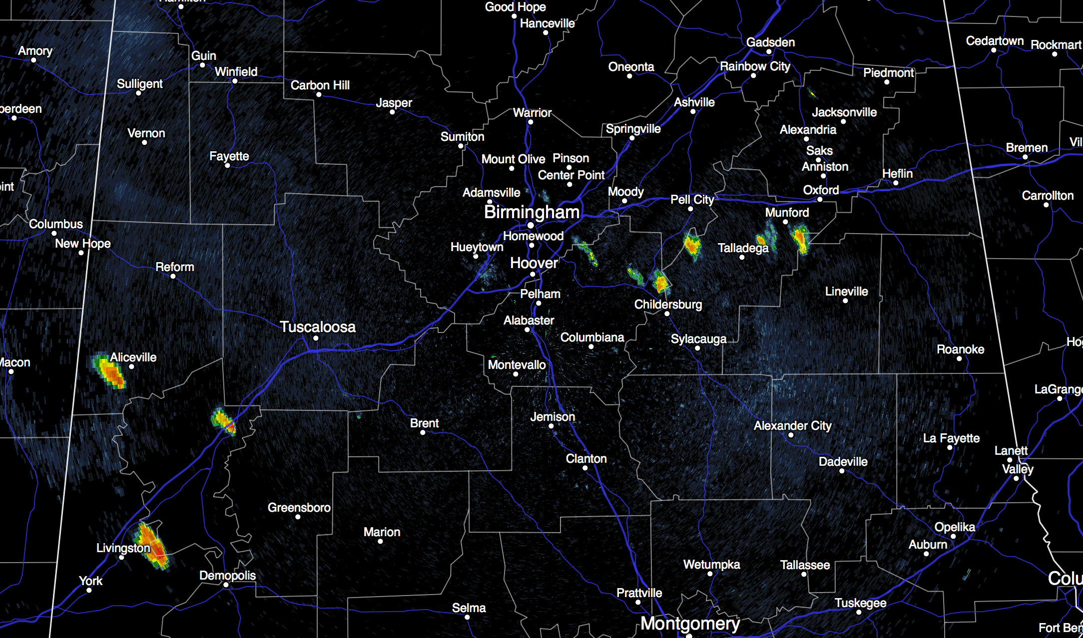
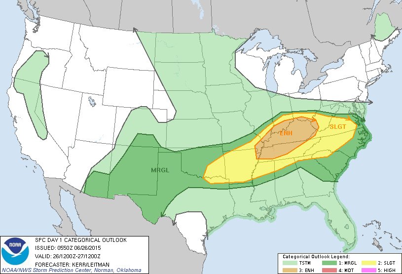
As the long awaited pattern change begins, we expect scattered to numerous showers and storms later today and tonight; some of those could be strong. SPC now has the standard “slight” risk of severe storms down into far North Alabama, with a “marginal” risk down to Birmingham.
Some of the storms that form today could bring microbursts (short lived, localized areas of damaging straight line winds that bring tree and power line damage), frequent lightning, and heavy rain. On the positive side, the weather won’t be as hot today with a high in the 87 to 90 degree range for most places.
THE WEEKEND: Tomorrow will be a day with more clouds than sun, and scattered to numerous showers and thunderstorms. There will be some nice breaks in the rain, and the sun could break out at times, but if you have something planned outdoors, be ready for showers or storms. We can’t give specific start/stop times, but the rain could come at any hour of the day. Temperatures won’t get past the mid 80s because of the clouds and showers. Rain will taper off late tomorrow afternoon and early tomorrow night as drier air works in from the north.
Sunday promises to be a delightful day, with ample sunshine and lower humidity. The GFS is printing a high of 85 for Birmingham Sunday afternoon… combine that with dewpoints down in the 50s, and it will be very comfortable for late June in Alabama.
NEXT WEEK: Dry air stays in place Monday, and some of the cooler pockets across North Alabama could reach the upper 50s at daybreak. The sky will remain generally sunny. Then, moisture returns Tuesday, and a few scattered afternoon showers or storms are possible. Then, each day for the rest of the week will feature a mix of sun and clouds, and the risk of “scattered, mostly afternoon and evening showers and thunderstorms”. Highs will be in the 87 to 90 degree range most days. And, this type of weather will likely continue into the Fourth of July weekend. See the Weather Xtreme video for maps, graphics, and more details.
AT THE BEACH: About 5 to 7 hours of sunshine today, tomorrow and Sunday with a few passing showers and thunderstorms. Then, for most of next week, 7 to 9 hours of sun daily with showers and storms becoming more widely spaced. Highs on the immediate coast will be in the mid to upper 80s, with low 90s possible inland. The sea water temperature early this morning at the Dauphin Island Sea Lab is 82 degrees.
TROPICS: The Atlantic basin remains very quiet, and tropical storm formation is not expected through the next five days.
WEATHER BRAINS: Don’t forget you can listen to our weekly 90 minute netcast anytime on the web, or on iTunes. This is the show all about weather featuring many familiar voices, including our meteorologists here at ABC 33/40.
CONNECT: You can find me on all of the major social networks…
Facebook
Twitter
Google Plus
Instagram
Look for the next Weather Xtreme video here by 4:00 this afternoon…. enjoy the day!
Category: Alabama's Weather
About the Author (Author Profile)
James Spann is one of the most recognized and trusted television meteorologists in the industry. He holds the AMS CCM designation and television seals from the AMS and NWA. He is a past winner of the Broadcast Meteorologist of the Year from both professional organizations.Subscribe
If you enjoyed this article, subscribe to receive more just like it.


