

Severe Weather Risk Upgraded to “Slight”
Our friends at the Storm Prediction Center have extended the “slight risk” area southwestward into much of Georgia and Alabama. Earlier today, we were under the standard “marginal risk”.
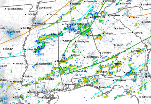
The risk area is within this green line that does include the Interstate 59 and Interstate 85 corridors. That means the population centers of Birmingham, Tuscaloosa, Anniston, Gadsden, and Montgomery are included now.
The SPC upgraded to a “slight risk” because relatively strong heating is occurring in these areas. This should yield pockets of afternoon CAPE values over 2500 J/kg, which is more than ample to allow storms to reach severe limits later today. Forecast soundings show moderately strong westerly flow loft, which will be leading to relatively fast storm motions and a greater risk of downward momentum transfer which are those “wet microbursts” that we talk about time to time. These “microbursts” can and do produce locally damaging winds. These damaging winds are the main threat with the stronger storms that develop in the region this afternoon and evening. Stay weather aware the rest of today.
Category: Alabama's Weather, Severe Weather
About the Author (Author Profile)
Macon, Georgia Television Chief Meteorologist, Birmingham native, and long time Contributor on AlabamaWX. Stormchaser. I did not choose Weather, it chose Me. College Football Fanatic. @Ryan_StinnetSubscribe
If you enjoyed this article, subscribe to receive more just like it.


