

Moisture Levels On The Rise
RADAR CHECK: Nothing on radar over the northern half of Alabama at mid-afternoon… we do note scattered storms over the southern quarter of the state.
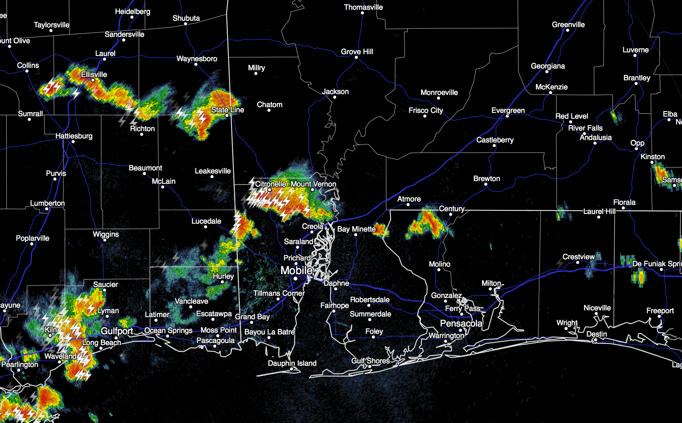
Temperatures are mostly in the upper 80s, and we will maintain the risk of widely scattered showers this evening over far North Alabama, especially near the Tennessee border.
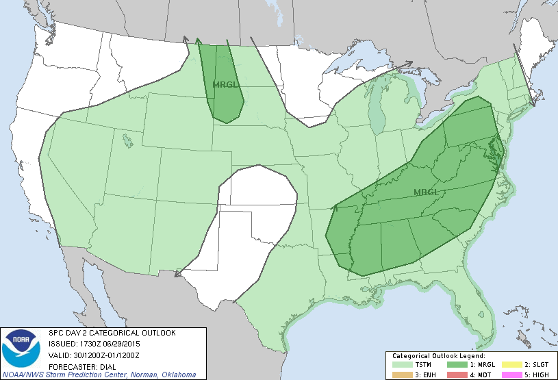
TOMORROW THROUGH THURSDAY: Moisture levels rise, and scattered showers and storms will return to North/Central Alabama all three days. As usual in summer, the rain won’t be continuous, rain distribution will not be even, and the sun will out at times. And, some of the storms could be strong, in fact SPC has much of North and Central Alabama under a “marginal” risk of severe storms tomorrow. The main threat will come from “wet microbursts”, or small areas of strong straight line winds that can knock down trees and power lines.
The best chance of showers and storms through mid-week will come during the afternoon and evening hours, but we can’t rule out a late night or morning shower. Highs will be in the mid to upper 80s.
FOURTH OF JULY WEEKEND: The overall pattern won’t change much Friday through Sunday. We will forecast a mix of sun and clouds each day, and the chance of “scattered, mostly afternoon and evening showers and storms” will continue. Chance of any one spot getting wet each day will be about one in three, and there will be some good intervals of sunshine away from the showers. Highs between 87 and 90 degrees… not too bad for early July in Alabama.
We are seeing evidence that an upper ridge will begin to build next week, meaning rising heat levels, and lower rain chances. See the Weather Xtreme video for maps, graphics, and more details.
AT THE BEACH: We are forecasting 7 to 9 hours of sunshine each day along the coast from Panama City Beach west to Gulf Shores through the holiday weekend with the usual risk of scattered showers and thunderstorms. Highs on the immediate coast will be in the mid to upper 80s, with low 90s inland. Sea water temperatures are mostly in the mid 80s.
TROPICS: A large amount of dry air continue to cover the deep tropics in the Atlantic, and we see no evidence of tropical storm formation through the next seven days.
WEATHER BRAINS: Don’t forget you can listen to our weekly 90 minute netcast anytime on the web, or on iTunes. This is the show all about weather featuring many familiar voices, including our meteorologists here at ABC 33/40. We will produce this week’s show tonight at 8:30p CT… you can watch it on “James Spann 24/7” on cable systems around the state, or on the web here.
CONNECT: You can find me on all of the major social networks…
Facebook
Twitter
Google Plus
Instagram
Look for the next Weather Xtreme video here by 7:00 a.m. tomorrow…
Category: Alabama's Weather
About the Author (Author Profile)
James Spann is one of the most recognized and trusted television meteorologists in the industry. He holds the AMS CCM designation and television seals from the AMS and NWA. He is a past winner of the Broadcast Meteorologist of the Year from both professional organizations.Subscribe
If you enjoyed this article, subscribe to receive more just like it.


