

Showers/Storms Return
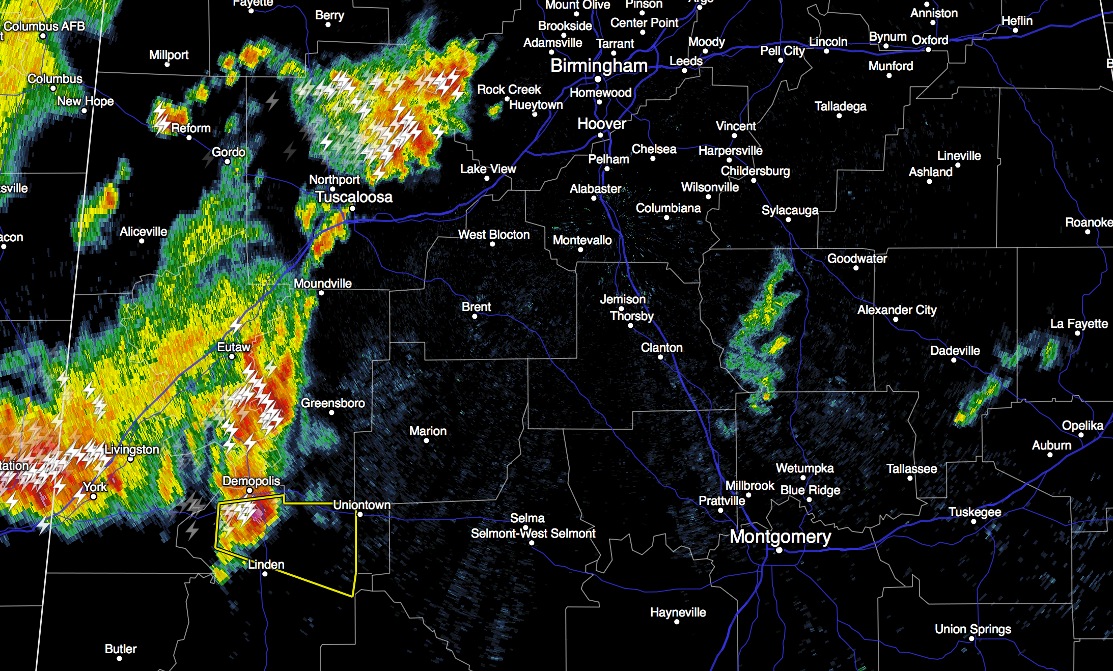
RADAR CHECK: As expected, moist air has returned to Central Alabama this morning, and the radar is pretty active just after daybreak. Some of the heavier storms are north of Tuscaloosa, and near Demopolis… and are producing heavy rain, frequent lightning, and some small hail as they move east. The NWS in Birmingham has just issued a severe thunderstorm warning for northern Marengo County until 7:15 am…
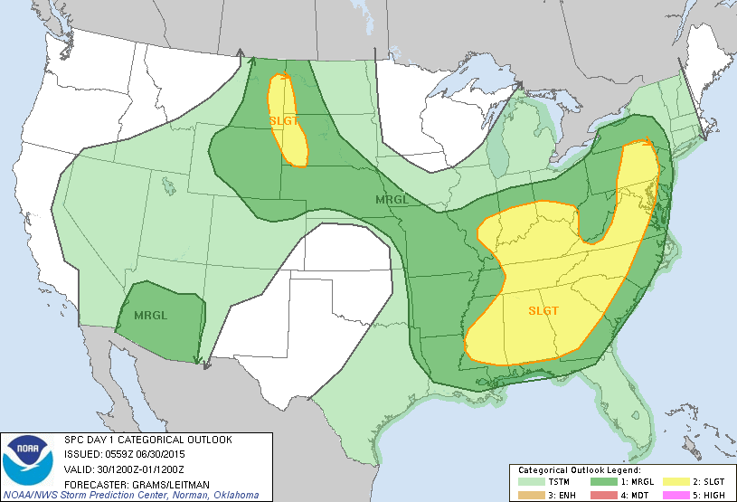
We will maintain the risk of scattered showers and storms today and tonight; some could be pretty strong… the Storm Prediction Center has most of the state in the standard “slight risk” of severe weather. The main threat will come from “wet microbursts”, or small areas of strong straight line winds that could bring down a few trees or power lines. And, of course, all summer storms feature gobs of lightning.
It won’t rain all day, and the sun should be out at times… the high this afternoon will be in the mid to upper 80s.
TOMORROW/THURSDAY: Not much change. Mixed sun and clouds; scattered showers and thunderstorms both days; best chance will come during the afternoon and evening hours, but we can’t rule out a late night or morning shower. Highs will be mostly in the 87 to 90 degree range.
FOURTH OF JULY WEEKEND: Very similar weather Friday through Sunday. Expect about 3 to 5 hours of sunshine each day, but there will be a good chance of a few passing showers or thunderstorms along the way. Due to the random and scattered nature of the storms, no way we can give you start/stop times of the rain for any specific location… just be ready for a downpour at times. Highs over the weekend will remain generally in the 87 to 90 degree range… not bad for early July in Alabama.
NEXT WEEK: Seems like an upper high will try and build across the region, meaning a trend toward fewer showers and storms and hotter afternoons… see the Weather Xtreme video for maps, graphics, and more details.
AT THE BEACH: Very typical summer weather through the holiday weekend from Panama City Beach west to Gulf Shores; about 7 to 9 hours of sunshine each day with the usual risk of scattered showers and thunderstorms. Highs on the immediate coast will be in the mid to upper 80s, with low 90s inland. The sea water temperature early this morning at the Dauphin Island Sea Lab is 82 degrees.
TROPICS: All is very quiet, and tropical storm formation is not expected through the weekend across the vast Atlantic basin.
WEATHER BRAINS: Don’t forget you can listen to our weekly 90 minute netcast anytime on the web, or on iTunes. This is the show all about weather featuring many familiar voices, including our meteorologists here at ABC 33/40. Scroll down for the show notes on the new episode we recorded last night.
CONNECT: You can find me on all of the major social networks…
Facebook
Twitter
Google Plus
Instagram
I will be doing a weather program today for the kids in the summer program at Oxmoor Valley Elementary in Birmingham… look for the next Weather Xtreme video here by 4:00 this afternoon. Enjoy the day!
Category: Alabama's Weather
About the Author (Author Profile)
James Spann is one of the most recognized and trusted television meteorologists in the industry. He holds the AMS CCM designation and television seals from the AMS and NWA. He is a past winner of the Broadcast Meteorologist of the Year from both professional organizations.Subscribe
If you enjoyed this article, subscribe to receive more just like it.


