

Severe Thunderstorm Warning for Birmingham Metro
LATE REPORT 7:29
John Talbot reports via scanner that there is a tree down on a power line at Oxmoor Road and Seminole Drive in Homewood.
Pea sized hail in Inverness as the storms approach the US-280 corridor. Hail was also reported in Hoover.
ORIGINAL POST
Strong thunderstorms are moving across the Birmingham Metro just in time for rush hour. They are just reaching I-65.
They have torrential rain, sharp lightning, some hail and the potential to produce damaging winds of 50-60 mph.
Try to be off the roads as the storms pass through. Do not pull under overpasses and block traffic!
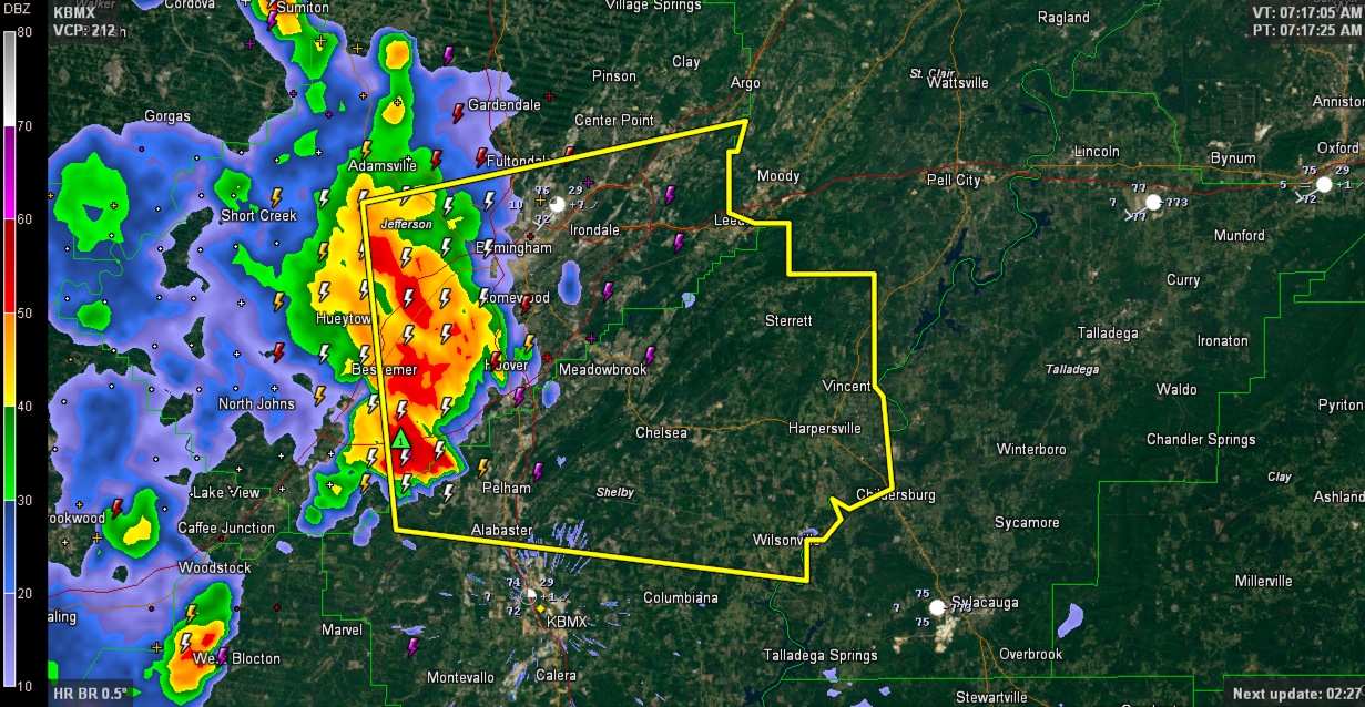
THE NATIONAL WEATHER SERVICE IN BIRMINGHAM HAS ISSUED A
* SEVERE THUNDERSTORM WARNING FOR…
SOUTHEASTERN JEFFERSON COUNTY IN CENTRAL ALABAMA…
CENTRAL SHELBY COUNTY IN CENTRAL ALABAMA…
* UNTIL 800 AM CDT
* AT 715 AM CDT…A SEVERE THUNDERSTORM WAS LOCATED OVER HELENA…
MOVING EAST AT 45 MPH.
HAZARD…60 MPH WIND GUSTS AND QUARTER SIZE HAIL.
SOURCE…RADAR INDICATED.
IMPACT…HAIL DAMAGE TO VEHICLES IS EXPECTED. EXPECT WIND DAMAGE
TO ROOFS…SIDING AND TREES.
* LOCATIONS IMPACTED INCLUDE…
BIRMINGHAM…HOOVER…VESTAVIA HILLS…ALABASTER…BESSEMER…
HOMEWOOD…PELHAM…MOUNTAIN BROOK…TRUSSVILLE…HELENA…
HUEYTOWN…IRONDALE…LEEDS…MOODY…FAIRFIELD…CHELSEA…
FULTONDALE…CHILDERSBURG…WILSONVILLE AND CENTER POINT.
Category: Severe Weather
About the Author (Author Profile)
Subscribe
If you enjoyed this article, subscribe to receive more just like it.


