

Severe Thunderstorm Warning for Calhoun County
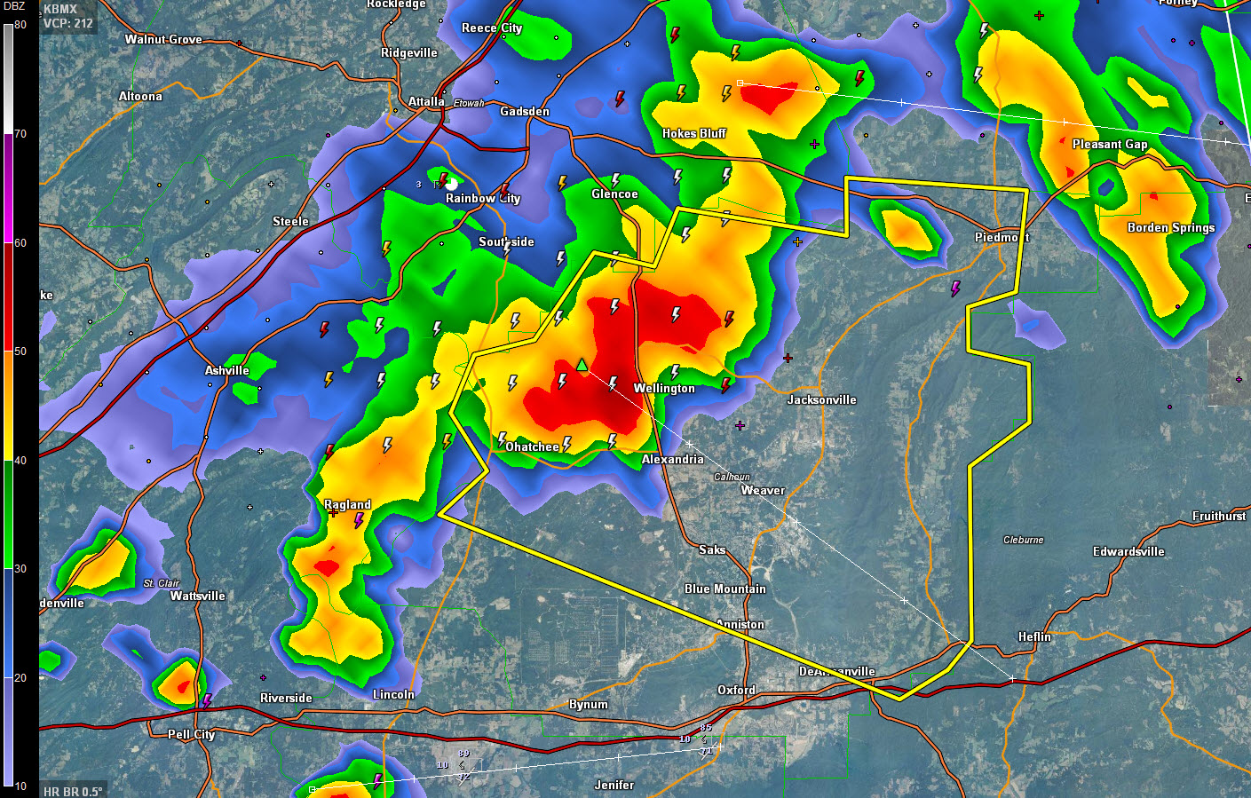
Strong thunderstorms moving from Etowah County into Calhoun County have intensified and are now considered to be severe.
They extend from Hokes Bluff to Ohatchee to Ragland.
Areas in the path include Piedmont, Wellington, Jacksonville, Weaver and northern parts of Anniston.
Damaging winds are the primary threat, but frequent lightning, torrential rains and some hail will accompany the storm as well.
THE NATIONAL WEATHER SERVICE IN BIRMINGHAM HAS ISSUED A
* SEVERE THUNDERSTORM WARNING FOR…
CALHOUN COUNTY IN EAST CENTRAL ALABAMA…
* UNTIL 430 PM CDT
* AT 333 PM CDT…A SEVERE THUNDERSTORM WAS LOCATED NEAR NEELY HENRY
LAKE…OR 7 MILES SOUTHEAST OF RAINBOW CITY…MOVING EAST AT 30
MPH.
HAZARD…60 MPH WIND GUSTS AND QUARTER SIZE HAIL.
SOURCE…RADAR INDICATED.
IMPACT…HAIL DAMAGE TO VEHICLES IS EXPECTED. EXPECT WIND DAMAGE
TO ROOFS…SIDING AND TREES.
Category: Severe Weather
About the Author (Author Profile)
Bill Murray is the President of The Weather Factory. He is the site's official weather historian and a weekend forecaster. He also anchors the site's severe weather coverage. Bill Murray is the proud holder of National Weather Association Digital Seal #0001 @wxhistorianSubscribe
If you enjoyed this article, subscribe to receive more just like it.


