

Muggy Fourth Of July Weekend
**No afternoon Weather Xtreme video today… we are on a holiday schedule**
RADAR CHECK: As you might expect on a summer day, rain totals have varied greatly across the great state of Alabama. Some northern counties have been under clouds and in rain much of the day, while the southern part of Alabama has enjoyed a mostly sunny sky. New storms are forming in the region where there is a good temperature gradient from clouds and rain to the north, and sun to the south.
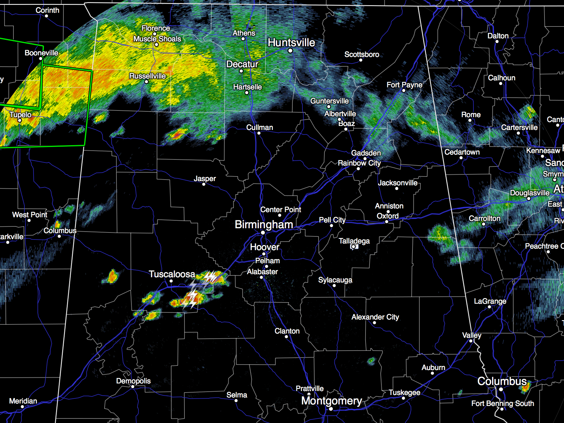
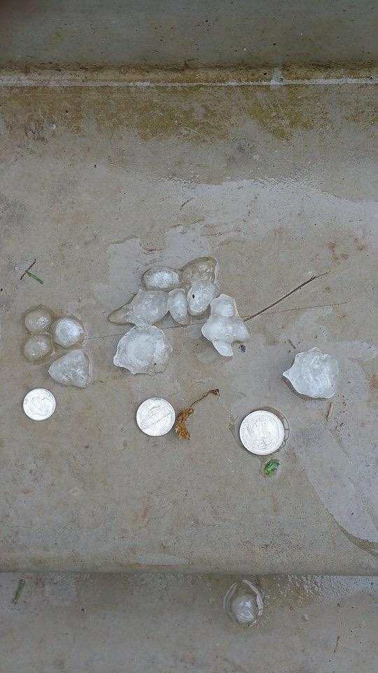
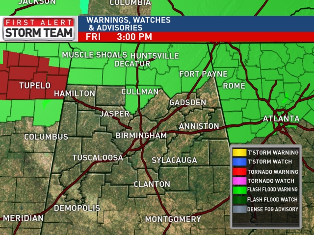
SPC maintains the standard “slight risk” of severe weather across North Central Alabama through tonight; storms that form could produce strong, gusty winds, some small hail, and lots of lightning. Hail below fell in Talladega around 1:30 this afternoon (photo from Joseph Swindall)…
And, we should point out the National Weather Service in Huntsville has issued a flash flood watch for the counties in their County Warning Area (CWA) through tomorrow.
REST OF THE HOLIDAY WEEKEND: Expect a few passing showers or thunderstorms tomorrow and Sunday as the moist air stays in place. While most of them will come during the afternoon and evening hours, we can’t rule out a late night or morning storm, much like today. And, where storms form they will be strong.
On the plus side, the sun will be out at times, and there will be some good breaks in the rain. And, heat levels not bad at all for July in Alabama with highs in the 80s.
FIREWORKS SHOWS: As you know in summer, storms tend to be very random and scattered, so there is no way to tell you exactly who will get rain at 9:00 tonight and tomorrow night when the shows start, but a majority of the venues should be dry with temperatures in the 70s.
AT THE BEACH: About 6 to 8 hours of sunshine each day through much of next week with the risk of an occasional passing thunderstorm from Panama City Beach west to Gulf Shores. Highs will remain in the mid to upper 80s on the immediate coast, with low 90s inland. Sea water temperatures are mostly in the low to mid 80s.
TROPICS: Tropical storm formation is not expected across the Atlantic basin through next week; dry air covers much of the deep tropics.
WEATHER BRAINS: Don’t forget you can listen to our weekly 90 minute netcast anytime on the web, or on iTunes. This is the show all about weather featuring many familiar voices, including our meteorologists here at ABC 33/40.
CONNECT: You can find me on all of the major social networks…
Facebook
Twitter
Google Plus
Instagram
Look for my next Weather Xtreme video here by Monday morning at 7:00… Brian Peters will have the video updates tomorrow and Sunday. Enjoy the weekend!
Category: Alabama's Weather
About the Author (Author Profile)
James Spann is one of the most recognized and trusted television meteorologists in the industry. He holds the AMS CCM designation and television seals from the AMS and NWA. He is a past winner of the Broadcast Meteorologist of the Year from both professional organizations.Subscribe
If you enjoyed this article, subscribe to receive more just like it.


