

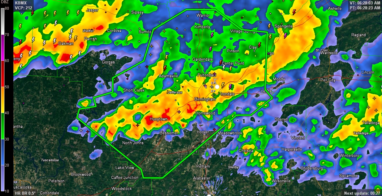
Flash Flood Warning for Jefferson/Metro Birmingham
LATE REPORT 7 AM
2.73 inches of rain at the Birmingham Airport in the past 24 hours, which 2.68 inches of it coming since 3:40 a.m.
Village Creek at Avenue W in Ensley (10.65′) has gone above its flood stage of 10 feet. More heavy rain is moving into the area and the creek will continue to rise.
ORIGINAL POST
Heavy rain continues this morning across North Central Alabama and flash flooding is becoming a real threat.
2-3 inches of rain has fallen across western Jefferson County from Sylvan Springs and Rock Creek to Downtown Birmingham.
Village Creek in Ensley is rising rapidly and will reach a moderate flood stage or higher. Currently forecast to reach 12.5 feet and could be higher if more rain develops to the west and moves in as expected.
Remember…turn around, don’t drown!
THE NATIONAL WEATHER SERVICE IN BIRMINGHAM HAS ISSUED A
* FLASH FLOOD WARNING FOR…
JEFFERSON COUNTY IN CENTRAL ALABAMA…
* UNTIL 930 AM CDT
* AT 629 AM CDT…DOPPLER RADAR INDICATED A THUNDERSTORM PRODUCING
HEAVY RAIN ACROSS THE WARNED AREA. UP TO THREE INCHES OF RAIN HAVE
ALREADY FALLEN. FLASH FLOODING IS EXPECTED TO BEGIN SHORTLY.
* SOME LOCATIONS THAT WILL EXPERIENCE FLOODING INCLUDE…
BIRMINGHAM…HOOVER…VESTAVIA HILLS…BESSEMER…HOMEWOOD…
MOUNTAIN BROOK…TRUSSVILLE…HUEYTOWN…GARDENDALE…IRONDALE…
LEEDS…MOODY…FAIRFIELD…FULTONDALE…SUMITON…CENTER POINT…
PLEASANT GROVE…CLAY…PINSON AND TARRANT.
ADDITIONAL RAINFALL OF 2 TO 4 INCHES POSSIBLE IN THE WARNED AREA.
Category: Severe Weather
About the Author (Author Profile)
Subscribe
If you enjoyed this article, subscribe to receive more just like it.


