

Cool Pic of the Day
Here is a cool graphic of the current visible satellite image with radar echoes superimposed.
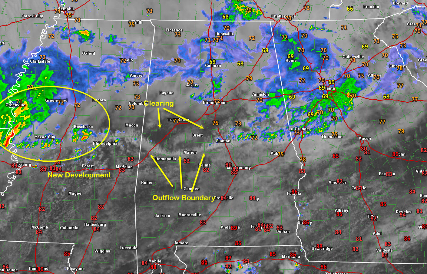
That delineated line is the outflow sinking south.
You can see clearing out behind it. The southward impetus of the outflow and the low level southerly surface winds are blowing off the tops of the clouds, resulting in the striations.
Additional storms are already firing back in western Mississippi, Louisiana and Arkansas. They are the result of another wind maximum moving through the upper trough just to our northwest that results in diffluence or spreading apart aloft, which creates lift at the surface!
Category: Alabama's Weather
About the Author (Author Profile)
Bill Murray is the President of The Weather Factory. He is the site's official weather historian and a weekend forecaster. He also anchors the site's severe weather coverage. Bill Murray is the proud holder of National Weather Association Digital Seal #0001 @wxhistorianSubscribe
If you enjoyed this article, subscribe to receive more just like it.


