

Severe Thunderstorm Watch Issued for North/North Central Alabama
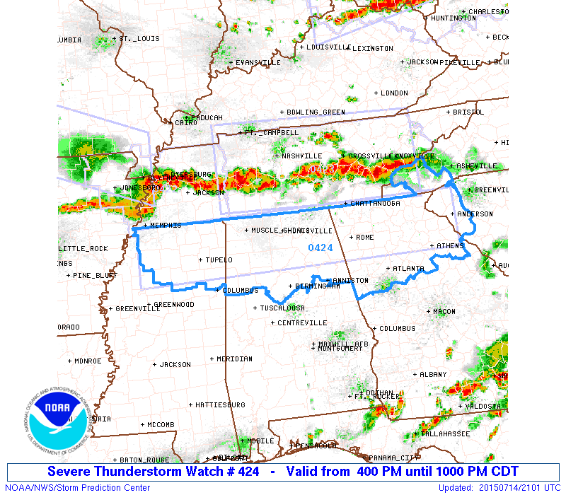
The SPC has issued a Severe thunderstorm Watch for North Alabama. It will be in effect until 10 p.m.
Central Alabama Counties include: Blount, Calhoun, Cherokee, Cleburne, Etowah, Fayette, Jefferson, Lamar, Marion, St. Clair, Walker and Winston.
North Alabama Counties include: Colbert, Cullman, DeKalb, Franklin, Jackson, Lauderdale, Lawrence, Limestone, Madison, Marshall and Morgan.
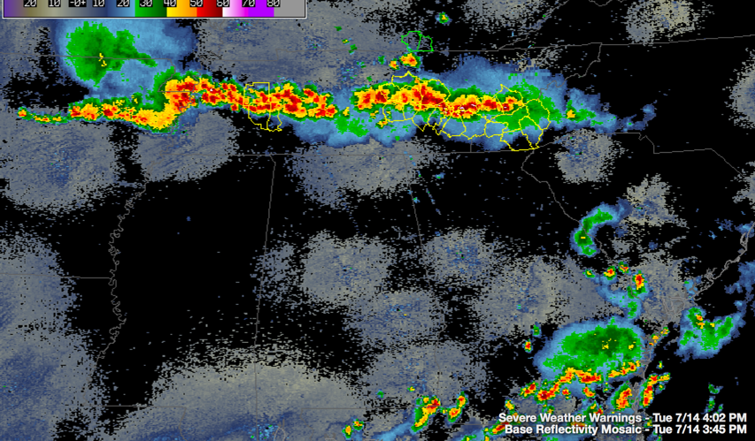
Severe thunderstorms are lined up in an almost continuous line across Tennessee from west to east. Severe thunderstorm warnings are in effect along the line.
Here is the composite radar with the warnings:
The storms are expected to weaken as they move out of the Tennessee Valley and into North Central Alabama, but sometimes these systems can take control of their own destiny with the development of a cold pool aloft, becoming a mesoscale convective system.
A significant damaging wind threat is approaching the Memphis area. Lots of reports of trees down upstream of the Memphis area.
Category: Alabama's Weather, Severe Weather
About the Author (Author Profile)
Bill Murray is the President of The Weather Factory. He is the site's official weather historian and a weekend forecaster. He also anchors the site's severe weather coverage. Bill Murray is the proud holder of National Weather Association Digital Seal #0001 @wxhistorianSubscribe
If you enjoyed this article, subscribe to receive more just like it.


