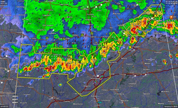
Storms Approaching I-59 Corridor
We continue to receive reports of wind damage from the line of thunderstorms that is dropping southeastward tonight.
At 7:20 p.m., trees were reported down near Jasper on Brakefield Road, with one tree on a vehicle.
Trees were reported down at 7:26 at Winfield in Marion County. Trees were also reported in Gu-Win in Marion County about 7:18.
In Blount County, trees were reported down near Brooksville in Blount County, near Highways 79/278.
At 7:50, the leading edge of the storms extend from Snead to Blountsville to Sipsey to Jasper to Vernon.
They are pushing southeast at 30 mph or so.
They will reach Ashville by 8:15-8:30, Birmingham about the same time, and Tuscaloosa a little after 9 p.m.
Damaging winds will be the threat, but remember, the storms have tremendous lightning as well. They will also produce brief heavy rainfall.
Category: Alabama's Weather, Severe Weather


