

Strong Storms Between Tuscaloosa/Birmingham
Ryan is working on the afternoon forecast discussion and should be along with a post soon, but I thought I would provide a radar check here at 2:30.
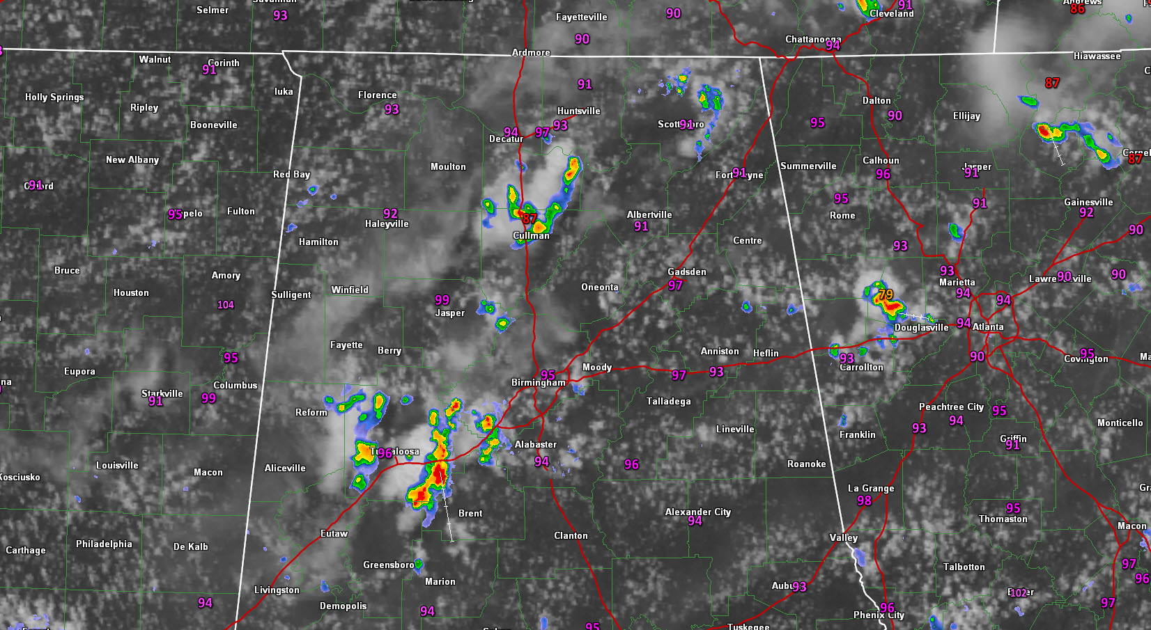
Showers and storms have continued to grow between Tuscaloosa and Birmingham and are pretty heavy now between Brookwood, Coaling and Duncanville. Others extend up to near Tannehill State Pak and North Johns, while others are over western Tuscaloosa County from Samantha to Coker and to near Fosters.
The eastern Tuscaloosa County storms are producing quite a bit of lightning and heavy rain. Gusty winds will be likely as well.
Other storms are near Cullman.
There is a light shower near Leeds in northeastern Shelby County, which could grow upscale into a storm soon.
Everything is pushing south.
Temperatures are now in the middle 90s, including 95F at Birmingham, 96F at Tuscaloosa and 97F at Talladega.
Category: Alabama's Weather
About the Author (Author Profile)
Bill Murray is the President of The Weather Factory. He is the site's official weather historian and a weekend forecaster. He also anchors the site's severe weather coverage. Bill Murray is the proud holder of National Weather Association Digital Seal #0001 @wxhistorianSubscribe
If you enjoyed this article, subscribe to receive more just like it.


