

Severe Thunderstorm Warning Tallapoosa Co.
This warning is for the lower portion of Tallapoosa County.
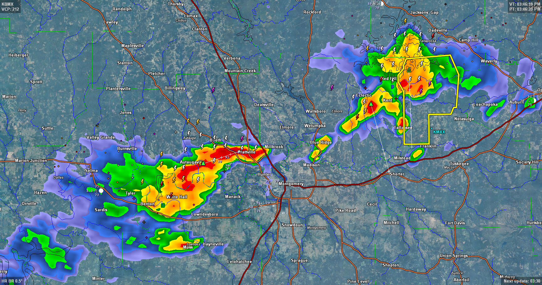
Storms are lined up north of I-85 and US-80 in South Central Alabama, pushing south and southeast.
Torrential rains, deadly lightning, gusty winds are all accompanying the storms. The severe storm has the potential to produce winds over 60 mph, which can cause tree and power line damage.
THE NATIONAL WEATHER SERVICE IN BIRMINGHAM HAS ISSUED A
* SEVERE THUNDERSTORM WARNING FOR…
SOUTH CENTRAL TALLAPOOSA COUNTY IN EAST CENTRAL ALABAMA…
* UNTIL 415 PM CDT
* AT 341 PM CDT…A SEVERE THUNDERSTORM WAS LOCATED NEAR MARTIN
DAM…OR 9 MILES NORTH OF TALLASSEE…MOVING SOUTH AT 20 MPH.
HAZARD…60 MPH WIND GUSTS.
SOURCE…RADAR INDICATED.
IMPACT…EXPECT DAMAGE TO ROOFS…SIDING AND TREES.
* LOCATIONS IMPACTED INCLUDE…
TALLASSEE…MARTIN DAM…TALLAPOOSA CITY…STILL WATERS RESORT…
LIBERTY CITY…REEVES AIRPORT…BLUE CREEK MARINA…YATES DAM…
REELTOWN AND YATES RESERVOIR.
Category: Severe Weather
About the Author (Author Profile)
Bill Murray is the President of The Weather Factory. He is the site's official weather historian and a weekend forecaster. He also anchors the site's severe weather coverage. Bill Murray is the proud holder of National Weather Association Digital Seal #0001 @wxhistorianSubscribe
If you enjoyed this article, subscribe to receive more just like it.


