

Storms About to Enter Birmingham Metro
A complex weather scenario is in place across Alabama and Mississippi this afternoon with a couple of disturbances sliding from west to east in the mid-level flow and a frontal system trying to works its way into the Tennessee Valley.
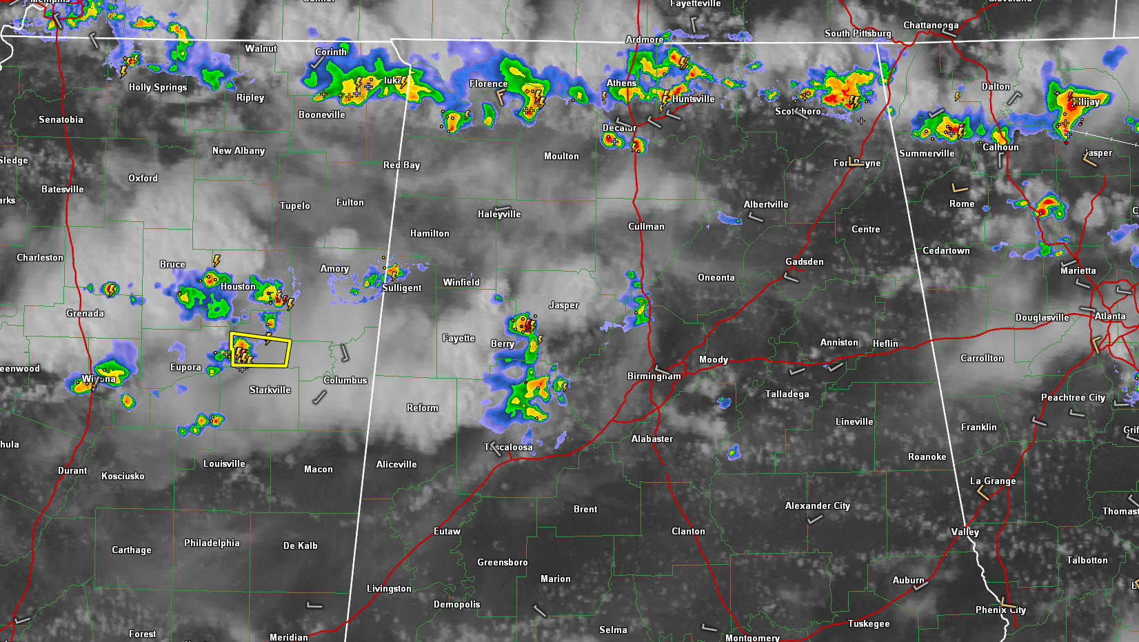
Showers and storms are lined up generally north of the Tennessee River in North Alabama and have been growing as they sink southward.
In addition, to the south of this activity, a couple of cluster of storms are moving along with the disturbance.
The first is about to enter western Jefferson County from Walker and northern Tuscaloosa counties. This activity will affect western parts of the Birmingham Metro by 4:30 continue across the Metro between 4:30-5:30. Lightning and gusty winds can be expected along with brief heavy rain. Winds gusted to 37 mph and the temperature dropped from 100F to 89F at Tuscaloosa as these storms passed just to the north of the city.
To the west, a loose grouping of storms was pushing into northeastern Mississippi between Bruce and Starkville. The storms appear to have peaked in intensity, probably as they run into the exhaust air from the first complex which is now approaching Birmingham. There is a severe thunderstorm warning for Clay County MS, north of Starkville.
It is funny to see the clouds being left in the wake of the first group of storms. It sort of looks like a smoking car coming east on US-82.
These storms may affect parts of West Alabama in about 75-90 minutes, around 5-5:30.
Category: Alabama's Weather
About the Author (Author Profile)
Bill Murray is the President of The Weather Factory. He is the site's official weather historian and a weekend forecaster. He also anchors the site's severe weather coverage. Bill Murray is the proud holder of National Weather Association Digital Seal #0001 @wxhistorianSubscribe
If you enjoyed this article, subscribe to receive more just like it.


