

Strong Storms Approaching Parts of Birmingham Metro
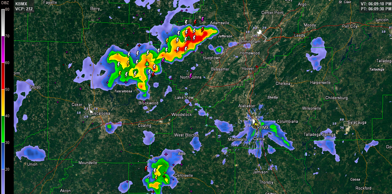
Strong thunderstorms over over western Jefferson and northeastern Tuscaloosa Counties at this hour. Areas from Short Creek down to north of Brookwood are under the gun right now with strong gusty winds, deadly lightning and torrential rains.
The strongest winds are over western Jefferson County west of Rock Creek.
Tops on the western Jefferson County cell are over 50,000 feet indicating a powerful storm.
The storm over northeastern Tuscaloosa County northwest of lake View is intensifying rapidly.
This activity will push southeast, affecting areas from Mulga and Fairfield down to Rock Creek and Hueytown to North Johns, Brookwood, Lake View, Peterson and Holt will be affected.
Elsewhere across Central Alabama, strong storms are west of Eutaw, south of Centreville, south of Clanton and over I-85 near Tuskegee.
Category: Alabama's Weather
About the Author (Author Profile)
Bill Murray is the President of The Weather Factory. He is the site's official weather historian and a weekend forecaster. He also anchors the site's severe weather coverage. Bill Murray is the proud holder of National Weather Association Digital Seal #0001 @wxhistorianSubscribe
If you enjoyed this article, subscribe to receive more just like it.


