

Storms More Numerous Today
RADAR CHECK: We have a few showers and storms on radar early this morning across Central Alabama… moving to the southeast.
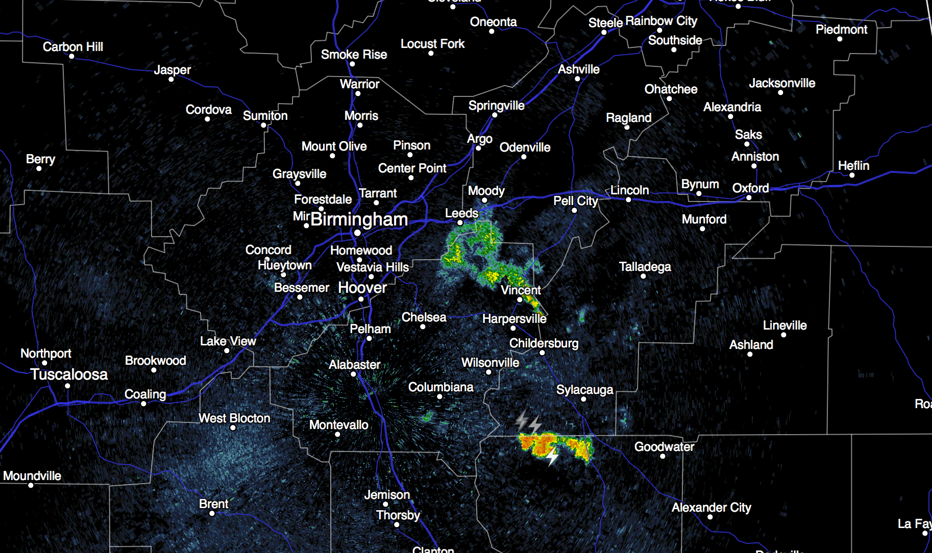
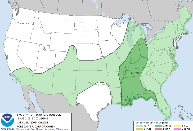
When you see early morning storms in summer, that is a pretty good sign the atmosphere is unstable and not capped, and that often means scattered to numerous showers and storms later in the day during the peak of the daytime heating process. The chance of any one spot seeing a storm today is about 50/50, and some of them could be strong. SPC maintains a “marginal” severe weather risk for much of Alabama today…
The prime risk will come from “wet microbursts”, or local areas of strong straight line winds. And, of course, all summer storms pack gobs of lightning. Most communities will see a high in the low to mid 90s today with a mix of sun and clouds.
TOMORROW: A surface boundary (notice we don’t call them “cold fronts” in late July) will move down into North Alabama, and will probably trigger more thunderstorms. I don’t think the coverage of the storms will be as high as today, but where they do form, they could be strong again, and SPC maintains a “marginal” severe weather threat for much of the state tomorrow. The high tomorrow afternoon will be in the mid 90s with a mix of sun and clouds.
FRIDAY AND THE WEEKEND: Drier air will filter into the northern half of Alabama, meaning slightly lower humidity levels, slightly cooler nights, and very few showers on these three days. The best chance of scattered storms will be over the southern third of the state. Highs will be in the 90s, but many North Alabama communities will enjoy lows in the 60s over the weekend because of the drier air and lower dew points.
The weather for the first few days of next week looks pretty calm with only isolated storms… see the Weather Xtreme video for maps, graphics, and more details.
AT THE BEACH: About 6 to 8 hours of sunshine daily on the coast from Gulf Shores east to Panama City Beach through the weekend, with a passing storm from time to time. Highs on the coast will be in the upper 80s, with mid 90s inland. The sea water temperature early this morning at the Dauphin Island Sea Lab is 85 degrees. See the complete Gulf Coast 7 Day Planner here. The Gulf Coast Beach Forecast is presented by Gulf Shores Plantation by Mandoki Hospitality Vacation Rentals. Escape to Gulf Shores Plantation where memories last a lifetime.
TROPICAL WEATHER: The Atlantic basin remains very quiet, and tropical storm formation is not expected through the weekend. The peak of the season usually comes in August and September, and it ends on the last day of November.
WEATHER BRAINS: Don’t forget you can listen to our weekly 90 minute netcast anytime on the web, or on iTunes. This is the show all about weather featuring many familiar voices, including our meteorologists here at ABC 33/40.
CONNECT: You can find me on all of the major social networks…
Facebook
Twitter
Google Plus
Instagram
Look for the next Weather Xtreme video here by 4:00 this afternoon… enjoy the day…
Category: Alabama's Weather
About the Author (Author Profile)
James Spann is one of the most recognized and trusted television meteorologists in the industry. He holds the AMS CCM designation and television seals from the AMS and NWA. He is a past winner of the Broadcast Meteorologist of the Year from both professional organizations.Subscribe
If you enjoyed this article, subscribe to receive more just like it.


