

Trending Wetter; Not As Hot
HEAT LEVELS COMING DOWN, RAIN CHANCES GOING UP: For some in Alabama, yesterday was the hottest day of the summer so far. The official high at Tuscaloosa and Montgomery was 100; Birmingham soared to 99, while Anniston hit 98. On the positive side, lower dew points resulted in relative humidity levels in the 30 percent range during the peak of the heat.
TODAY: A well defined short wave over Missouri will slowly approach, meaning a better chance of scattered showers and thunderstorms this afternoon and tonight. The chance of any one spot seeing a storm this afternoon is about one in three, and the high will be in the mid 90s. We should mention scattered storms are possible into the late night hours with upper support from the wave to the northwest.
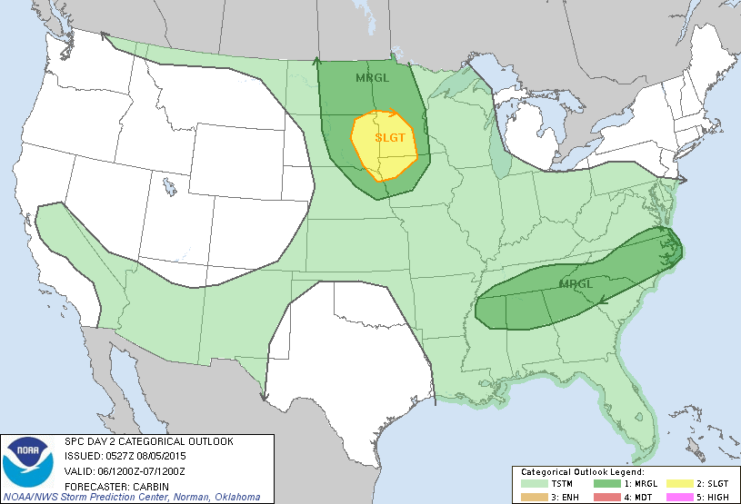
TOMORROW: This should be the wettest day of the week, with scattered to numerous showers and thunderstorms likely. Maybe a few strong storms; SPC has the northern half of the state in a “marginal” severe weather risk…
The prime risk with the stronger storms tomorrow will come from strong straight line winds. On the positive side, because of the clouds and showers, many North/Central Alabama communities won’t get out of the 80s.
FRIDAY: While the weather begins to trend drier, we will still need to mention at least the chance of one or two passing showers or storms with a northwest flow aloft, and a fairly moist airmass still in place. Otherwise, Friday will be partly sunny with a high at or just over 90 degrees.
THE ALABAMA WEEKEND: Saturday looks like a typical August day; partly sunny, hot, and humid with the risk of widely scattered showers and thunderstorms. Then, on Sunday, showers become very isolated with a good supply of sunshine. The GFS is printing 94 for Saturday, and 97 Sunday for Birmingham.
NEXT WEEK: Hot and humid Monday and Tuesday with some risk of “scattered, mostly afternoon and evening showers and thunderstorms”… highs up in the mid 90s. Then, we could very well see an increase in the number of showers and storms Wednesday and Thursday with a surface boundary approaching from the north; see the Weather Xtreme video for maps, graphics, and more details.
AT THE BEACH: About 3 to 5 hours of sunshine today on the coast from Panama City Beach west to Gulf Shores, with scattered to numerous showers and storms. Then, tomorrow through the weekend, about 6 to 8 hours of sun daily with the usual risk of a passing thunderstorm from time to time. Understand there is some risk of a storm every day in summer on the Gulf Coast. Highs on the immediate coast will be in the upper 80s, with mid 90s just a few miles inland. The sea water temperature early this morning at the Dauphin Island Sea Lab is 85 degrees.
See the complete Gulf Coast 7 Day Planner here. The Gulf Coast Beach Forecast is presented by Gulf Shores Plantation by Mandoki Hospitality Vacation Rentals. Escape to Gulf Shores Plantation where memories last a lifetime.
TROPICS: The broad surface low around the Outer Banks of North Carolina is moving northeast, and no development is expected there. Over in the Pacific, Tropical Storm Guillermo will pass north of the Hawaiian Islands while slowly weakening in coming days, and Typhoon Soudelor will approach Taiwan Friday. Soudelor will be weakening by then, but sustained winds could still be in the 100 mph range. See the Weather Xtreme video for all the maps.

WEATHER BRAINS: Don’t forget you can listen to our weekly 90 minute netcast anytime on the web, or on iTunes. This is the show all about weather featuring many familiar voices, including our meteorologists here at ABC 33/40.
CONNECT: You can find me on all of the major social networks…
Facebook
Twitter
Google Plus
Instagram
Thanks to Bill Murray for covering while I was away on vacation; we are back on the “two a day” schedule, and the next Weather Xtreme video will be posted here by 4:00 this afternoon. Enjoy the day!
Category: Alabama's Weather
About the Author (Author Profile)
James Spann is one of the most recognized and trusted television meteorologists in the industry. He holds the AMS CCM designation and television seals from the AMS and NWA. He is a past winner of the Broadcast Meteorologist of the Year from both professional organizations.Subscribe
If you enjoyed this article, subscribe to receive more just like it.


