

Wet/Stormy Day Ahead
RADAR CHECK: A number of showers and thunderstorms are in progress early this morning across the northern half of Alabama. Not severe, but producing heavy rain in spots…
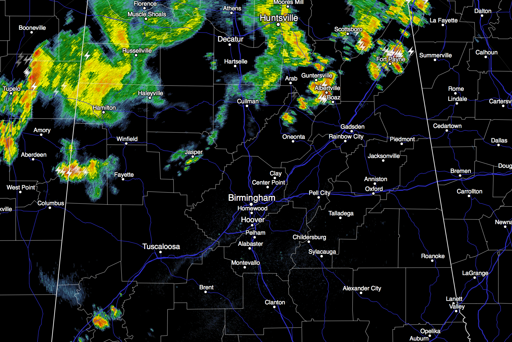
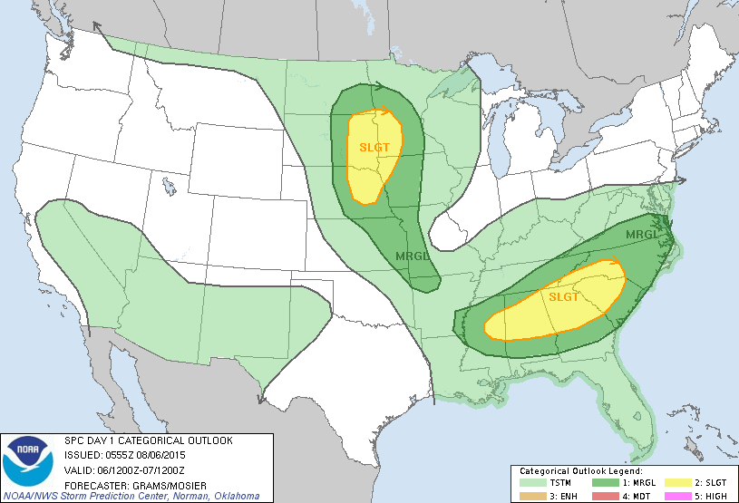
A short wave trough in the upper atmosphere will provide good dynamic support for more showers and storms later today, and some of them could be pretty strong. SPC now has much of North/Central Alabama in the standard “slight risk” of severe weather for this afternoon…
The heavier storms could produce strong, gusty winds and heavy rain. Some flooding issues are not out of the question; our in house mesoscale model (RPM) suggests a few spots could see over two inches of rain.
On the positive side, we won’t get out of the 80s today because of clouds and showers.
TOMORROW AND THE WEEKEND: The weather trends hotter and drier. While a passing shower or storm is still possible tomorrow afternoon, many communities will be dry as temperatures rise into the low 90s. Then, Saturday and Sunday are looking mostly rain-free. Expect a good supply of sunshine both days with afternoon highs up in the mid 90s. The chance of rain over the weekend is not zero, but any showers and storms will be very isolated.
NEXT WEEK: Confidence is not especially high with inconsistent model output, but we do expect an increase in the number of showers and storms early in the week as a surface front approaches from the north. The latest GFS run (06Z) hints the front could push into South Alabama by Wednesday, with drier air over the northern counties of the state. We all know fronts don’t make it that far south too often in August; for now we will keep the risk of scattered storms in the forecast through mid-week and make adjustments as needed. See the Weather Xtreme video for maps, graphics, and more details.
AT THE BEACH: About 6 to 8 hours of sunshine daily on the coast from Panama City Beach west to Gulf Shores through the weekend with a passing storm from time to time. Highs on the immediate coast will be in the upper 80s, with mid 90s just a few miles inland. The sea water temperature early this morning at the Dauphin Island Sea Lab is 82 degrees.
See the complete Gulf Coast 7 Day Planner here. The Gulf Coast Beach Forecast is presented by Gulf Shores Plantation by Mandoki Hospitality Vacation Rentals. Escape to Gulf Shores Plantation where memories last a lifetime.
TROPICS: The Atlantic basin remains very quiet, but over in the western Pacific Typhoon Soudelor is nearing Taiwan with sustained winds of 100 mph and torrential rain. Some strengthening is likely before it reaches the island tomorrow.

WEATHER BRAINS: Don’t forget you can listen to our weekly 90 minute netcast anytime on the web, or on iTunes. This is the show all about weather featuring many familiar voices, including our meteorologists here at ABC 33/40.
CONNECT: You can find me on all of the major social networks…
Facebook
Twitter
Google Plus
Instagram
Look for the next Weather Xtreme video here by 4:00 this afternoon… enjoy the day!
Category: Alabama's Weather
About the Author (Author Profile)
James Spann is one of the most recognized and trusted television meteorologists in the industry. He holds the AMS CCM designation and television seals from the AMS and NWA. He is a past winner of the Broadcast Meteorologist of the Year from both professional organizations.Subscribe
If you enjoyed this article, subscribe to receive more just like it.


