

Stormy This Evening; Drying Trend Begins Tomorrow
RADAR CHECK: This has been an unusually wet day for early August in Alabama; parts of the Tennessee Valley region of far North Alabama have received over two inches of rain since midnight, and temperatures are only in the 70s and low 80s in most places due to the clouds and rain.
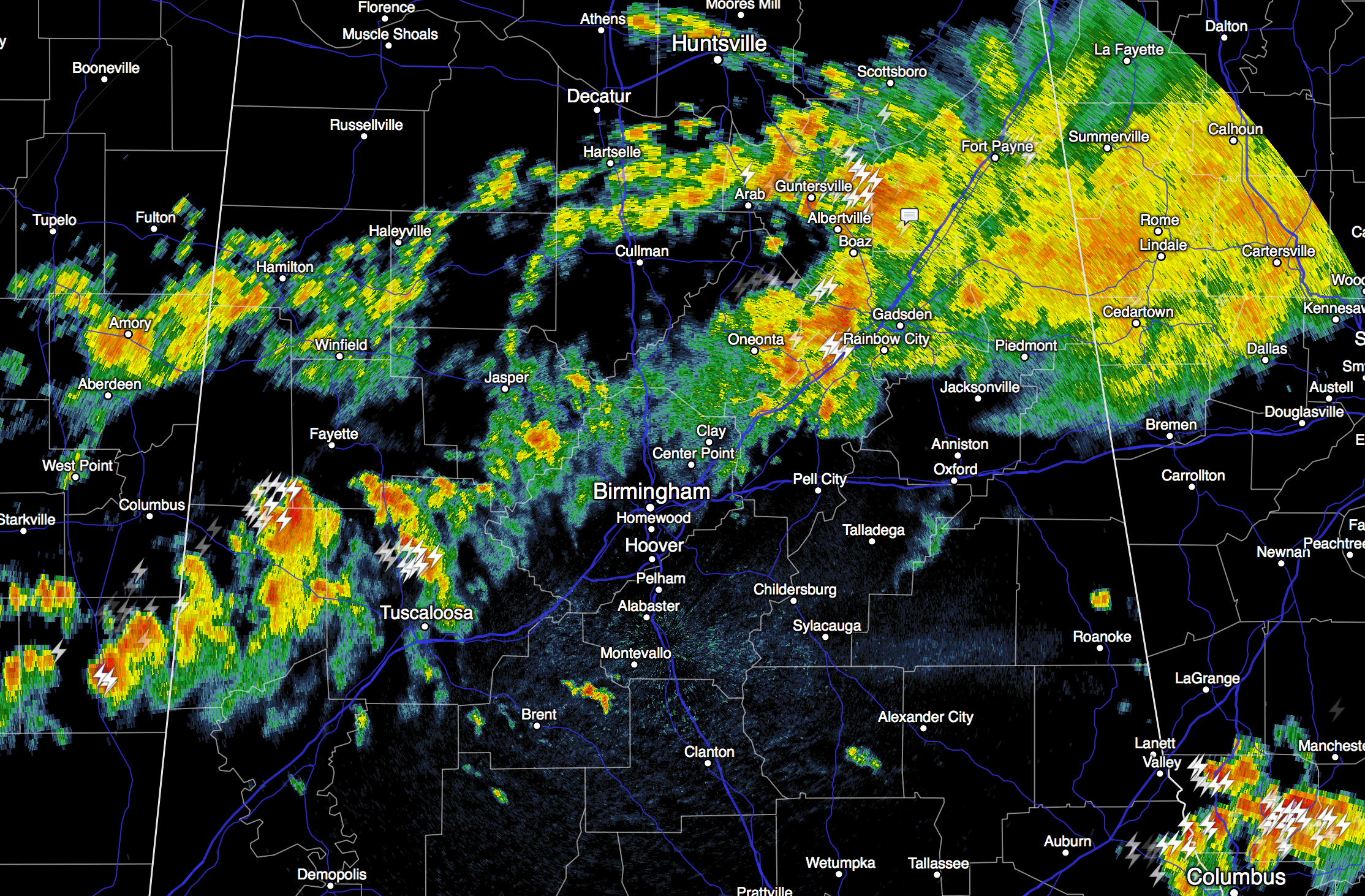
The air is rather unstable across Central Alabama, and strong to severe storms remain possible through early tonight. The primary threat will come from strong straight line winds. Showers and storms will diminish late tonight as the short wave axis moves east of the state.
TOMORROW AND THE WEEKEND: Our weather will trend drier and hotter. A few widely scattered storms are still possible tomorrow, especially south of I-20, but Saturday and Sunday look mostly rain-free with only isolated afternoon storms. We project a high in the low 90s tomorrow, and mid 90s over the weekend. A few spots over West Alabama will probably see upper 90s Sunday afternoon.
NEXT WEEK: Scattered, mostly afternoon and evening showers and thunderstorms are possible Monday through Wednesday with a low in the low 90s on these three days; some chance drier air works down into North Alabama by the end of the week. If this happens, we could see one or two mornings with lows in the low 60s, or even upper 50s. See the Weather Xtreme video for maps, graphics, and more details.
AT THE BEACH: About 6 to 8 hours of sunshine daily on the coast from Gulf Shores west to Panama City Beach through the weekend with a passing storm from time to time. Highs on the coast will be in the upper 80s, with mid 90s inland. Sea water temperatures are mostly in the mid 80s.
See the complete Gulf Coast 7 Day Planner here. The Gulf Coast Beach Forecast is presented by Gulf Shores Plantation by Mandoki Hospitality Vacation Rentals. Escape to Gulf Shores Plantation where memories last a lifetime.
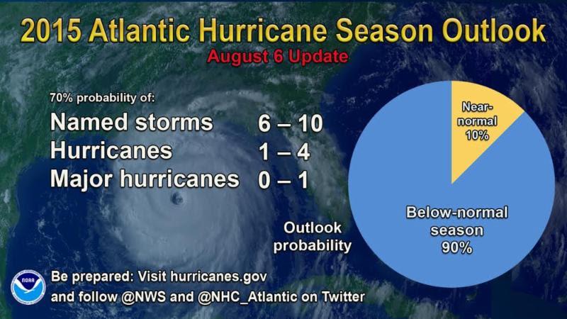
TROPICAL SEASON UPDATE: The National Hurricane Center updated their 2015 Atlantic basin hurricane season outlook today, suggesting it might be one of the slowest on record due to the current El Nino cycle.
Tropical storm formation in the Atlantic basin is not expected at least through the weekend.
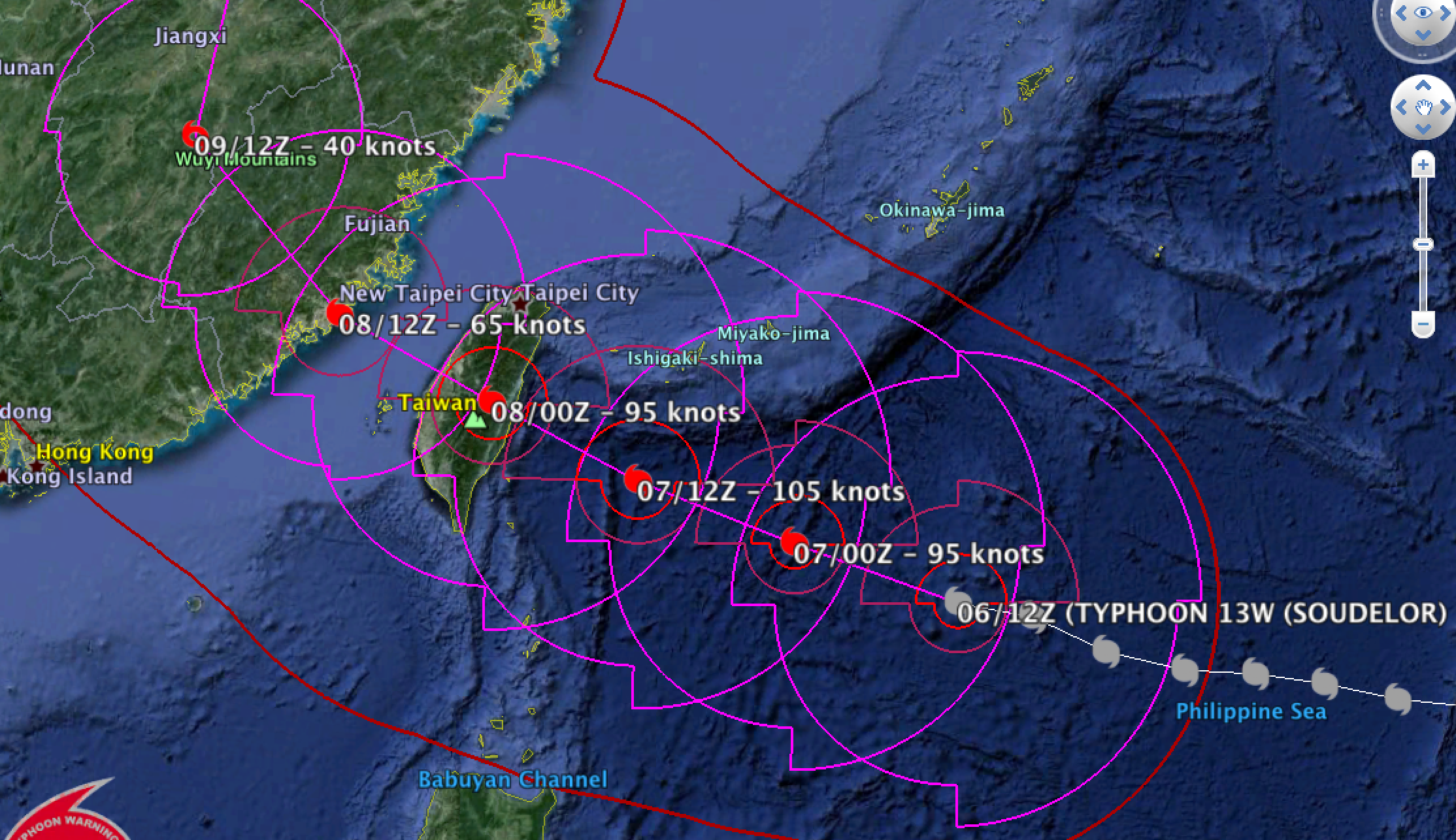
Over in the western Pacific, Typhoon Soudelor is nearing Taiwan with sustained winds of 100 mph and torrential rain. Some strengthening is likely before it reaches the island tomorrow.
WEATHER BRAINS: Don’t forget you can listen to our weekly 90 minute netcast anytime on the web, or on iTunes. This is the show all about weather featuring many familiar voices, including our meteorologists here at ABC 33/40.
CONNECT: You can find me on all of the major social networks…
Facebook
Twitter
Google Plus
Instagram
Look for the next Weather Xtreme video here by 7:00 a.m. tomorrow…
Category: Alabama's Weather
About the Author (Author Profile)
James Spann is one of the most recognized and trusted television meteorologists in the industry. He holds the AMS CCM designation and television seals from the AMS and NWA. He is a past winner of the Broadcast Meteorologist of the Year from both professional organizations.Subscribe
If you enjoyed this article, subscribe to receive more just like it.


