

Hot And Humid; Afternoon Storms
AT DAYBREAK: It is a warm, humid morning across the great state of Alabama with temperatures generally in the 70s. We do note strong storms northwest of here around Memphis…
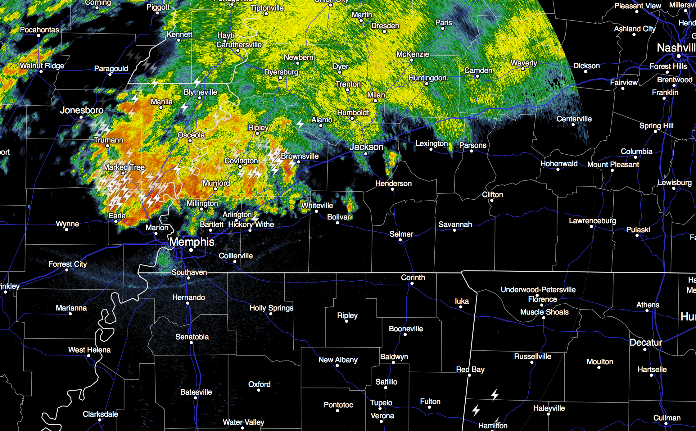
This batch of storms will move into North Alabama later this morning, and will work southward this afternoon. Temperatures will reach the low to mid 90s before the storms arrive, but the rain will cool things down nicely this afternoon.
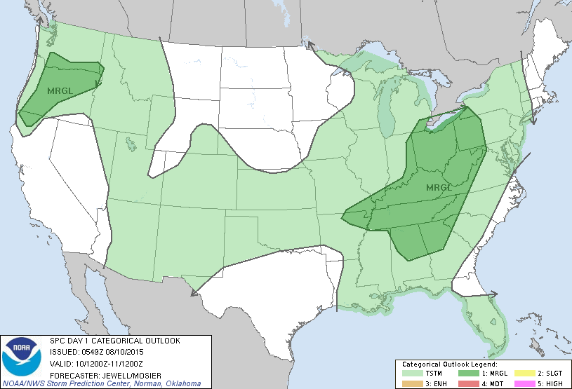
We should also note SPC has the northern half of the state in a “marginal” severe weather risk for this afternoon and tonight…
The prime risk from the heavier storms will come from strong straight line winds.
TOMORROW: A surface boundary will push through the state, something that doesn’t happen too much in August. The high resolution NAM model suggests the best chance of storms tomorrow will actually come during the morning hours, with the best chance of rain shifting down into South Alabama by afternoon. It won’t be as hot tomorrow with a high at or just over 90 degrees.
WEDNESDAY/THURSDAY: Drier, continental air will cover the northern half of the state on these two days, meaning lots of sunshine, lower humidity, and cooler nights. The high will be close to 90, but early Thursday morning we should drop into the mid 60s, with potential for low 60s in cooler spots.
FRIDAY AND THE WEEKEND: Moisture levels will creep up again, so a few afternoon and evening thunderstorms could pop up, but they should be widely scattered. Highs will be mostly in the low 90s, right at seasonal averages for mid-August in Alabama.
Not much change into early next week; see the Weather Xtreme video for maps, graphics, and more details.
AT THE BEACH: Not a bad week on the coast from Panama City Beach over to Gulf Shores. Of course, you will deal with a passing thunderstorm from time to time, otherwise about 7 to 9 hours of sunshine daily with highs in the upper 80s on the immediate coast, with low to mid 90s inland. The sea water temperature early this morning at the Dauphin Island Sea Lab is 81 degrees.
TROPICS: The Atlantic basin remains very quiet, and tropical storm formation is not expected this week.
PERSEID METEOR SHOWER: Earth is entering a stream of debris from Comet Swift-Tuttle, source of the annual Perseid meteor shower. Forecasters expect meteor rates to peak at 100+ per hour on the night of Aug. 12-13 when our planet passes through the heart of the debris stream. Perseids produce more fireballs than any other meteor shower of the year. Keep an eye on the night sky.
WEATHER BRAINS: Don’t forget you can listen to our weekly 90 minute netcast anytime on the web, or on iTunes. This is the show all about weather featuring many familiar voices, including our meteorologists here at ABC 33/40. We will produce this week’s show tonight at 8:30 CT… watch it on “James Spann 24/7” on cable systems around the state, or on the web here.
CONNECT: You can find me on all of the major social networks…
Facebook
Twitter
Google Plus
Instagramy
I will be speaking to the residents at Kirkwood By The River this morning… look for the next Weather Xtreme video here by 4:00 this afternoon. Enjoy the day!
Category: Alabama's Weather
About the Author (Author Profile)
James Spann is one of the most recognized and trusted television meteorologists in the industry. He holds the AMS CCM designation and television seals from the AMS and NWA. He is a past winner of the Broadcast Meteorologist of the Year from both professional organizations.Subscribe
If you enjoyed this article, subscribe to receive more just like it.


