

Severe Thunderstorm Warning: Shelby & NE Bibb Counties
New warnings have been issued for Shelby County and Northeastern Bibb County.
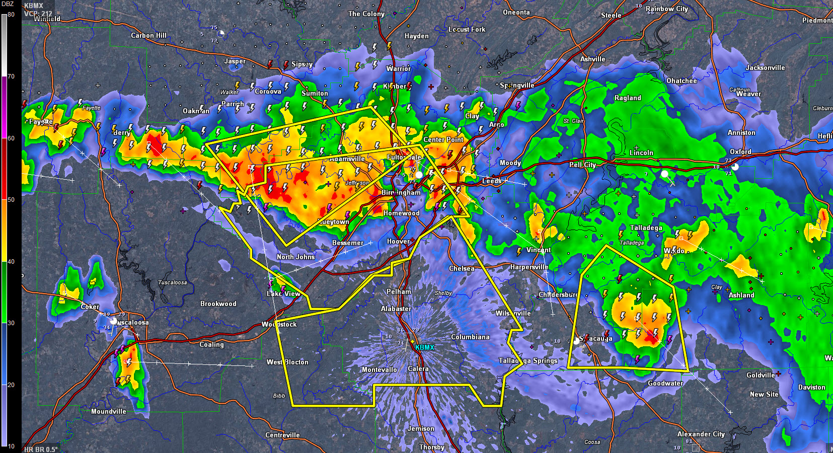
THE NATIONAL WEATHER SERVICE IN BIRMINGHAM HAS ISSUED A
* SEVERE THUNDERSTORM WARNING FOR…
SHELBY COUNTY IN CENTRAL ALABAMA…
NORTHEASTERN BIBB COUNTY IN CENTRAL ALABAMA…
* UNTIL 930 PM CDT
* AT 834 PM CDT…SEVERE THUNDERSTORMS WERE LOCATED ALONG A LINE
EXTENDING FROM THE SUMMIT TO NORTH JOHNS…MOVING SOUTHEAST AT 35
MPH.
HAZARD…60 MPH WIND GUSTS.
SOURCE…TRAINED WEATHER SPOTTERS.
IMPACT…EXPECT DAMAGE TO ROOFS…SIDING AND TREES.
* LOCATIONS IMPACTED INCLUDE…
HOOVER…ALABASTER…PELHAM…HELENA…CALERA…CHELSEA…
MONTEVALLO…COLUMBIANA…WILSONVILLE…INDIAN SPRINGS VILLAGE…
WOODSTOCK…WEST BLOCTON…WILTON…UNIVERSITY OF MONTEVALLO…
BRIERFIELD IRONWORKS PARK…ASHBY…MEADOWBROOK…LAY LAKE…OAK
MOUNTAIN STATE PARK AND MAYLENE.
These storms have the potential of producing widespread wind damage, as they have done across Walker and Jefferson Counties. Large hail and deadly lightning is also occurring with these storms, so take precautionary measures and move indoors!
Category: Severe Weather
About the Author (Author Profile)
Bill Murray is the President of The Weather Factory. He is the site's official weather historian and a weekend forecaster. He also anchors the site's severe weather coverage. Bill Murray is the proud holder of National Weather Association Digital Seal #0001 @wxhistorianSubscribe
If you enjoyed this article, subscribe to receive more just like it.


