

Severe Thunderstorm Warning: Chilton County
A new warning has been issued for Chilton County. Torrential rain and strong winds, as well as hail, are occurring with these storms, which may lead to flash flooding. Be cautious and do not drive your vehicle through flooded areas.
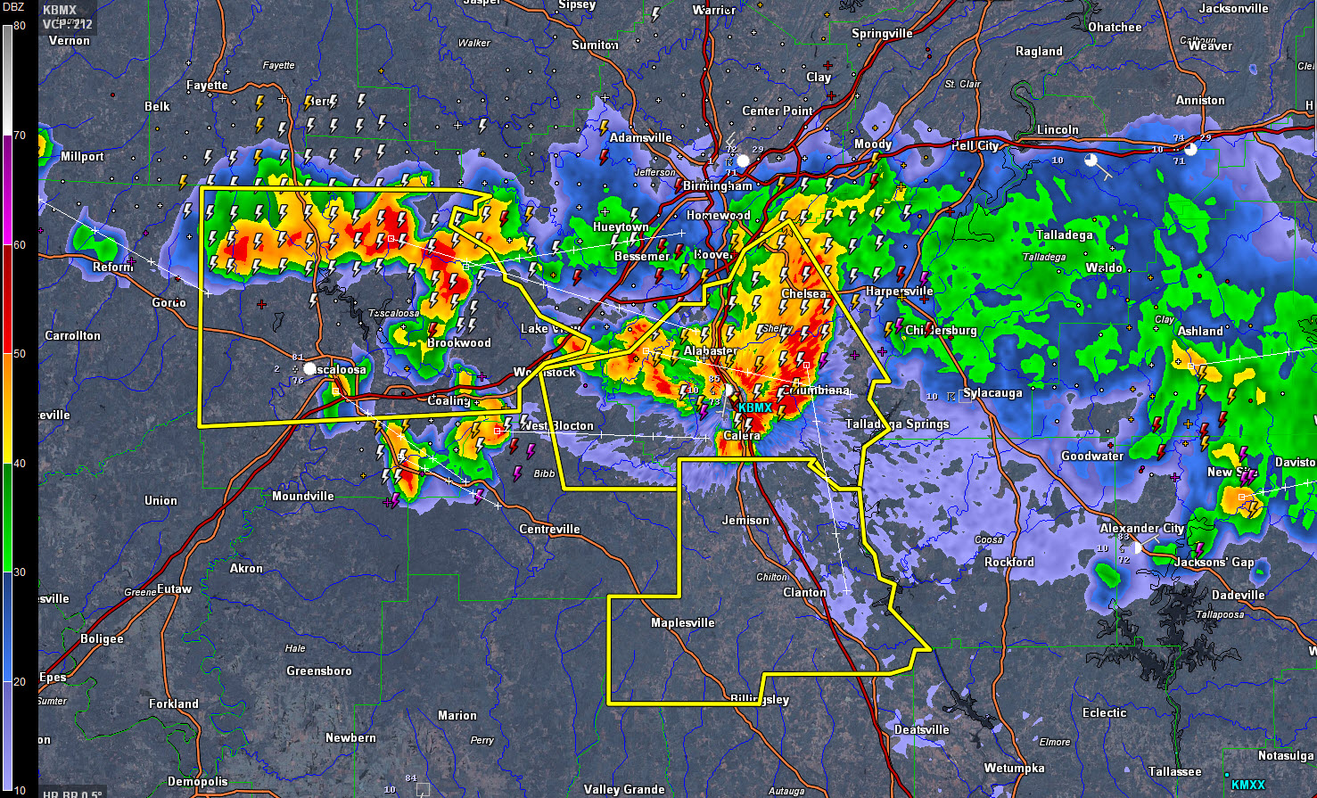
THE NATIONAL WEATHER SERVICE IN BIRMINGHAM HAS ISSUED A
* SEVERE THUNDERSTORM WARNING FOR…
CHILTON COUNTY IN CENTRAL ALABAMA…
* UNTIL 1030 PM CDT
* AT 923 PM CDT…SEVERE THUNDERSTORMS WERE LOCATED ALONG A LINE
EXTENDING FROM NEAR TALLADEGA SPRINGS TO NEAR CALERA TO NEAR
CENTREVILLE…MOVING SOUTH AT 35 MPH.
HAZARD…60 MPH WIND GUSTS.
SOURCE…RADAR INDICATED.
IMPACT…EXPECT DAMAGE TO ROOFS…SIDING AND TREES.
* LOCATIONS IMPACTED INCLUDE…
CALERA…CLANTON…JEMISON…THORSBY…MAPLESVILLE…BILLINGSLEY…
PLECHER…GAP OF THE MOUNTAIN…CHILTON COUNTY MOTOR SPORTS PARK…
HIGGINS FERRY PARK…POOLES CROSSROADS…PARNELL…VERBENA…
MITCHELL LAKE…LAY LAKE DAM…LAY LAKE…ISABELLA…I 65 REST
AREA…WAXAHATCHEE CREEK AND CAMPBELL.
Category: Severe Weather
About the Author (Author Profile)
Bill Murray is the President of The Weather Factory. He is the site's official weather historian and a weekend forecaster. He also anchors the site's severe weather coverage. Bill Murray is the proud holder of National Weather Association Digital Seal #0001 @wxhistorianSubscribe
If you enjoyed this article, subscribe to receive more just like it.


