

Drier Air Moves In Later Today
RADAR CHECK: We have early morning showers and thunderstorms in progress cross North and Central Alabama ahead of a surface front… these are moving southeast, and are well below severe limits.
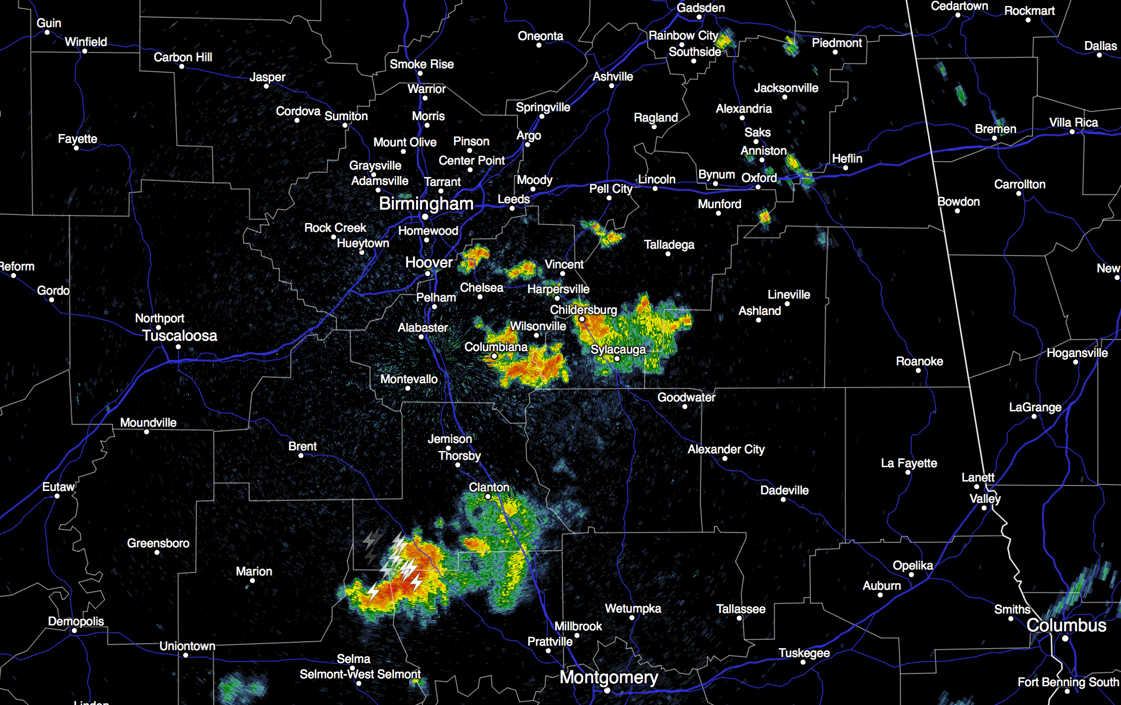
As the front pushes southward, we believe most of the showers and storms will wind up over the southern half of Alabama this afternoon as dry air arrives over the northern counties of the state. Today’s high will be in the low 90s with a mix of sun and clouds.
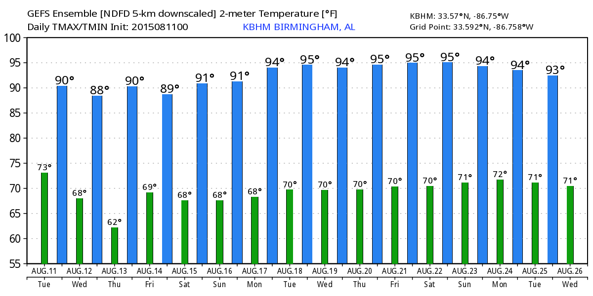
TOMORROW/THURSDAY: No doubt these will be the nicest days of the week, with sunny days, lower humidity, and cooler nights. Highs between 88 and 91, and by Thursday morning some of the cooler pockets across North Alabama will drop to near 60 degrees for a little preview of fall. Any showers will be confined to the far southern part of Alabama.
FRIDAY AND THE WEEKEND: Moisture levels will slowly rise; we will introduce a small risk of a shower Friday afternoon, and for the weekend, the chance of “scattered, mostly afternoon and evening showers and thunderstorms”, so typical for a summer day. Days will be partly sunny with afternoon highs pretty close to 90 degrees.
Not much change into next week… see the Weather Xtreme video for maps, graphics, and more details.
GULF COAST WEATHER: Yes, you will experience a passing storm from time to time, but the overall picture looks good for the Central Gulf Coast (Panama City Beach west to Gulf Shores) through the weekend with about 7 to 9 hours of sunshine each day. Highs on the immediate coast will hold in the upper 80s, with low to mid 90s inland. Sea water temperatures are in the low to mid 80s.
See the complete Gulf Coast 7 Day Planner here. The Gulf Coast Beach Forecast is presented by Gulf Shores Plantation by Mandoki Hospitality Vacation Rentals. Escape to Gulf Shores Plantation where memories last a lifetime.
TROPICS: The Atlantic basin remains very, very quiet and tropical storm formation is not expected through the week.
WEATHER BRAINS: Don’t forget you can listen to our weekly 90 minute netcast anytime on the web, or on iTunes. This is the show all about weather featuring many familiar voices, including our meteorologists here at ABC 33/40. Scroll down for the show notes on the new episode we recorded last week.
CONNECT: You can find me on all of the major social networks…
Facebook
Twitter
Google Plus
Instagram
I will be doing a weather program today at the AIDB Regional Center in Birmingham… look for the next Weather Xtreme video here by 4:00 this afternoon. Enjoy the day!
Category: Alabama's Weather
About the Author (Author Profile)
James Spann is one of the most recognized and trusted television meteorologists in the industry. He holds the AMS CCM designation and television seals from the AMS and NWA. He is a past winner of the Broadcast Meteorologist of the Year from both professional organizations.Subscribe
If you enjoyed this article, subscribe to receive more just like it.


