

Humidity Levels Rising
MOIST AIR RETURNS: After two days of dry, continental air, the typical maritime tropical airmass returns to much of Alabama today, meaning we will have the risk of “scattered, mostly afternoon and evening showers and thunderstorms” today. We should mention we actually have an early morning shower over Cherokee County, in far Northeast Alabama, as I write this around 6:00…
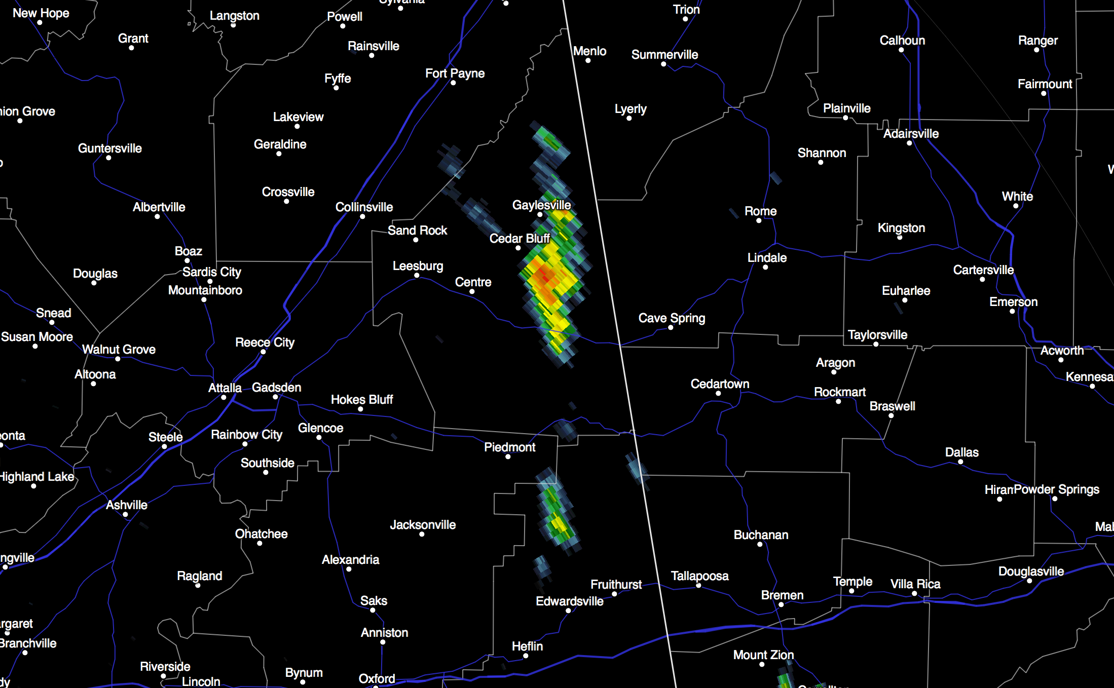
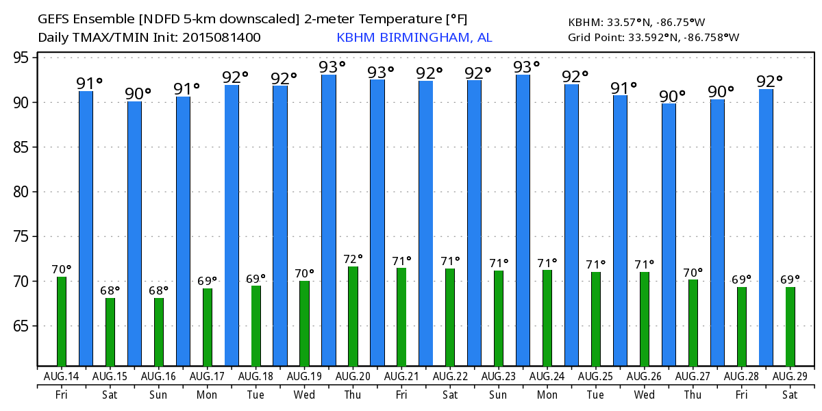
Chance of any one spot getting wet today is about one in three, and the high will be around 90 with a partly sunny sky. Very typical weather for mid-August in Alabama.
THE WEEKEND: The overall pattern just won’t change much. Mixed sun and clouds tomorrow and Sunday, and the risk of a passing afternoon shower or storm in random, scattered spots. Highs close to 90 degrees.
And, this won’t change much next week… if anything the coverage of showers and storms will be a little higher with a broad upper low/weakness across the Deep South. Highs will remain around 90 degrees. And, of course, in summer there is no skill in identifying the exact placement and timing of showers and storms. Just know they will be around, mainly during the afternoon and evening hours. See the Weather Xtreme video for maps, graphics, and more details.
GULF COAST WEATHER: About 7 to 9 hours of sunshine daily along the Gulf Coast through early next week (from Panama City Beach west to Gulf Shores)… with a passing thunderstorm from time to time. Storms could be tad more numerous Sunday and Monday. Highs on the coast will be in the upper 80s, with low 90s inland. The sea water temperature early this morning at the Dauphin Island Sea Lab is a warm 87 degrees.
See the complete Gulf Coast 7 Day Planner here. The Gulf Coast Beach Forecast is presented by Gulf Shores Plantation by Mandoki Hospitality Vacation Rentals. Escape to Gulf Shores Plantation where memories last a lifetime.
TROPICS: Still no sign of life across the Atlantic basin in this El Nino pattern… tropical storm formation is not expected through early next week.
GODZILLA? Almost every night on national news media outlets, we hear of “monster storms” with “80 million in the path” that are “unprecedented”. Today a new level of hyperbole has been introduced with a “Godzilla” El Nino.
The truth is that we are in a very significant El Nino cycle. But, understand we only have good ENSO (El Nino Southern Oscillation) phase data back to the 1950s, and there is much to learn. What does it mean for Alabama? El Nino winters here tend to be fairly wet, relatively mild, and occasionally stormy. We also have intrusions of shallow cold air at times, which can open the door for ice issues. But, long time readers know I am no fan of seasonal outlooks since there is very little skill in them. We will just have to wait and see…?
WEATHER BRAINS: Don’t forget you can listen to our weekly 90 minute netcast anytime on the web, or on iTunes. This is the show all about weather featuring many familiar voices, including our meteorologists here at ABC 33/40.
CONNECT: You can find me on all of the major social networks…
Facebook
Twitter
Google Plus
Instagram
I will be speaking at an event this morning at Parrish in Walker County… be looking for the next Weather Xtreme video here by 4:00 this afternoon. Enjoy the day!
Category: Alabama's Weather
About the Author (Author Profile)
James Spann is one of the most recognized and trusted television meteorologists in the industry. He holds the AMS CCM designation and television seals from the AMS and NWA. He is a past winner of the Broadcast Meteorologist of the Year from both professional organizations.Subscribe
If you enjoyed this article, subscribe to receive more just like it.


