

Storms West, Sun East
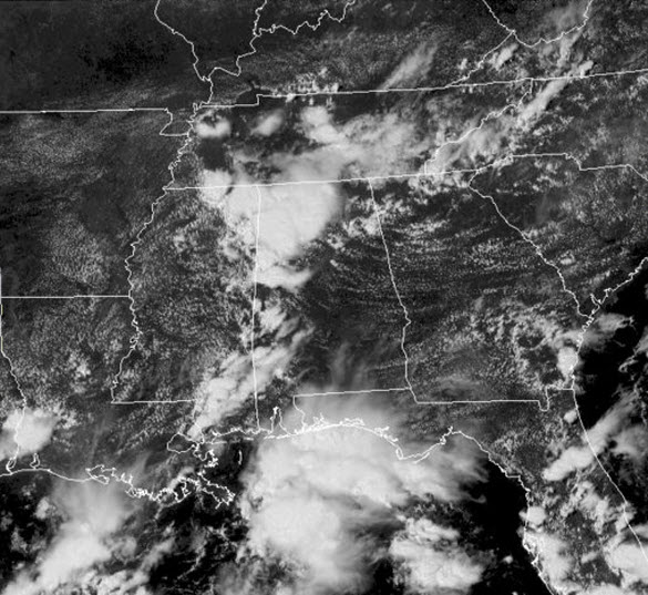
Most of Central Alabama is seeing more sun than clouds, but we are seeing a lot more cloud cover over West and Northwest Alabama. We can see that in the visible satellite image below. Lots of those puffy white clouds showing up, while most of the state bask in sunshine.
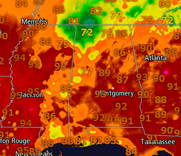
Where it is raining we are seeing temps in the 70s and 80s, where it is not, upper 80s and lower 90s are more common. For the most part, it is a hot and humid day across much of North-Central Alabama .
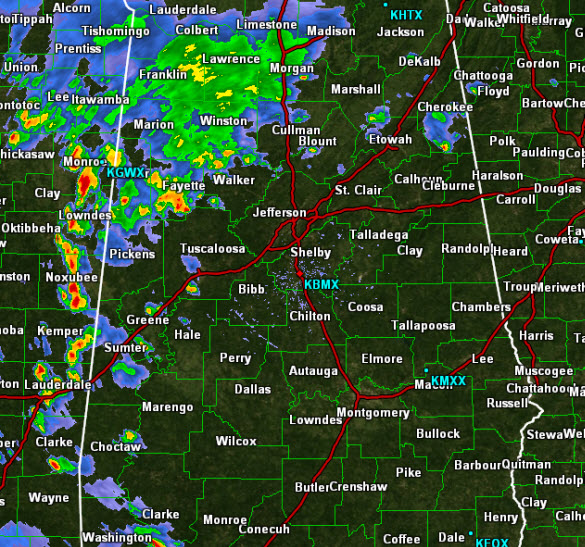
Showers and storms continue to impact many locations across West and Northwest Alabama. We continue to see the bulk of the convection west of Interstate 65 with a few storms scattered elsewhere across the state.
Heavy rain and lots of lightning are the main threats with these storms. There could be a few isolated areas of localized flooding for some areas seeing the storms today. These showers and storms will continue through the afternoon and evening, and should begin to wind down slowly once the sun sets and daytime heating is loss.
Tomorrow will be very similar to today. Expect a mix of sun and clouds with highs into the 90s. We will see scattered showers and storms once again, but like today, not everyone will see rain, and the vast majority of us will be stay dry.
Category: Alabama's Weather
About the Author (Author Profile)
Macon, Georgia Television Chief Meteorologist, Birmingham native, and long time Contributor on AlabamaWX. Stormchaser. I did not choose Weather, it chose Me. College Football Fanatic. @Ryan_StinnetSubscribe
If you enjoyed this article, subscribe to receive more just like it.


