

Wet, Unsettled Pattern Continues
OCCASIONAL SHOWERS: Another wet day is shaping up for Alabama… we have a number of showers and storms in progress as the sun comes up…
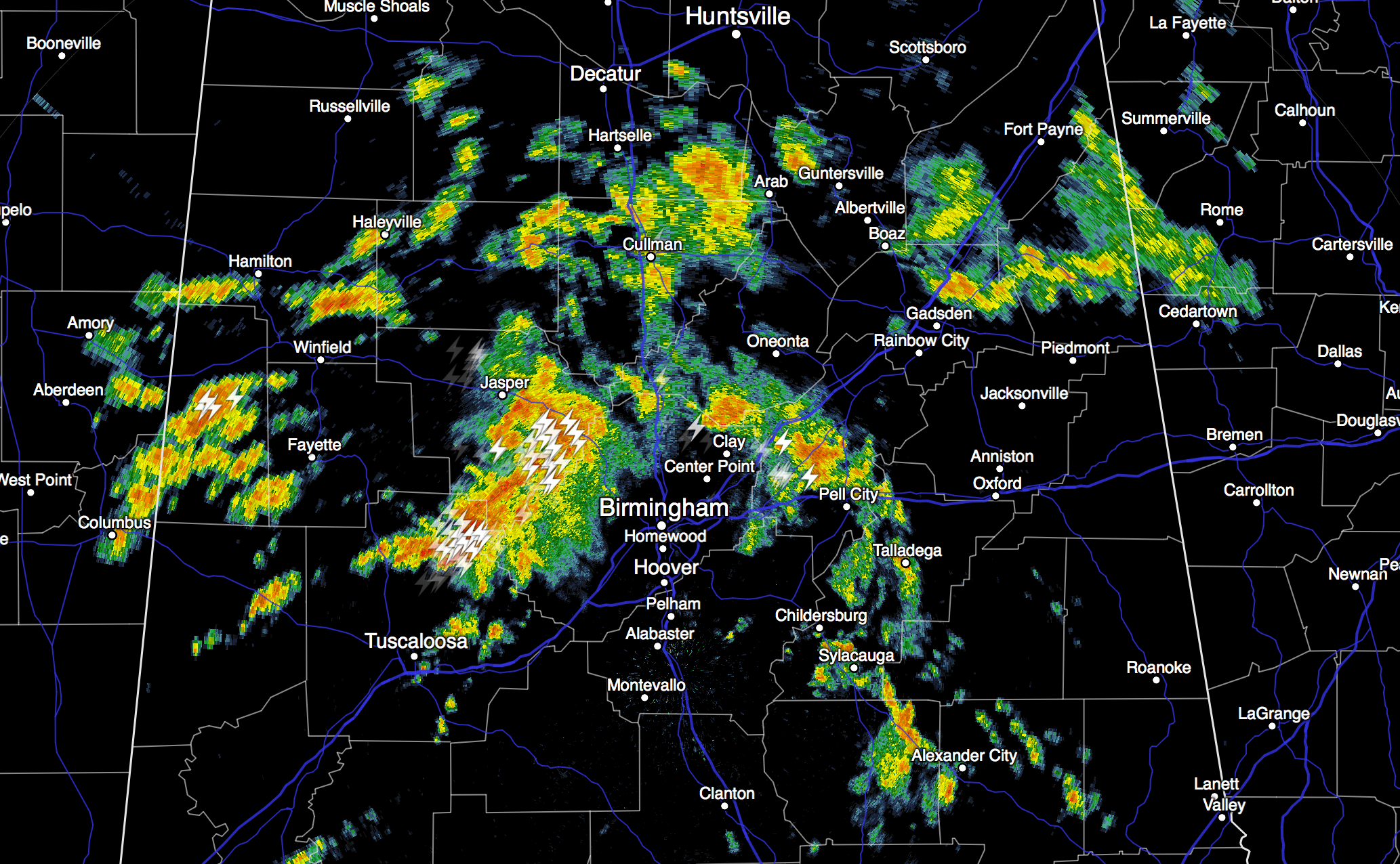
A broad upper trough to the west will keep a good chance of occasional showers and storms in our forecast through mid-week. Understand there will be some nice breaks in the rain, and the sun could very well pop out at times, but you need to be ready for rain at just about any hour of the day or night through Thursday.
On the positive side, severe storms are not expected, and highs will be only in the 80s due to the clouds and showers. Interesting to note yesterday’s high in Birmingham was only 79 degrees… within three degrees of the record low maximum for August 17… 76 set in 1973.
TO THE NORTH: A deep upper trough will bring the risk of severe storms to parts of the Great Plains today, but that feature will pass well to the north of Alabama later in the week, with the severe weather threat remaining to the north as well.
FRIDAY AND THE WEEKEND: We will still forecast scattered to numerous showers and thunderstorms Friday and Saturday with some sun at times, but Sunday should be brighter with showers and storms becoming fewer in number. The high will be back around 90 degrees by the weekend.
NEXT WEEK: The latest GFS is suggesting a dry, continental airmass has a chance of moving down into the northern half of Alabama early in the week, with potential for some upper 50s early Tuesday. Not totally convinced this will happen, but potential is there. See the Weather Xtreme video for maps, graphics, and more details. One way or another, next week will be drier.
TROPICS: The wave in the Atlantic between Africa and the Lesser Antilles has a high chance of becoming a tropical depression or storm during the next 48 hours as it moves to the west/northwest. This feature is moving just below a layer of very dry air, and there isn’t much shear. So, this might become a hurricane by the end of the week. Long range model data shows it near Hispaniola early next week, and it remains to be seen if this survives, and if it will have a chance of impacting the U.S.
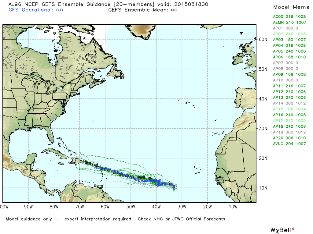
Again, watch the Weather Xtreme video for more details on this.
WEATHER BRAINS: Don’t forget you can listen to our weekly 90 minute netcast anytime on the web, or on iTunes. This is the show all about weather featuring many familiar voices, including our meteorologists here at ABC 33/40. Scroll down for the show notes on the new episode we produced last night in Norman, Oklahoma.
CONNECT: You can find me on all of the major social networks…
Facebook
Twitter
Google Plus
Instagram
I will be traveling back to Alabama later today… so I doubt if I can produce an afternoon video, but I will post forecast notes here on the blog by 4:00. Enjoy the day!
Category: Alabama's Weather
About the Author (Author Profile)
James Spann is one of the most recognized and trusted television meteorologists in the industry. He holds the AMS CCM designation and television seals from the AMS and NWA. He is a past winner of the Broadcast Meteorologist of the Year from both professional organizations.Subscribe
If you enjoyed this article, subscribe to receive more just like it.


