

Strong Storms Over West Alabama
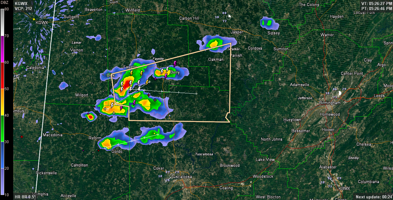
Strong thunderstorms are over parts of Fayette and northern Tuscaloosa Counties at this hour.
They have prompted a Significant Weather Alert for parts of those counties into southwestern Walker County.
Winds could reach 40 mph with these storms in addition to heavy rain and frequent lightning.
These storms should reach western Jefferson County around 7 p.m.
Storms in Clay and Chickasaw Counties in northeastern Mississippi have prompted Severe Thunderstorm Warnings. If these hold together, they will impact northern Lamar and Marion Counties starting as early as 6:45 p.m.
Over South Central Alabama, showers and storms are widespread in the US-80 Corridor from Choctaw County through Marengo, Wilcox, Lowndes, Montgomery, Elmore, Macon and Tallapoosa Counties. A Significant Weather Alert was just issued for Sumter and Marengo Counties.
Category: Alabama's Weather
About the Author (Author Profile)
Bill Murray is the President of The Weather Factory. He is the site's official weather historian and a weekend forecaster. He also anchors the site's severe weather coverage. Bill Murray is the proud holder of National Weather Association Digital Seal #0001 @wxhistorianSubscribe
If you enjoyed this article, subscribe to receive more just like it.


