

One More Dry Day For Alabama
ANOTHER PLEASANT AUGUST DAY: With a good supply of sunshine, temperatures are mostly in the mid 80s across the great state of Alabama this afternoon, and again there is no rain on radar. Today is the 12th consecutive day with a high under 90 (at Birmingham), and fourth consecutive day with no rain.
We stay dry tomorrow… the sky will be partly to mostly sunny with a high close to 90 in most places.
THE WEEKEND: Moisture levels will rise, and we will mention the risk of scattered showers and thunderstorms both Saturday and Sunday. Otherwise, expect a mix of sun and clouds with a high in the mid 80s. Chance of any one spot getting wet both days is about one in three; best chance of showers will come during the afternoon and evening hours, but we can’t rule out a late night or morning shower as well.
NEXT WEEK: While eyes will be on potential Hurricane Erika just off the South Atlantic Coast of the U.S., our weather looks relatively quiet, with partly sunny days, fair nights, and only widely scattered showers. Highs next week will be in the 88 to 91 degree range, about average for the end of August in Alabama.
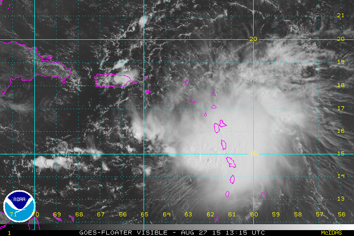
CHALLENING TROPICAL FORECAST: We have more questions than answers with Tropical Storm Erika this afternoon. Convection is now displaced well to the east of the circulation center due to wind shear, and NHC estimates maximum sustained winds at 45 mph. Also, the center has reformed farther to the south, putting computer model data into question due to poor initialization.
Strengthening is not expected for the next three days due to shear, and interaction with Hispaniola. In fact, it is not totally out of the question that Erika dissipates like Danny last week. But, there is a pretty good chance it survives, and conditions will favor strengthening by Sunday and Monday. The official NHC track has been adjusted slightly to the left, putting Erika near the Florida Atlantic Coast Monday as a category one hurricane.
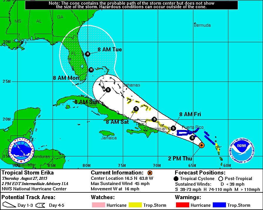
Odds are still high this won’t be a Gulf of Mexico storm, but the chance is not zero. Overall forecast confidence is low, and expect changes in coming days. Everyone from the Florida Peninsula up to the North Carolina Outer Banks will need to keep an eye on this one.
GULF COAST WEATHER: Mostly sunny weather continues tomorrow from Gulf Shores west to Panama City Beach; then for the weekend expect about 6 to 8 hours of sunshine both days with potential for a few scattered thunderstorms. A little too early for a specific Labor Day weekend forecast, but at the moment we don’t see anything that would suggest significant problems.
See the complete Gulf Coast 7 Day Planner here. The Gulf Coast Beach Forecast is presented by Gulf Shores Plantation by Mandoki Hospitality Vacation Rentals. Escape to Gulf Shores Plantation where memories last a lifetime.
WEATHER BRAINS: Don’t forget you can listen to our weekly 90 minute netcast anytime on the web, or on iTunes. This is the show all about weather featuring many familiar voices, including our meteorologists here at ABC 33/40. We will have a special Hurricane Katrina 10th Anniversary special tonight at 8:30 CT… you can watch it on “James Spann 24/7” on cable systems around the state, or on the web here.
CONNECT: You can find me on all of the major social networks…
Facebook
Twitter
Google Plus
Instagram
Look for the next Weather Xtreme video here by 7:00 a.m. tomorrow…
Category: Alabama's Weather
About the Author (Author Profile)
James Spann is one of the most recognized and trusted television meteorologists in the industry. He holds the AMS CCM designation and television seals from the AMS and NWA. He is a past winner of the Broadcast Meteorologist of the Year from both professional organizations.Subscribe
If you enjoyed this article, subscribe to receive more just like it.


