

Strong Storms Continue
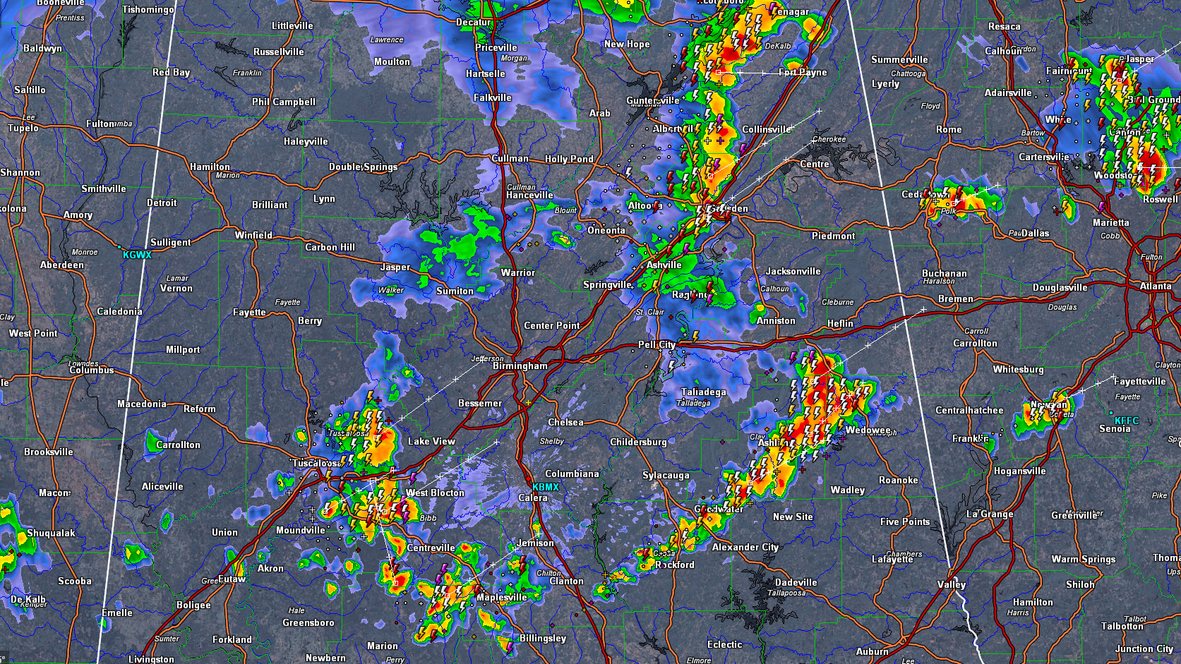
Strong thunderstorms continue across parts of Central Alabama this evening.
For the Birmingham Metro area, the storms over Tuscaloosa and Bibb Counties will affect Jefferson and Shelby Counties over the next 90 minutes with heavy rain, frequent lightning and gusty winds. They are not severe and aren’t expected to become severe.
Other storms over Northeast Alabama have produced reports of wall clouds and what people thought were funnel clouds, but they aren’t severe either. They are affecting the Gadsden area right now and will move into Cherokee County shortly.
The strongest storms in the state right now are over Clay and Randolph Counties from west of Wedowee back to Goodwater.
Everything is moving ENE at 25 mph.
Be alter and stay indoors if a storm approaches your location.
Category: Alabama's Weather
About the Author (Author Profile)
Bill Murray is the President of The Weather Factory. He is the site's official weather historian and a weekend forecaster. He also anchors the site's severe weather coverage. Bill Murray is the proud holder of National Weather Association Digital Seal #0001 @wxhistorianSubscribe
If you enjoyed this article, subscribe to receive more just like it.


