

Wetter Days Ahead
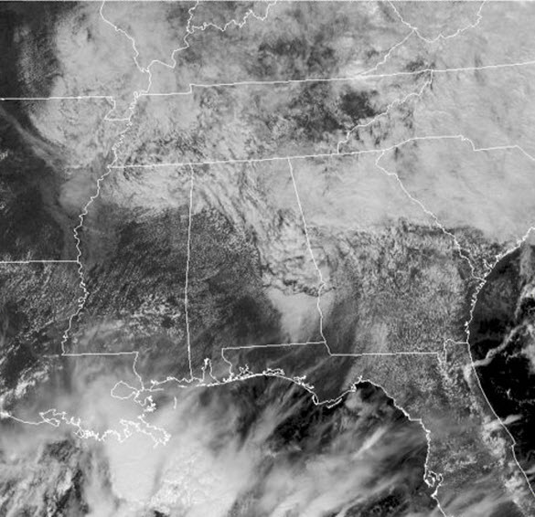
Pesky area of low pressure is lifting out of the area and for much of Central Alabama we are seeing cloudy conditions, while portions of South and West Alabama are seeing plenty of sunshine. This is once again impacting temperatures and we are seeing a range in temps across the state this afternoon as we have lower 70s to lower 80s from east to west.
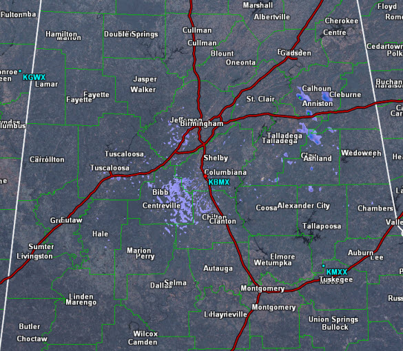
Some light showers are showing up on the radar, and these will remain possible today, but these are going to be confined to North and East Alabama. Tomorrow will be very similar to today, with a mix of sun and clouds, with scattered showers possible. The majority of the day will be dry, as we wait on our next rain maker which will begin to impact the area heading into Sunday night.
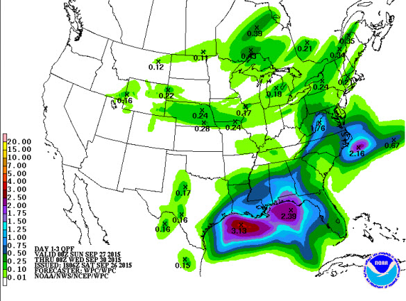
A trough of low pressure moving across the Yucatan today, will move north and allow an area of low pressure to develop in the southern Gulf by tomorrow. This low, will track towards the north and will bring lots of tropical moisture with it into the northern Gulf Coast. We should begin to see rain overspreading the state from the south Sunday night and into Monday. The rain is expected to continue through Tuesday, before slowly tapering off late Wednesday as the low moves north of the state. With the clouds and rain, expect afternoon highs to be in the 70s. Rainfall amounts from Sunday night into Tuesday are expected to be in the 1-3 inch range, with some heavy amounts possible. We are not expecting any flooding issues, as the rain will be falling over a longer period in time. We need the rain as many locations across the state are seeing rainfall deficits.
Category: Alabama's Weather
About the Author (Author Profile)
Macon, Georgia Television Chief Meteorologist, Birmingham native, and long time Contributor on AlabamaWX. Stormchaser. I did not choose Weather, it chose Me. College Football Fanatic. @Ryan_StinnetSubscribe
If you enjoyed this article, subscribe to receive more just like it.


