

Scattered Showers/Storms
SHOWERS; A FEW STORMS: We have seen more breaks in the overcast than expected across North/Central Alabama today, in some cases pushing temperatures up into the mid 80s. This has made the air unstable, and we have a few thunderstorms on radar over Northwest Alabama (Marion and Lamar Counties as I write this at 3:15 p.m.)…
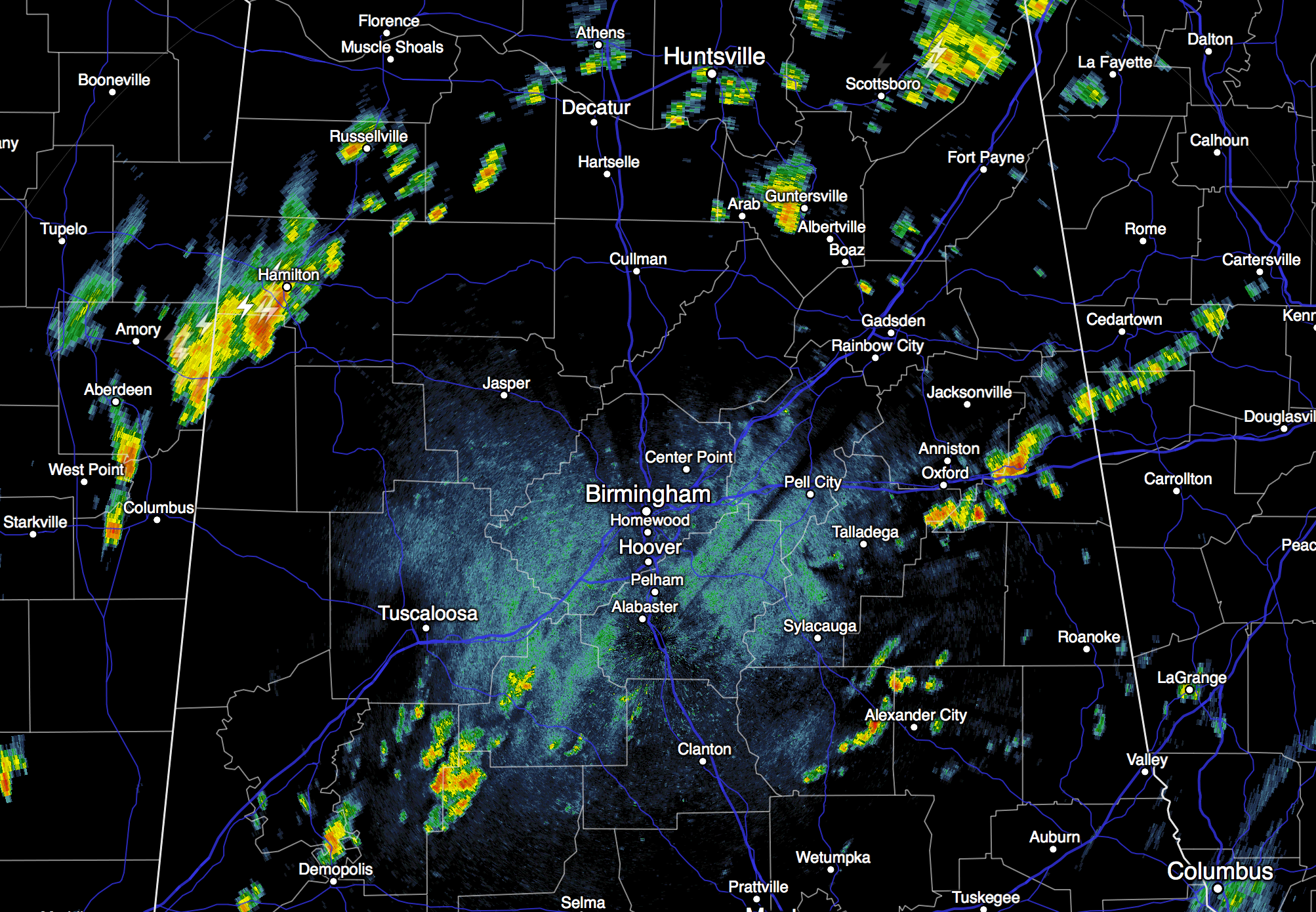
Showers and storms are showing very little movement, and we will maintain the risk of a few scattered showers tonight as an upper trough gets closer to the state.
TOMORROW: The weather won’t change much… expect a mix of sun and clouds, with scattered showers still possible, mostly during the afternoon and evening hours. The high will be in the 78 to 81 degree range.
THURSDAY/FRIDAY: The weather begins to turn sharply cooler; the GFS hints we won’t get out of the 60s Thursday with a cool north breeze of 10-20 mph along with cloudy periods. We also note the GFS keeps moisture in place over the eastern third of the state, suggesting some risk of a few showers east of Birmingham both days. Nothing too widespread, and the higher risk of showers will be over Georgia. West Alabama should enjoy a decent amount of sunshine, however, on Thursday and Friday.
THE WEEKEND: Looking glorious. Sunny pleasant days, clear, cool, crisp nights. Highs in the low 70s, lows in the low 50s, with 40s for colder pockets. No risk of rain.
And, the cool, dry weather stays in place for at least the first half of next week… see the Weather Xtreme video for maps, graphics, and more details.
FOOTBALL WEATHER: Auburn hosts San Jose State Saturday at Jordan Hare Stadium (3:00p CT kickoff)… the weather looks perfect with a sunny sky and a kickoff temperature near 72 degrees, falling into the 60s by the fourth quarter. Alabama will take on Georgia at Athens Saturday (2:30p CT kickoff); the sky will be partly to mostly sunny; temperatures will fall from near 73 at kickoff into the 60s by the fourth quarter.
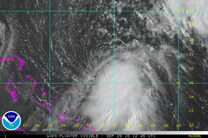
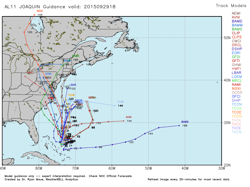
TROPICS: Tropical Storm Joaquin sure looks organized this afternoon east of the Bahamas despite wind shear in the area. Sure seems like it is on the way to becoming a hurricane sooner than later. Forecast confidence remains low with a huge spread in model output. But, one way or another, it looks like a very wet and unsettled period for the Northeast U.S. later this week and over the weekend with potential for heavy rain and beach erosion.
Another disturbance east of Joaquin has potential for slow development over the next few days, but that should remain far from land.
AT THE BEACH: Scattered showers and storms remain possible tomorrow from Gulf Shores over to Panama City Beach, but the weather looks excellent Thursday through the weekend with sunny days and fair nights. Highs around 80… See the complete Gulf Coast 7 Day Planner here. The Gulf Coast Beach Forecast is presented by Gulf Shores Plantation by Mandoki Hospitality Vacation Rentals. Escape to Gulf Shores Plantation where memories last a lifetime.
WEATHER BRAINS: Don’t forget you can listen to our weekly 90 minute netcast anytime on the web, or on iTunes. This is the show all about weather featuring many familiar voices, including our meteorologists here at ABC 33/40.
CONNECT: You can find me on all of the major social networks…
Facebook
Twitter
Google Plus
Instagram
Look for the next Weather Xtreme video here by 7:00 a.m. tomorrow…
Category: Alabama's Weather
About the Author (Author Profile)
James Spann is one of the most recognized and trusted television meteorologists in the industry. He holds the AMS CCM designation and television seals from the AMS and NWA. He is a past winner of the Broadcast Meteorologist of the Year from both professional organizations.Subscribe
If you enjoyed this article, subscribe to receive more just like it.


