

South Carolina Flooding
Twitter and Facebook are filled with pictures of the flooding which is going on in South Carolina this morning. Once again the NWS offices in South Carolina have prepared a map of that state from actual rainfall observations received through 7 am today.
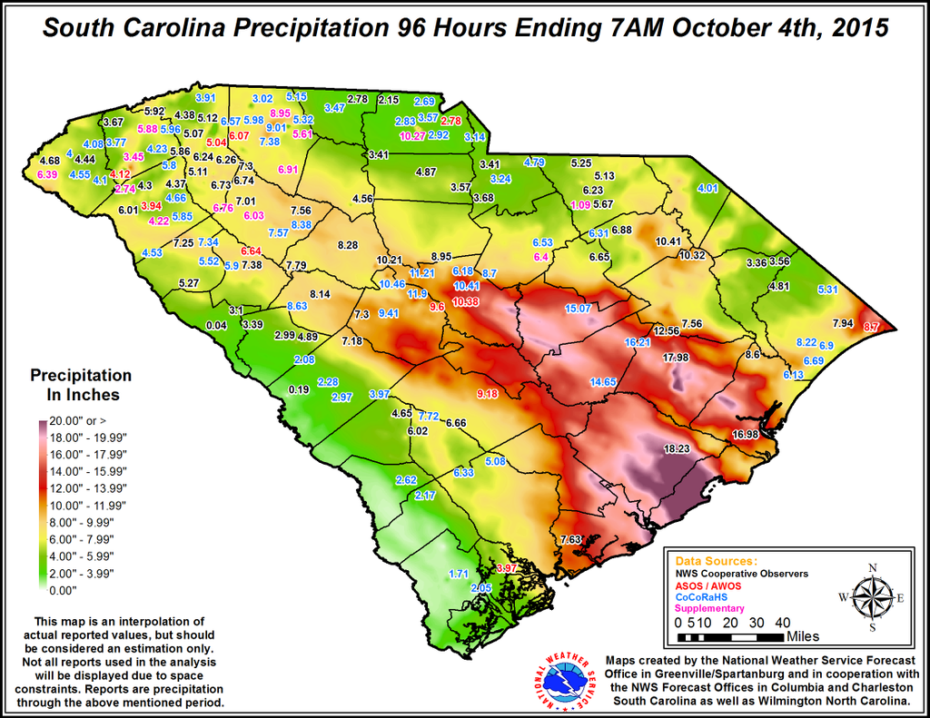
The area shown in red up to purple represents rainfall values for the previous 96 hours of 10 inches plus and runs roughly from Columbia southeastward to the coast just northeast of Charleston. And unfortunately the rain continues to fall!
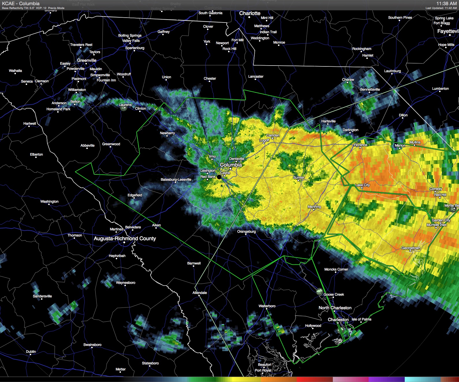
This is the image from the Columbia, SC, NWS radar taken at 11:38 am and rain runs in a wide band from Columbia slightly south of east to Myrtle Beach. Motion of these echoes was toward the west. So the flooding problems for South Carolina are just going to get worse. And keep in mind, while the initial flooding problems are coming from what I would term flash flooding, the problem is going to last for days and days because all of this water has got to go into the larger rivers which will create additional flooding problems for some time to come.
-Brian-
Category: Headlines, Hodgepodge
About the Author (Author Profile)
Brian Peters is one of the television meteorologists at ABC3340 in Birmingham and a retired NWS Warning Coordination Meteorologist. He handles the weekend Weather Xtreme Videos and forecast discussion and is the Webmaster for the popular WeatherBrains podcast.Subscribe
If you enjoyed this article, subscribe to receive more just like it.


