

Warm, Mostly Dry Through Thursday
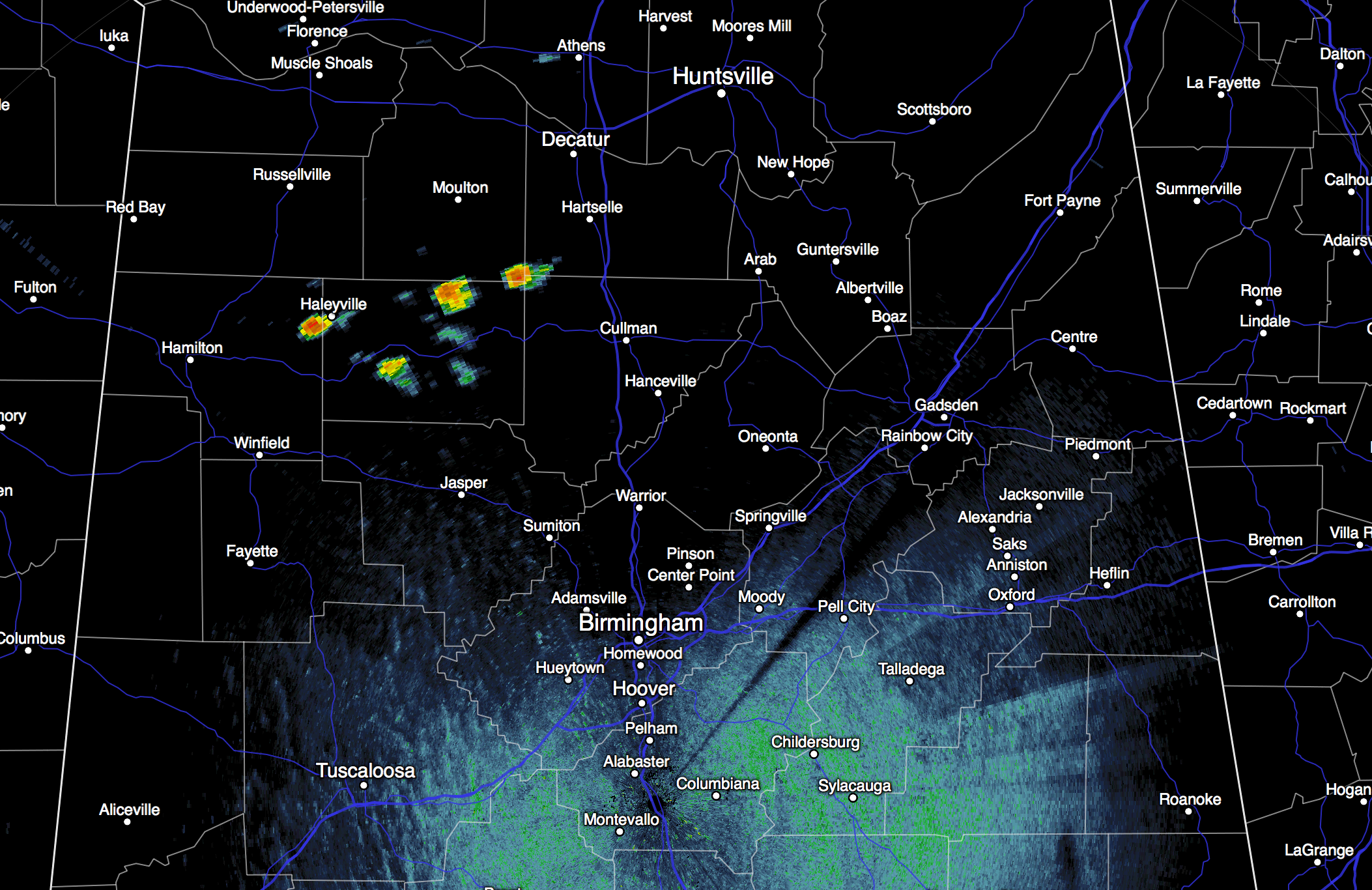
RADAR CHECK: A few small, isolated showers have popped up across North Alabama this afternoon; most of them are over Winston County, and most of the state is dry.
Temperatures are generally in the low 80s with a mix of sun and clouds.
TOMORROW/THURSDAY: Warm, dry weather is the story. Partly to mostly sunny days, and mostly fair nights. Highs in the mid 80s, lows in the 60s. Showers will be almost impossible to find.
FRIDAY: Another warm day with a high in the low to mid 80s, but we will mention the risk of scattered showers and thunderstorms Friday afternoon and Friday night thanks to an approaching front. The upper support passes well to the north, and the moisture will be rather limited, so rain amounts probably won’t be too heavy.
THE ALABAMA WEEKEND: Cooler, drier air returns Saturday; the latest GFS is printing a high of 74 at Birmingham with a good supply of sunshine and a fresh north breeze. Sunday looks very nice, with ample sunshine statewide. After starting the day down in the low 50s (with potential for 40s across the colder valleys), we rise to near 80 degrees Sunday afternoon.
NEXT WEEK: The weather looks mostly dry; low 80s for the first half of the week, with a cooling trend toward Thursday and Friday. See the Weather Xtreme video for maps, graphics, and more details.

FOOTBALL WEATHER: Alabama will host Arkansas at Bryant-Denny Stadium Saturday evening (6:00p CT kickoff)… the sky will be mostly fair, with temperatures falling from 75 degrees at kickoff into the mid 60s by the final whistle.
NATIONAL SHRIMP FESTIVAL: The weather looks very nice in Gulf Shores for the annual event this weekend; mostly sunny days, fair nights, highs around 80 degrees. The chance of a shower is so small we won’t mention it in the forecast.
TROPICS: Hurricane Joaquin is moving eastward across the North Atlantic; it could be an issue for Europe in 5-7 days as a post-tropical storm. The wave approaching the Leeward Islands is not developing due to shear, and the rest of the Atlantic basin is quiet.
WEATHER BRAINS: Don’t forget you can listen to our weekly 90 minute netcast anytime on the web, or on iTunes. This is the show all about weather featuring many familiar voices, including our meteorologists here at ABC 33/40.
CONNECT: You can find me on all of the major social networks…
Facebook
Twitter
Google Plus
Instagram
I had a great time today visiting with the 6th graders at Mountain Brook Elementary, be looking for them on the Pepsi KIDCAM today at 5:00 on ABC 33/40 News! Look for the next Weather Xtreme video here by 7:00 a.m. tomorrow…
Category: Alabama's Weather
About the Author (Author Profile)
James Spann is one of the most recognized and trusted television meteorologists in the industry. He holds the AMS CCM designation and television seals from the AMS and NWA. He is a past winner of the Broadcast Meteorologist of the Year from both professional organizations.Subscribe
If you enjoyed this article, subscribe to receive more just like it.


