

Rain Closing in on Alabama
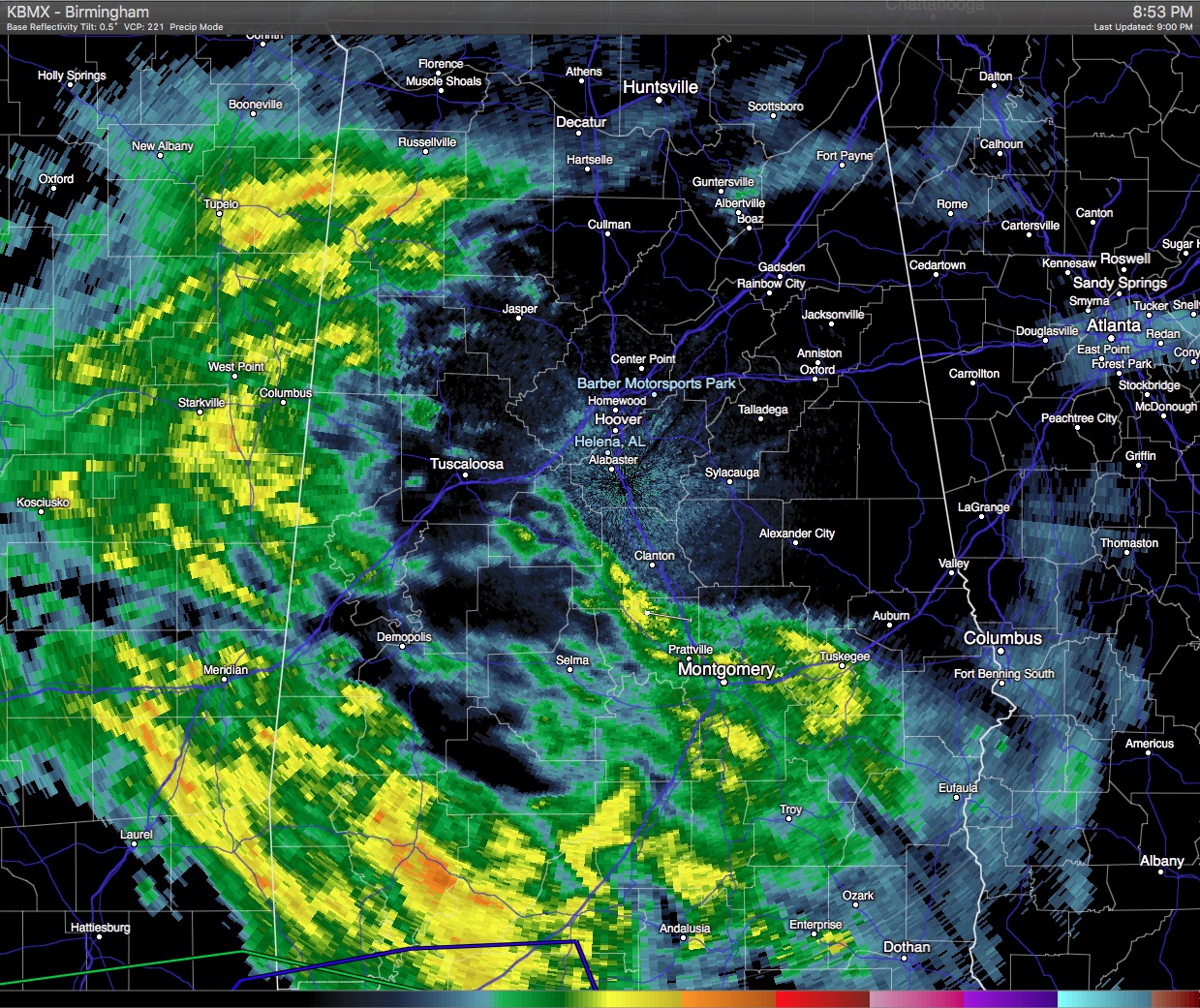
As you can see from the image immediately below this paragraph, the rain which has been slowly but steadily advancing eastward all day has finally begun reaching into Central Alabama. A small junk of rain has reaching Montgomery while much heavier rain has moved into Southwest Alabama. Rain is also coming across the Alabama/Mississippi line from about Russellville in Colbert County southward to Demopolis in northern Marengo County. A time lapse of the last few radar images still indicated more of a northward component than an eastward component to the motion of the large rain area. But the bottom line it is moving into Central Alabama and by early Monday much of Central Alabama will have seen at least some rain.
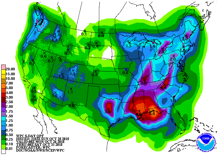
Rainfall is still expected to be heavy over the next couple of days especially along the Gulf Coast. As you can see from the WPC QPF map below, 4 to 7 inches of rain is forecast along the Gulf Coast from Central Louisiana eastward to near Apalachicola over the next five days. Rainfall totals across Central and North Alabama are likely to fall within the 1.5 to 3.5 inch amounts. Fortunately, thanks to a relatively long dry spell of about two weeks, flash flooding is not expected to be a problem for us. But we still need to monitor what is unfolding in case the atmosphere produces more or heavier rain that we are anticipating.
James will have the next full Weather Xtreme Video here by 7 am on Monday.
-Brian-
Category: Alabama's Weather
About the Author (Author Profile)
Brian Peters is one of the television meteorologists at ABC3340 in Birmingham and a retired NWS Warning Coordination Meteorologist. He handles the weekend Weather Xtreme Videos and forecast discussion and is the Webmaster for the popular WeatherBrains podcast.Subscribe
If you enjoyed this article, subscribe to receive more just like it.


