

Raining All Over the World
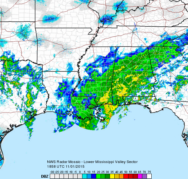
Well, not exactly, but there sure is a lot of rain going on across the Southeast US. Here’s a look at radar at 1:20 pm CST. This is a composite of the various radars from the National Weather Service (NWS) network. Rain covers much of Southeast Louisiana, the southeaster two thirds of Mississippi, all but the extreme northwest corner of Alabama, a good portion of the Florida Panhandle, a pretty big chunk of Georgia, and just a small sliver of the southeast corner of Tennessee. Heaviest rain was over Southwest Alabama, Southeast Mississippi, and just offshore in the Gulf between New Orleans and Mobile.
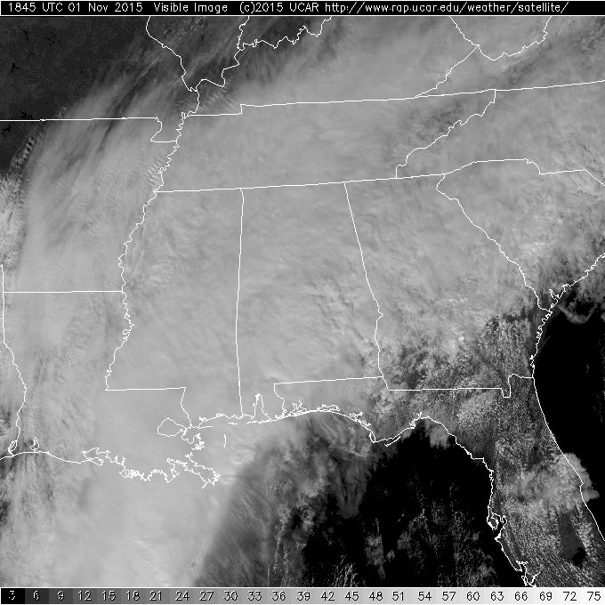
As you would expect, clouds cover all of those areas looking like a soft blanket of white cotton candy – too much influence from Halloween!
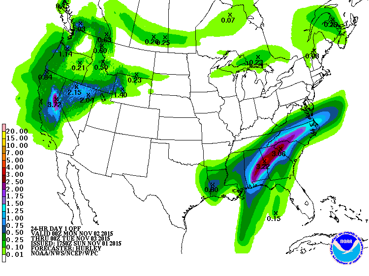
The heaviest rainfall through 12Z on Monday is expected to be in a fairly narrow band from just northeast of Mobile northeastward across the northern half of Georgia and northwestern quadrant of South Carolina ending in Central North Carolina. Rainfall for the 24 hours ending at 6 am tomorrow morning in this band should come in between 2.5 and 3 inches.
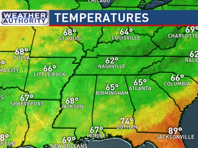
Rain and clouds are doing their part to keep the temperatures down across all of the Southeast US. Readings at 1:00 pm were mainly in the 60s under the extensive cloud cover. South Georgia and the Florida Peninsula were seeing temperatures in the 80s.
Bill Murray has the latest below on the status of flash flood watches around the Southeast US.
-Brian-
Category: Alabama's Weather
About the Author (Author Profile)
Brian Peters is one of the television meteorologists at ABC3340 in Birmingham and a retired NWS Warning Coordination Meteorologist. He handles the weekend Weather Xtreme Videos and forecast discussion and is the Webmaster for the popular WeatherBrains podcast.Subscribe
If you enjoyed this article, subscribe to receive more just like it.


