

Chapala Churning Closer to Land
Typhoon Chapala remained a hurricane this morning and continued to churn across the Arabian Sea and the Gulf of Aden as it gets closer to landfall in Yemen.
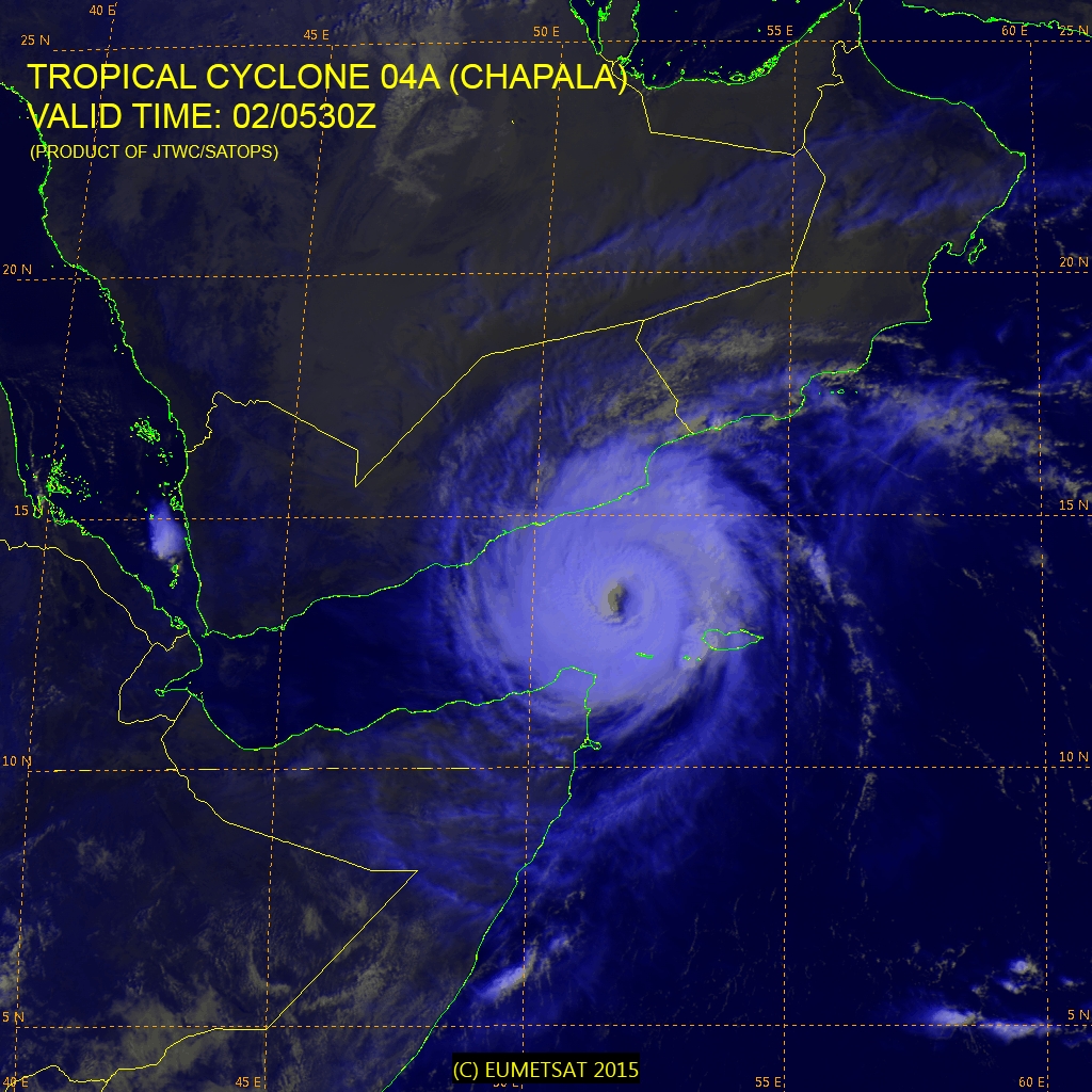
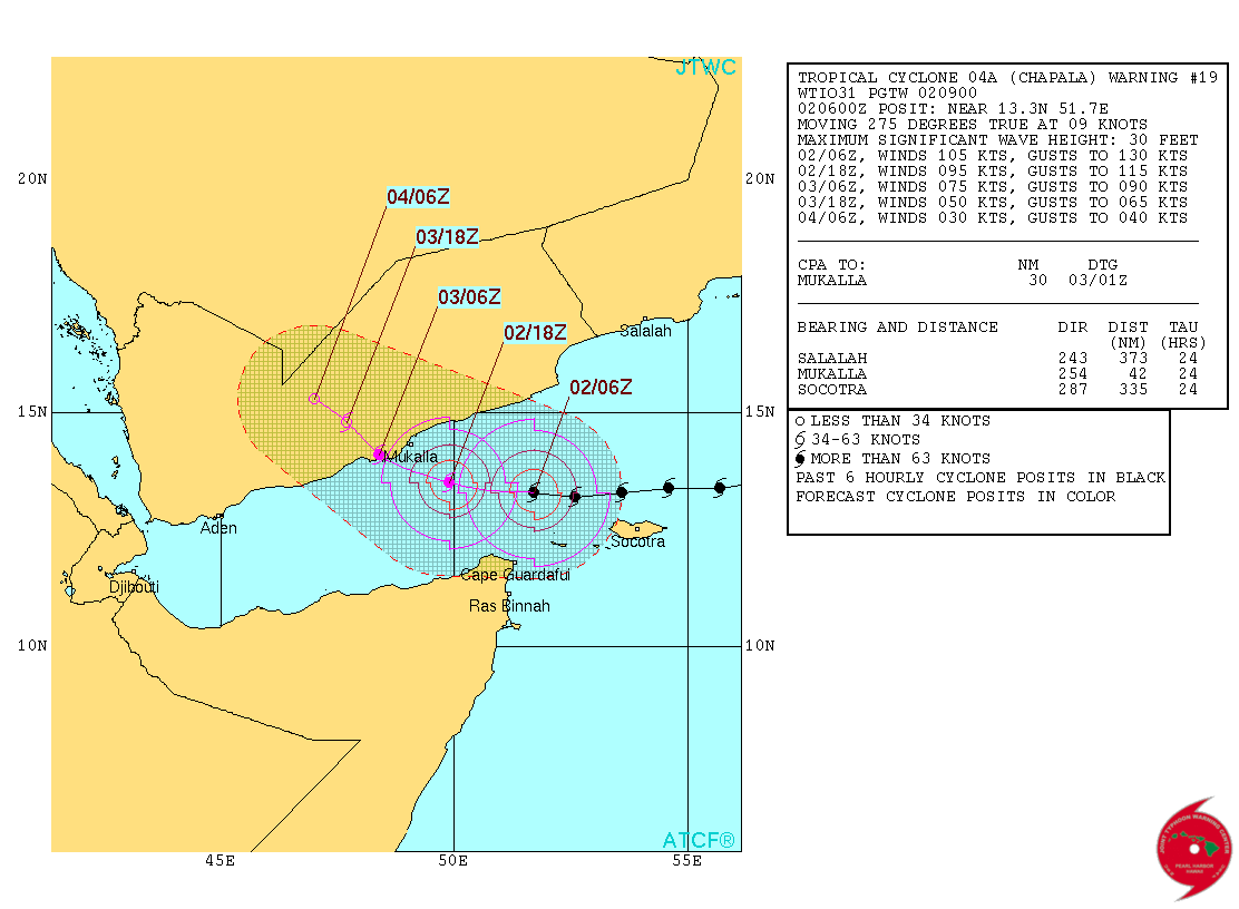
This is the latest satellite view of Chapala. It was getting closer to Yemen after brushing just north of the island of Socotra in the Arabian Sea. The Joint Typhoon Warning Center (JTWC) placed Chapala’s wind at 105 knots this morning with gusts to 130 knots (120 mph with gusts to 150 mph). The forecasters there continued to predict a gradual weakening trend as Chapala makes its was toward landfall just to the west of Mukalla (or Al Mukalla on some maps) around midnight tonight. Once the eye has made landfall, the tropical cyclone should diminish in strength rapidly falling below tropical storm strength about 24 hours after landfall. Here’s the graphic from JTWC.
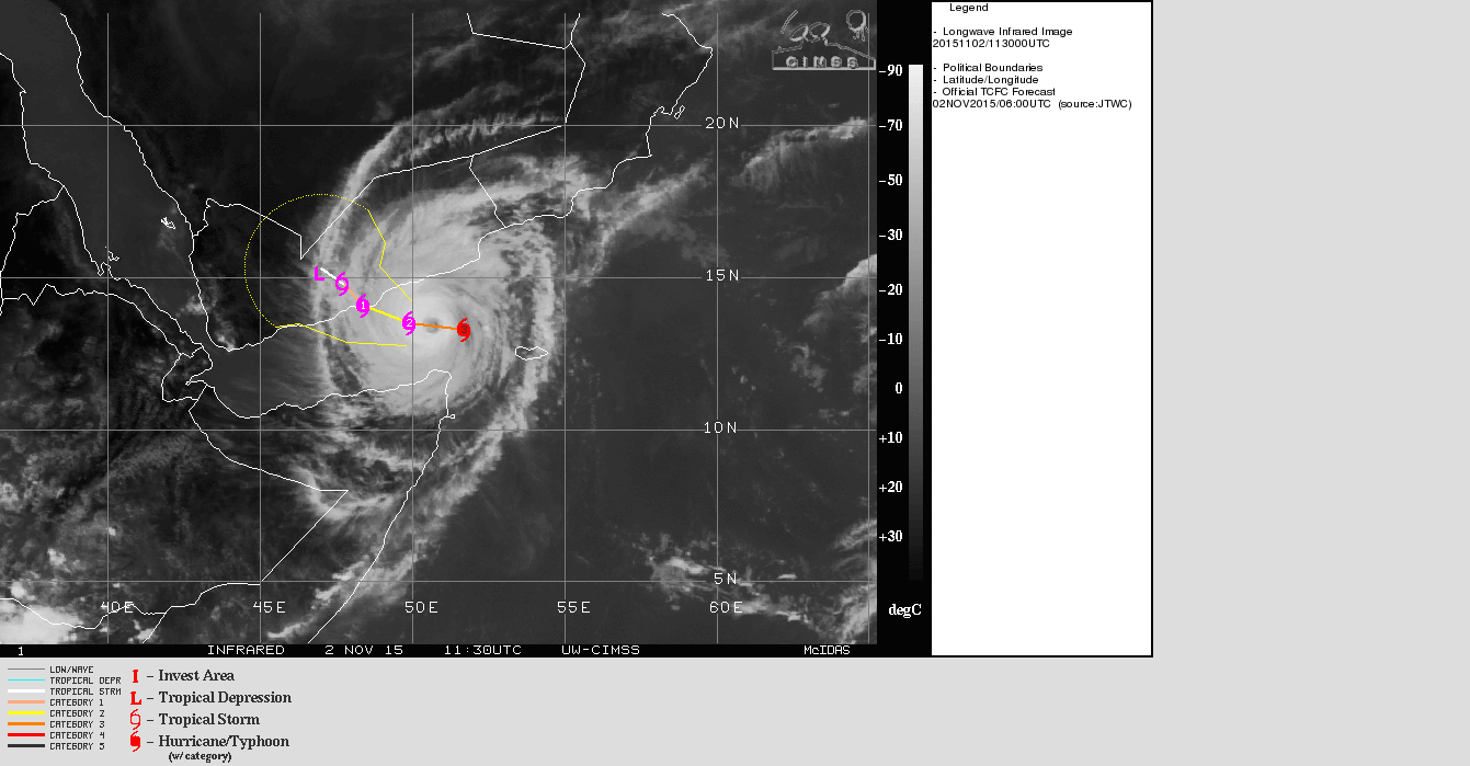
Here’s another view of Cyclone Chapala.
-Brian-
About the Author (Author Profile)
Brian Peters is one of the television meteorologists at ABC3340 in Birmingham and a retired NWS Warning Coordination Meteorologist. He handles the weekend Weather Xtreme Videos and forecast discussion and is the Webmaster for the popular WeatherBrains podcast.Subscribe
If you enjoyed this article, subscribe to receive more just like it.


